Almond, North Carolina
| Almond, North Carolina | |
|---|---|
| Unincorporated community | |
 Almond, North Carolina  Almond, North Carolina | |
| Coordinates: 35°22′11″N 83°33′55″W / 35.36972°N 83.56528°WCoordinates: 35°22′11″N 83°33′55″W / 35.36972°N 83.56528°W | |
| Country | United States |
| State | North Carolina |
| County | Swain |
| Elevation | 1,722 ft (525 m) |
| Time zone | UTC-5 (Eastern (EST)) |
| • Summer (DST) | UTC-4 (EDT) |
| ZIP code | 28702 |
| Area code(s) | 828 |
| GNIS feature ID | 1018806[1] |
Almond is an unincorporated community in Swain County, North Carolina, United States. Almond is located on the Little Tennessee River and North Carolina Highway 28 7.9 miles (12.7 km) west-southwest of Bryson City. Almond has a post office with ZIP code 28702, which opened on March 17, 1886.[2][3] The community was named for Bud Almond, who provided the land on which the town was founded.[1]
References
- 1 2 "Almond". Geographic Names Information System. United States Geological Survey.
- ↑ United States Postal Service (2012). "USPS - Look Up a ZIP Code". Retrieved 2012-02-15.
- ↑ "Postmaster Finder - Post Offices by ZIP Code". United States Postal Service. Retrieved March 11, 2013.
Municipalities and communities of Swain County, North Carolina, United States | ||
|---|---|---|
| Town | 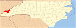 | |
| CDP | ||
| Unincorporated communities | ||
| Indian reservation | ||
| Footnotes | ‡This populated place also has portions in an adjacent county or counties | |
This article is issued from
Wikipedia.
The text is licensed under Creative Commons - Attribution - Sharealike.
Additional terms may apply for the media files.