Alhambra, Phoenix
| Alhambra | |
|---|---|
| Urban village of Phoenix, Arizona | |
| Alhambra Village | |
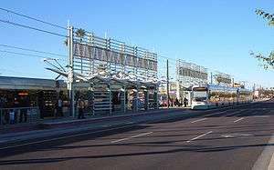 Phoenix METRO Light Rail Station in Alhambra. | |
| Country | United States |
| State | Arizona |
| County | Maricopa |
| City | Phoenix |
| Area[1] | |
| • Total | 20 sq mi (50 km2) |
| Population (2010)[2] | |
| • Total | 127,764 |
| • Density | 6,400/sq mi (2,500/km2) |
| Website | Alhambra Village Planning Committee |
Alhambra is an urban village[3] of Phoenix, Arizona. It encompasses an area south of Northern Avenue, west of 7th Street, east of 43rd Avenue, and north of Grand Avenue or the Grand Canal.[4]

History
The community's name was chosen by W. J. Murphy, to designate one of the four North Phoenix areas he sub-divided and later developed.[1] The area saw growth in the 1940s and 1950s, during a population boom that followed World War II. Many of those who moved to the area discovered it when they were stationed at Luke Air Force Base.[1]
Demographics
As of 2010, Alhambra had a population of 127,764 living in an area of roughly 20 square miles, giving a density of about 6,400/square mile. 61.1% of residents were white, 6.6% were black or African American, 3.4% were American Indian or Alaska Native, and 4.1% were Asian or Pacific Islander. 21% of residents were some other race, and 3.9% were persons of two or more races.[2]
Coordinates: 33°29′54″N 112°08′01″W / 33.49833°N 112.13361°W
References
- 1 2 3 "Alhambra Village" (PDF). City of Phoenix. Retrieved 25 January 2018.
- 1 2 "2010 Census Summary File 1: Alhambra Village" (PDF). City of Phoenix. Archived from the original (PDF) on 4 March 2016. Retrieved 25 January 2018.
- ↑ "Villages". City of Phoenix. Retrieved 25 January 2018.
- ↑ "Alhambra Village Annual Report" (PDF). City of Phoenix. 2016. Retrieved 25 January 2018.