Alebtong
| Alebtong Alebtongo | |
|---|---|
 Alebtong Location in Uganda | |
| Coordinates: 02°15′00″N 33°18′54″E / 2.25000°N 33.31500°E | |
| Country |
|
| Region | Northern Region of Uganda |
| Sub-region | Lango Sub-region |
| District | Alebtong District |
| Elevation | 3,600 ft (1,100 m) |
| Population (2013 Estimate) | |
| • Total | 15,100 |
Alebtong, sometimes spelled Alebtongo, is a town in the Northern Region of Uganda. It is the chief municipal, administrative, and commercial centre of Alebtong District.
Location
Alebtong lies on the main road between the city of Lira, in Lira District to the west, and the town of Omoro, in Alebtong District to the east. This is approximately 50 kilometres (31 mi), by road, east of Lira, the largest city in the Lango sub-region.[1] Alebtong is about 285 kilometres (177 mi) by road northeast of Kampala, the capital of Uganda and its largest city.[2] The coordinates of Alebtong are: 2°15'00.0"N, 33°18'54.0"E (Latitude:2.2500; Longitude:33.3150).[3]
Population
In 2013, it was estimated that within a radius of 7 kilometres (4.3 mi) from the center of the town, the total population is approximately 15,100.[4]
Points of interest
The following points of interest lie within the town limits or close to the edges of the town:
- headquarters of Alebtong District Administration
- offices of Alebtong Town Council
- Alebtong Central Market
- Lira-Omoro Road, passing through Alebtong in a northwest to southeast direction.
See also
References
- ↑ "Road Distance Between Lira And Alebtong With Map". Globefeed.com. Retrieved 2 June 2014.
- ↑ "Map Showing Kampala And Alebtong With Distance Marker". Globefeed.com. Retrieved 2 June 2014.
- ↑ Google (2 July 2015). "Location of Alebtong At Google Maps" (Map). Google Maps. Google. Retrieved 2 July 2015.
- ↑ "Estimated Population of Alebtong Town In 2013". Fallingrain.com. Retrieved 2 June 2014.
External links
Capital: Alebtong | ||
| Towns and villages | 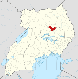 | |
| Notable people | ||