Alderville, Ontario
| Alderville | |
|---|---|
| Indian reserve | |
| Alderville First Nation Indian Reserve | |
 | |
 Alderville | |
| Coordinates: 44°11′N 78°04′W / 44.183°N 78.067°WCoordinates: 44°11′N 78°04′W / 44.183°N 78.067°W | |
| Country |
|
| Province |
|
| County | Northumberland |
| First Nation | Alderville |
| Government | |
| • Chief | James "JimBob" Marsden |
| Area[1] | |
| • Land | 12.60 km2 (4.86 sq mi) |
| Population (2011)[1] | |
| • Total | 469 |
| • Density | 37.2/km2 (96/sq mi) |
| Time zone | UTC-5 (EST) |
| • Summer (DST) | UTC-4 (EDT) |
| Website |
www |
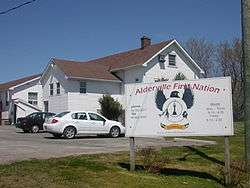
Alderville is one of two reserves of the Alderville First Nation, along with Sugar Island 37A. Alderville consists of six non-contiguous areas surrounded by the township of Alnwick/Haldimand. It was previously known as Alderville 37.
References
- 1 2 "Alderville First Nation, Ontario census profile". 2011 Census of Population. Statistics Canada. Retrieved 2015-05-12.
Places adjacent to Alderville, Ontario | |
|---|---|
This article is issued from
Wikipedia.
The text is licensed under Creative Commons - Attribution - Sharealike.
Additional terms may apply for the media files.