Albion, Victoria
| Albion Melbourne, Victoria | |||||||||||||||
|---|---|---|---|---|---|---|---|---|---|---|---|---|---|---|---|
 The John Darling & Son flour mill in Albion, Victoria. | |||||||||||||||
 Albion | |||||||||||||||
| Coordinates | 37°46′52″S 144°48′52″E / 37.781°S 144.8145°ECoordinates: 37°46′52″S 144°48′52″E / 37.781°S 144.8145°E | ||||||||||||||
| Population | 4,731 (2016)[1] | ||||||||||||||
| • Density | 1,890/km2 (4,900/sq mi) | ||||||||||||||
| Established | 1849 | ||||||||||||||
| Postcode(s) | 3020 | ||||||||||||||
| Area | 2.5 km2 (1.0 sq mi) | ||||||||||||||
| Location | 13 km (8 mi) from Melbourne | ||||||||||||||
| LGA(s) | City of Brimbank | ||||||||||||||
| State electorate(s) | St Albans | ||||||||||||||
| Federal Division(s) | Gellibrand | ||||||||||||||
| |||||||||||||||
Albion is a suburb of Melbourne, Victoria, Australia, 13 km west from Melbourne's Central Business District, located within the City of Brimbank local government area. Albion recorded a population of 4,731 at the 2016 census.
Albion is bordered on the north by Ballarat Road, the south by Forrest Street, the west by Kororoit Creek and the east by Anderson Road. The suburb is completely surrounded by other parts of Sunshine except for Ardeer, which lies to Albion's due west across Kororoit Creek.
History
The area was originally called Darlington, from at least 1860 to about 1890.[2] The area originally known as Albion was directly west of Duke Street, as can be noted by the many streets there named after English counties and placenames – Albion being an ancient name for the island of Great Britain.
Albion station opened on 5 January 1860 as Albion and Darlington but closed a year later.[3] It was not until 1919 that a new station was opened on the same site with the name Albion station.[3]
In March 1885 the Albion Quarrying Company began its operations in the area[4][5] The disused Albion quarry, accessed from Hulett St, Sunshine was the location for AC/DC's Jailbreak music video.[6][7]
It was H. V. McKay of Sunshine Harvester Works fame who bought land to develop a residential community for his workers in first decades on the 20th century. His concept for Sunshine was the Sunshine Estate: a community developed according to the ideals of the Garden city movement, an influential town planning movement of the late 19th and early 20th centuries.[8][9] This area was mainly in what is now called Albion. McKay's own residence, The Gables, was in Talmage Street (where the cul-de-sac The Gables now is) until it was consumed by fire and subsequently demolished.
Today
Albion has many period homes such as California bungalows and 1940s weatherboard houses. In the eastern parts of Albion, many of the oldest homes were built by H. V. McKay as part of his Sunshine Estate, a housing community built according to the influential early 20th Century Garden city movement.
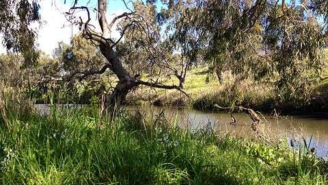
Kororoit Creek provides the western border for Albion. Along it runs the Kororoit Creek Trail which runs all the way southwards to meet the Federation Trail in Brooklyn.
Stony Creek lies on the eastern edge of Albion, close to Anderson Road. As of 2013, the creek's environmental state west of Anderson Rd is very poor as it has long been converted to nothing more than a concrete stormwater drain for this particular section of its course.
A notable landmark of Albion is the red brick John Darling and Son Flour Mill built in 1922. It is just to the south of Ballarat Rd, next to Albion train station.[10]
Transport
Albion railway station is on the Sunbury line and lies in the PTV zones 1+2 overlap.
Metropolitan buses service the suburb and Albion station. These include:
- 215 Caroline Springs – Highpoint SC via Albion RS, Burnside SC (every day). Operated by Transdev Melbourne.
- 216 Caroline Springs – Brighton Beach via Deer Park West, Sunshine, Footscray, Melbourne, St Kilda Road, Prahran, and Elsternwick (every day). Operated by Transdev Melbourne.
- 400 Sunshine - Laverton via Deer Park RS, Dame Phyllis Frost Centre, Metropolitan Remand Centre, and Port Phillip Prison (every day). Operated by Sita Buslines and CDC Melbourne.
- 451 Sunshine - Deer Park North via Deer Park RS (every day). Operated by Sita Buslines.
- 456 Sunshine – Woodgrove SC via Albion RS, Burnside SC, Caroline Springs, Melton (every day). Operated by Sita Buslines.
- 903 Altona – Mordialloc SC via Essendon, Northland SC, Box Hill, Chadstone SC (every day). Operated by Ventura Bus Lines.
Cyclists in Albion are represented by BrimBUG, the Brimbank Bicycle User Group.[11] The Kororoit Creek Trail runs along Albion's western perimeter.
Facilities
Education
- Albion Primary School
- St Theresa's Catholic Primary School
- Albion Kindergarten
Sporting facilities
The Albion Cats are the local Australian rules football team. They compete in the Western Region Football League.[12]
Other sports clubs include:
- Western Eagles (Association) Football Club
- Sunshine Baseball Club
- Sunshine Bowls Club
- Polish Sports Centre
- Sunshine United Cricket Club
- Ace GoKarts
- Albion Tennis Club
Religious sites
- St Theresa's Catholic Church
- Slovakian Baptist Church
- Assemblies of God Church
See also
- City of Sunshine - Albion was previously within this former local government area.
- Albion railway station, Melbourne
- Kororoit Creek
- Kororoit Creek Trail
References
- ↑ Australian Bureau of Statistics (27 June 2017). "Albion (State Suburb)". 2016 Census QuickStats. Retrieved 5 July 2017.

- ↑ National Library of Australia, Digital Collections - Maps - Geological Survey of Victoria. Geological Survey of Victoria. No. 1 cartographic material, retrieved 30 August 2009
- 1 2 VICSIG Infrastructure - Albion
- ↑ "A Stroll Along the Merri - Provenance Number 6 - PUBLIC RECORD OFFICE VICTORIA". Archived from the original on 18 September 2009. Retrieved 30 August 2009.
- ↑ Kennedy, B: Australian Place Names, page 3. ABC Books, 2006
- ↑ Wall, Mick (2012). AC/DC: Hell Aint a Bad Place to Be. London: Orion Publishing group. ISBN 9781409115359.
- ↑ Evans, Mark, Dirty Deeds: My Life Inside/Outside of AC/DC, Bazillion Points, 2011
- ↑ HO Selwyn Park Archived 22 October 2009 at the Wayback Machine.
- ↑ "HO Sugar Gum row" (PDF). Archived from the original (PDF) on 22 October 2009. Retrieved 25 August 2009.
- ↑ "Darling's Flour Mill" (PDF). Brimbank City Council website. Brimbank City Council. Archived from the original (PDF) on 2 May 2013. Retrieved 17 March 2013.
- ↑ http://www.brimbug.org.au
- ↑ Full Points Footy, Albion, retrieved 15 April 2009