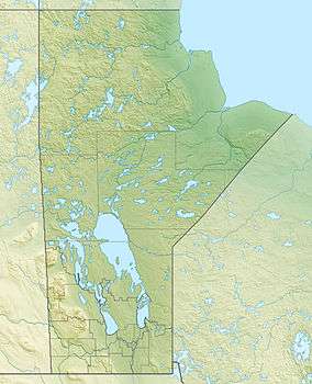
Alberts Lake (Manitoba)
| Alberts Lake | |
|---|---|
 Alberts Lake | |
| Location | Manitoba |
| Coordinates | 54°48′17″N 101°31′59″W / 54.80472°N 101.53306°WCoordinates: 54°48′17″N 101°31′59″W / 54.80472°N 101.53306°W |
| Lake type | Glacial Lake |
| Primary inflows | none |
| Primary outflows | Thompson Lake |
| Basin countries | Canada |
| Max. length | 5.4 km (3.4 mi) |
| Max. width | 2 km (1.2 mi) |
| Shore length1 | 26 km (16 mi) |
| Surface elevation | 301 m (988 ft) |
| Islands | 27 |
| 1 Shore length is not a well-defined measure. | |
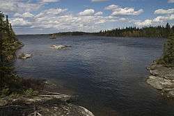
Alberts Lake is a glacial lake approximately 17 km (11 mi) northeast of Bakers Narrows which drains into Thompson Lake. It is part of the Nelson River watershed, in the Hudson Bay drainage basin in the Northern Region of Manitoba, Canada.
Description
The lakes sits in Churchill River Upland portion of the Midwestern Canadian Shield forests and is surrounded by mixed forest with stands of black spruce, white spruce, jack pine, and trembling aspen. The shoreline is characterized by steeply sloping irregular rock ridges and poorly drained areas of muskeg.[1] The lake contains burbot, lake whitefish, northern pike, walleye, and yellow perch.[2] The lake is part of the well-known Mistik Creek Canoe route, and has portages to Leo Lake in the south and Naosap Mud Lake to the north.[3]
Name
The lake was named to honor a prospector in the area.[4] The name was officially adopted in 1941.[5]
Canoe Route
Alberts Lake is part of the "Mistik Creek Loop", a well-known remote canoe trip which is 80 km (50 mi) in total length and can be paddled in four days.[6] The route begins and ends at Bakers Narrows and from Alberts lake there are portages north to Naosap Mud Lake and south to Leo Lake.[3]
See also
References
- ↑ Smith, R.E. (1998). Terrestrial Ecozones, Ecoregions, and Ecodistricts of Manitoba (PDF). Winnipeg, Manitoba: Agriculture and Agri-Food Canada. p. 88. ISBN 0-662-27446-6.
- ↑ "Master Angler Awards". Travel Manitoba. Retrieved 19 May 2014.
- 1 2 Berard, Real (1968). Mistik Creek Canoe Route. Manitoba Dept. of Natural Resources. Archived from the original on 2014-05-18.
- ↑ Ham, Penny (1980). Place Names of Manitoba. Saskatoon, Saskatchewan: Modern Press. p. 1. ISBN 0888330677. Archived from the original on 2007-09-29. Retrieved 2014-05-19.
- ↑ "Geographic Names Board of Canada". Natural Resources Canada. Retrieved 19 May 2014.
- ↑ Schick, RoseAnna (2003-06-21). "Live the song of the paddles". Winnipeg Free Press. Retrieved 18 May 2014.