Alabaster, Alabama
| Alabaster, Alabama | |
|---|---|
| City | |
 Location of Alabaster in Shelby County, Alabama. | |
 Alabaster, Alabama Location in the United States | |
| Coordinates: 33°13′52″N 86°49′25″W / 33.23111°N 86.82361°W | |
| Country | United States |
| State | Alabama |
| County | Shelby |
| Government | |
| • Mayor | Marty Handlon |
| Area[1] | |
| • Total | 25.49 sq mi (66.02 km2) |
| • Land | 25.18 sq mi (65.22 km2) |
| • Water | 0.31 sq mi (0.81 km2) |
| Elevation | 502 ft (153 m) |
| Population (2010)[2] | |
| • Total | 30,352 |
| • Estimate (2017)[3] | 33,202 |
| • Density | 1,318.53/sq mi (509.10/km2) |
| Time zone | UTC-6 (Central (CST)) |
| • Summer (DST) | UTC-5 (CDT) |
| ZIP code | 35007, 35114 |
| Area code(s) | 205 |
| FIPS code | 01-00820 |
| Website | http://www.cityofalabaster.com |
Alabaster is a city and southern suburb of Birmingham in Shelby County, Alabama, United States. At the 2010 census, the population was 30,352. According to the 2013 Census Estimates, the city had a population of 31,342. Alabaster is the 16th largest city in Alabama (by number of residents) and still a growing population.[2]
Geography
Alabaster is located at 33°13′52″N 86°49′26″W / 33.23111°N 86.82389°W (33.231162, −86.823829).[4]
Alabaster mostly occupies the Cahaba and Opossum Valleys, which are divided by the Pine Ridge that runs north to south. To the east and west, both valleys are flanked by parallel mountain ridges that locally run north to south, but are a part of a larger system of ridges that generally runs north-east to south-west (the tailing ends of the Appalachian foothills). The valleys are drained by small creeks (Buck Creek, Beaverdam Creek) which flow into the Cahaba River.[5]
According to the U.S. Census Bureau, the city has a total area of 20.6 square miles (53 km2), of which 20.5 square miles (53 km2) is land and 0.1 square miles (0.26 km2) (0.24%) is water.
History
George L. Scott, Sr., an Alabaster pioneer, owned and operated Alabaster Lime Co. His shipping point was known as “Scott Rock”. Later, housing was built to accommodate some of the employees, and the community acquired its name Alabaster from the "white calcium carbonate mineral". The First Bank of Alabaster opened in 1952, and its president was George L. Scott, Jr., who later became the first mayor of Alabaster. The first attempt in 1952 to incorporate Alabaster failed. In January 1953, the petition was again filed, and on February 23, 1953, Alabaster was officially incorporated with a favorable vote of 79 to 23, and 427 residing inhabitants. In 1955, the Alabaster Water and Gas Board was formed.[6]
Demographics
| Historical population | |||
|---|---|---|---|
| Census | Pop. | %± | |
| 1960 | 1,623 | — | |
| 1970 | 2,642 | 62.8% | |
| 1980 | 7,079 | 167.9% | |
| 1990 | 14,732 | 108.1% | |
| 2000 | 22,619 | 53.5% | |
| 2010 | 30,352 | 34.2% | |
| Est. 2017 | 33,202 | [3] | 9.4% |
| U.S. Decennial Census[7] 2013 Estimate[8] | |||
2010 Census data
As of the census of 2010, there were 30,352 people, 11,016 households, and 6,482 families residing in the city [9].The population density was 1,104.8 people per square mile (426.6/km²). The racial makeup of the city was 81.2% White,15.0% Black or African American, 0.31% Native American, 0.64% Asian, 0.02% Pacific Islander, 2.2% from other races, and 0.69% from two or more races. 4.54% of the population were Hispanic or Latino of any race.
There were 11,016 households out of which 41.9% had children under the age of 18 living with them, 68.0% were married couples living together, 8.9% had a female householder with no husband present, and 20.6% were non-families. 17.1% of all households were made up of individuals and 3.6% had someone living alone who was 65 years of age or older. The average household size was 2.73 and the average family size was 3.09.
In the city, the population was spread out with 27.7% under the age of 18, 7.0% from 18 to 24, 32.0% from 25 to 44, 25.0% from 45 to 64, and 8.0% who were 65 years of age or older. The median age was 35 years. For every 100 females, there were 94.7 males. For every 100 females age 18 and over, there were 90.7 males.
The median income for a household in the city was $64,411, and the median income for a family was $78,940. The per capita income for the city was $22,466. About 4.3% of families and 5.9% of the population were below the poverty line, including 7.0% of those under age 18 and 12.3% of those age 65 or over.
Government
The government consists of a mayor who is elected at large and a seven-member city council. One member is elected from each of the seven wards.
The Mayor and City Council are elected every four years.
The most recent election was held in 2016.
Schools
On 1 July 2013, the Alabaster City Schools System officially separated from the Shelby County Schools system, and now operates the public schools in the city.[9] Private school K-12 education is also available.
- Creek View Elementary School
- Meadow View Elementary School
- Thompson Intermediate School
- Thompson Sixth Grade Center
- Thompson Middle School
- Thompson High School
- Kingwood Christian School
- Evangel Christian School
Gallery

 Alabaster City Hall
 Buck Creek
References
- ↑ "2017 U.S. Gazetteer Files". United States Census Bureau. Retrieved Jul 7, 2018.
- 1 2 "Population Estimates". United States Census Bureau. Retrieved 2014-06-07.
- 1 2 "Population and Housing Unit Estimates". Retrieved March 24, 2018.
- ↑ "US Gazetteer files: 2010, 2000, and 1990". United States Census Bureau. 2011-02-12. Retrieved 2011-04-23.
- ↑ United States Geological Survey (August 14, 2015). Alabaster, AL quadrangle (Topographic map). Reston, VA: United States Geological Survey. Retrieved August 14, 2015 – via TopoQuest.
- ↑ Alabaster merged with the adjoining city of Siluria, Alabama April 27, 1971. "History of Shelby County". ALGenWeb: Shelby County. Retrieved on 2008-05-21.
- ↑ United States Census Bureau. "Census of Population and Housing". Archived from the original on May 12, 2015. Retrieved June 7, 2014.
- ↑ "Annual Estimates of the Resident Population: April 1, 2010 to July 1, 2013". Retrieved June 7, 2014.
- ↑ http://blog.al.com/spotnews/2013/07/alabaster_school_district_cele.html
External links
Coordinates: 33°13′52″N 86°49′26″W / 33.231162°N 86.823829°W
Municipalities and communities of Shelby County, Alabama, United States | ||
|---|---|---|
| Cities | 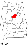 | |
| Towns | ||
| CDPs | ||
| Unincorporated communities | ||
| Footnotes | ‡This populated place also has portions in an adjacent county or counties | |