Alabama's 9th congressional district
| Alabama's 9th congressional district | |
|---|---|
| Obsolete | |
| Population (1950) | 558,928 |
| Created | 1890 Census |
| Eliminated | 1960 Census |
| Years | 1893-1963 |
Alabama's 9th congressional district was formerly apportioned to portions of central and western Alabama from 1893 until 1963 when the seat was lost due to reapportionment after the 1960 United States Census.
Highlights
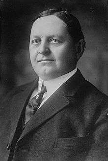
Formed in 1893, the district was first represented by Louis Washington Turpin, a self-educated tax assessor from Hale County. The district was represented by Democrats during the whole of its existence except from 1896-1897 when Truman Heminway Aldrich, a Republican, unseated Oscar W. Underwood in a post-election contest.
The 1960 United States Census and the subsequent reapportionment decreased Alabama's representation in the United States Congress.
History
By the 1890s the growth of Birmingham, Alabama, coupled with overall growth of Alabama's population, increased the number of representatives in the United States House from Alabama to nine.
It was decided to draw the new ninth district primarily from Jefferson County but also to include a few more rural counties to the south. In the first election in the district over 29,000 votes were cast. This was the most votes in any Alabama Congressional district.
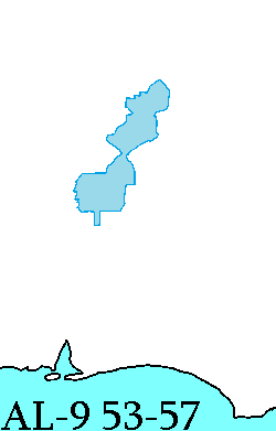
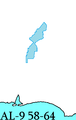
It lost some area to the 6th district in 1902.
In 1916, redistricting again occurred, which reduced the ninth district to only include Jefferson County. These boundaries remained essentially the same until the district was dissolved in 1962.
Population disparity
By the early 1940s the 9th district had a population of 459,930.[1] This was 103,000 more people than the next largest district, and 209,000 more people than lived in the neighboring 6th district. By the 1950s there were 558,928 people in the ninth district and 250,726 in the 6th district. From 1932 through 1962 the state of Alabama did not reapportion its congressional districts.
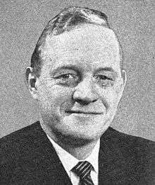
List of representatives


Historical Boundaries
| Census Year | Population | Counties |
|---|---|---|
| 1890 | 181,085 | Bibb, Blount, Hale, Jefferson, Perry |
| 1900 | 213,820 | Bibb, Blount, Jefferson, Perry |
| 1910 | 226,476 | Jefferson |
| 1920 | 310,054 | |
| 1930 | 431,493 | |
| 1940 | 459,930 | |
| 1950 | 558,928 |
References
- ↑ "colorado.edu". Archived from the original on 2007-08-06. Retrieved 2007-08-09.
- Population data from U.S. Census Bureau: Population of Counties by Decennial Census: 1900 to 1990
- Additional population data and counties from the Official Congressional Directories of the 53rd Congress (1893); 58th Congress (1903); 81st Congress (1950); and 83rd Congress (1953).
- Martis, Kenneth C. (1989). The Historical Atlas of Political Parties in the United States Congress. New York: Macmillan Publishing Company.
- Martis, Kenneth C. (1982). The Historical Atlas of United States Congressional Districts. New York: Macmillan Publishing Company.
- Congressional Biographical Directory of the United States 1774–present
Coordinates: 33°29′11.17″N 86°52′47.58″W / 33.4864361°N 86.8798833°W