Al Kharrara
| Al Kharrara الخرارة | |
|---|---|
| Village | |
 Al Kharrara | |
| Coordinates: 24°54′2″N 51°10′17″E / 24.90056°N 51.17139°ECoordinates: 24°54′2″N 51°10′17″E / 24.90056°N 51.17139°E | |
| Country | Qatar |
| Municipality | Al Wakrah Municipality |
| Area | |
| • Total | 902.4 km2 (348.4 sq mi) |
| Population (2015) | |
| • Total | 3,478 |
| • Density | 3.9/km2 (10.0/sq mi) |
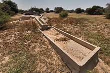
Al Kharrara (Arabic: الخرارة) is a village in Qatar, located in the municipality of Al Wakrah.[1] The closest sizable city is Mesaieed, located to the east.[2] It is a desert area, characterized by high aridity and the presence of grazing animals such as dromedary camels, goats and sheep.[3]
History
In J.G. Lorimer's 1908 publication Gazetteer of the Persian Gulf, he refers Al Kharrara as a Bedouin outpost that lies "20 miles south of Dohah and 6 from the east coast, between Naqiyān and Jabalat-at-Tuwar". He noted the presence of a masonry well, 27 fathoms deep, containing good water.[4]
Geography
Al Kharrara is situated in south-central Qatar. The village of Umm Houtah is nearby.[5]
Demographics
As of the 2010 census, the village comprised 45 housing units.[6] There were 117 people living in the village, of which 100% were male and 0% were female. Out of the 117 inhabitants, 98% were 20 years of age or older and 2% were under the age of 20. The literacy rate stood at 70.1%. Employed persons made up 100% of the total population.[7]
| Year | Population |
|---|---|
| 1986[8] | 94 |
| 1997[9] | 130 |
| 2004[10] | 45 |
| 2010[11] | 117 |
| 2015[1] | 3,478 |
References
- 1 2 "2015 Population census" (PDF). Ministry of Development Planning and Statistics. April 2015. Retrieved 8 August 2017.
- ↑ "Four killed in road crash near Mesaieed". The Peninsula Qatar. 21 May 2015. Retrieved 2 July 2015.
- ↑ "First evidence of scavenging behaviour in the herbivorous lizard Uromastyx aegyptia microlepis" (PDF). Journal of Arid Environments. 2010. Retrieved 2 July 2015.
- ↑ "'Gazetteer of the Persian Gulf. Vol. II. Geographical and Statistical. J G Lorimer. 1908' [1521] (1636/2084)". Qatar Digital Library. Retrieved 6 July 2018. This article incorporates text from this source, which is in the public domain.
- ↑ "Qatar Socio-Economic Atlas". Ministry of Development Planning and Statistics. Retrieved 8 August 2017.
- ↑ "Housing units, by type of unit and zone (April 2010)" (PDF). Qatar Statistics Authority. Retrieved 9 August 2015.
- ↑ "Geo Statistics Application". Ministry of Development Planning and Statistics. Archived from the original on 2012-09-11. Retrieved 9 August 2015.
- ↑ "1986 population census" (PDF). Qatar Statistics Authority. Archived from the original (PDF) on 3 July 2015. Retrieved 2 July 2015.
- ↑ "1997 population census" (PDF). Qatar Statistics Authority. Archived from the original (PDF) on 29 May 2015. Retrieved 2 July 2015.
- ↑ "2004 population census". Qatar Statistics Authority. Retrieved 2 July 2015.
- ↑ "2010 population census" (PDF). Qatar Statistics Authority. Retrieved 2 July 2015.
| Administrative zones | |
|---|---|
| Other areas |
|