Raqqa District
| Raqqa District منطقة مركز الرقة | |
|---|---|
| District | |
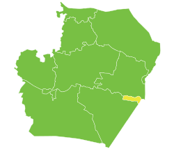
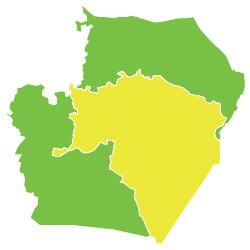 Location of Raqqa District within Raqqa Governorate | |
 Raqqa District Location in Syria | |
| Coordinates (Raqqa): 35°57′N 39°01′E / 35.95°N 39.02°E | |
| Country |
|
| Governorate | Raqqa |
| Seat | Raqqa |
| Subdistricts | 4 nawāḥī |
| Area | |
| • Total | 7,327.92 km2 (2,829.33 sq mi) |
| Population (2004)[1] | 503,960 |
| Geocode | SY1101 |
Raqqa District (Arabic: منطقة مركز الرقة, translit. Manṭiqat ar-Raqqah) is a district of the Raqqa Governorate in northern Syria. Administrative centre is the city of Raqqa. At the 2004 census, the district had a population of 503,960.[1]
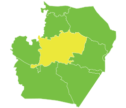
The administrative center of Raqqa Subdistrict shown above is the city of Raqqa.
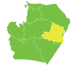
The administrative center of Al-Karamah Subdistrict shown above is the city of Al-Karamah.
The administrative center of Al-Sabkhah Subdistrict shown above is the city of Al-Sabkhah.
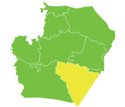
The administrative center of Maadan Subdistrict shown above is the city of Ma'adan.
Sub-districts
The district of Raqqa is divided into four subdistricts or nawāḥī (population as of 2004[1]):
- Raqqa Subdistrict (ناحية الرقّة): population 338,773.[2]
- Al-Sabkhah Subdistrict (ناحية السبخة): population 48,106[3]
- Al-Karamah Subdistrict (ناحية الكرامة): population 74,429.[4]
- Maadan Subdistrict (ناحية معدان): population 42,652.[5]
References
- 1 2 3 "General Census of Population and Housing 2004" (PDF) (in Arabic). Syrian Central Bureau of Statistics. Archived from the original (PDF) on 8 December 2015. Retrieved 15 October 2015. Also available in English: "2004 Census Data". UN OCHA. Retrieved 15 October 2015.
- ↑ "Ar-Raqqah nahiyah population". Cbssyr.org. Archived from the original on 2013-03-09. Retrieved 2012-07-05.
- ↑ "As-Sabkha nahiyah population". Cbssyr.org. Retrieved 2012-07-05.
- ↑ "Karamah nahiyah population". Cbssyr.org. Retrieved 2012-07-05.
- ↑ "Ma'adan nahiyah population". Cbssyr.org. Retrieved 2012-07-05.
This article is issued from
Wikipedia.
The text is licensed under Creative Commons - Attribution - Sharealike.
Additional terms may apply for the media files.