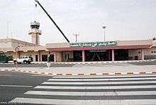
Al-Ahsa International Airport
| Al-Ahsa International Airport مطار الأحساء الدولي | |||||||||||
|---|---|---|---|---|---|---|---|---|---|---|---|
 | |||||||||||
| Summary | |||||||||||
| Airport type | Public | ||||||||||
| Operator | Government | ||||||||||
| Serves | Al-Ahsa Governorate | ||||||||||
| Location | Hofuf | ||||||||||
| Elevation AMSL | 588 ft / 179 m | ||||||||||
| Coordinates | 25°17′07″N 049°29′06″E / 25.28528°N 49.48500°ECoordinates: 25°17′07″N 049°29′06″E / 25.28528°N 49.48500°E | ||||||||||
| Map | |||||||||||
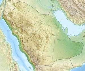 OEAH Location of airport in Saudi Arabia | |||||||||||
| Runways | |||||||||||
| |||||||||||
Al-Ahsa International Airport (Arabic: مطار الأحساء الدولي, IATA: HOF[3], ICAO: OEAH) is an airport serving Hofuf (also known as Al-Ahsa or Al-Hasa), a city in Eastern Province, Saudi Arabia.
History
GACA formally approved the airport’s international status in 2011.[4] The airport is expected to grow by 300,000 passengers per annum between 2015 and 2020, a GACA study predicted.[4] Around 300,000 expatriate workers live in the area.[4]
Airlines and destinations
| Airlines | Destinations |
|---|---|
| Air Arabia | Sharjah |
| Air Cairo | Cairo[5] |
| flydubai | Dubai-International [6] |
| Nile Air | Cairo |
| Saudia | Jeddah, Riyadh |
References
- ↑ Airport information for OEAH from DAFIF (effective October 2006)
- ↑ Airport information for HOF at Great Circle Mapper. Source: DAFIF (effective October 2006).
- ↑ "IATA Airport Code Search (HOF – City: Hofuf, Airport: Al-Ahsa)". International Air Transport Association. Retrieved 7 September 2013.
- 1 2 3 International flights soon from Al-Ahsa airport Arab News 16 September 2013
- ↑ "Air Cairo". www.flyaircairo.com.
- ↑ "flydubai adds Hofuf to KSa network" (Press release). flydubai. 19 January 2014. Retrieved 21 January 2014.
External links
![]()
- Aeronautical chart for OEAH at SkyVector
- Current weather for OEAH at NOAA/NWS
- Accident history for HOF at Aviation Safety Network
- https://web.archive.org/web/20140116135927/http://www.alriyadh.com/net/article/901315
This article is issued from
Wikipedia.
The text is licensed under Creative Commons - Attribution - Sharealike.
Additional terms may apply for the media files.