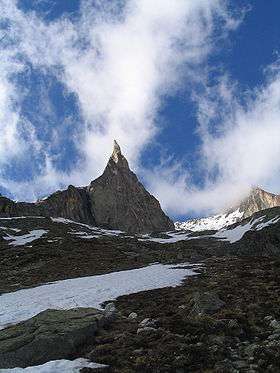
Aiguille Dibona
| Aiguille Dibona | |
|---|---|
| Pain de Sucre du Soreiller | |
 | |
| Highest point | |
| Elevation | 3,130 m (10,270 ft) |
| Coordinates | 44°57′45″N 6°14′34″E / 44.96250°N 6.24278°ECoordinates: 44°57′45″N 6°14′34″E / 44.96250°N 6.24278°E |
| Geography | |
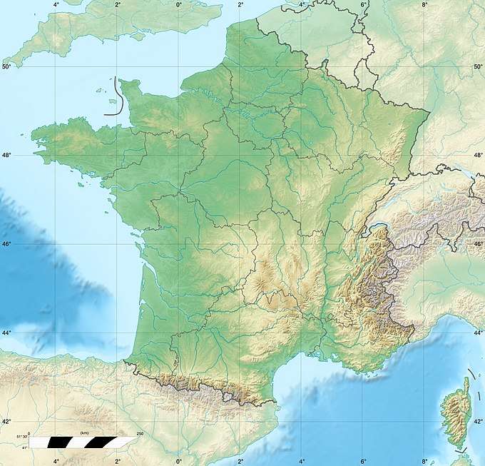 Aiguille Dibona Location in southeastern France | |
| Location | Hautes-Alpes, France |
| Parent range | Massif des Écrins, French Alps |
| Climbing | |
| First ascent | Angelo Dibona and Guido Mayer, 27 June 1913 |
The Aiguille Dibona, formerly called (Aiguille du) Pain de Sucre du Soreiller[1] (3,130 m (10,269 ft)) is a mountain in the French Alps, in the Massif des Écrins, notable for its "astonishing triangular granite spear."[2]
Because of its singular shape, the ease of access, and the exceptional quality of its granite the mountain is very popular among climbers. The many routes on the mountain are among the most popular in the Écrins. Formerly called Pain de Sucre du Soreiller, it was renamed for Angelo Dibona, the Dolomites guide and mountaineer, who made the first ascent on 27 June 1913 with Guido Mayer.[3] At the foot of the mountain is the refuge du Soreiller, accessible in 3h30m from the village of Étages.[4]
Climbing routes
The main climbing routes are:[5]
- Normal and historical route: PD (peu difficile),[6] The last section of the route can be replaced by a more challenging route variant consisting in 8 pitches of climb at IV (UIAA grade).[7]
- On the south face are the most popular routes:
- Voie des Savoyards (14 pitches, 6a max but 5c compulsory, partially bolted)
- Voie Madier (15 pitches, 6a+, partially bolted)
- Visite obligatoire (12 pitches, 6a sustained, well bolted)
- Voie Berthet-Boell-Stoefer (15 pitches, 5b, partially bolted)
- The east and west faces are less frequented
References
- ↑ Appalachia, vols. 17-18. 1929. p. 186.
- ↑ Reynolds, Kev (1999). Walking in the Alps. Interlink. p. 37. ISBN 978-1-56656-343-7.
- ↑ François Labande (2007). Guide du Haut-Dauphiné: Massif des Écrins. Vol. 1: Partie nord: Râteau, Soreiller, Meije, Grande Ruine. Carthoteque. ISBN 978-2-912878-29-8.
- ↑ Lasonder, H.; E. Nieuwenhuis; B. Hiddema (2006). ranse Alpen / druk 4: savoie, Drôme. ANWB. p. 232. ISBN 978-90-18-02181-8. Retrieved 2 December 2010.
- ↑ Aiguille Dibona sur camptocamp.org
- ↑ "Aiguille Dibona: Arête N (voie normale)". Camptocamp.org. Retrieved 2 December 2010.
- ↑ "Aiguille Dibona: Voie du Nain + Normal Route". Summitpost.org. Retrieved 2 December 2010.