Aghunato
| Aghunato | |
|---|---|
| town | |
 | |
 Aghunato Location of Aghunato in Nagaland, India | |
| Coordinates: 26°00′33″N 94°31′26″E / 26.0092911°N 94.5237627°ECoordinates: 26°00′33″N 94°31′26″E / 26.0092911°N 94.5237627°E | |
| Country |
|
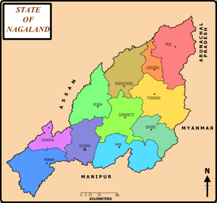
| State | Nagaland |
| District | Zunheboto |
| Area | |
| • Total | 13 km2 (5 sq mi) |
| Area rank | 2nd in Zunheboto |
| Elevation | 1,555.77 m (5,104.23 ft) |
| Population (2011) | |
| • Total | 15,670 |
| • Rank | 2nd in Zunheboto & 23 in Nagaland |
| • Density | 1,200/km2 (3,100/sq mi) |
| Languages | |
| • Official | English and Sumi |
| Time zone | UTC+5:30 (IST) |
| Vehicle registration | NL |
| Website |
nagaland |
Aghunato is a sub division of the Zunheboto district in Nagaland [1] in the far north east of India. Like other parts of Nagaland it is unusual, for India, in having the Baptist Church as the dominant religion due to the work of American missionaries. It has its own constituency in the state assembly and had 15659 registered voters in the 2013 elections.[2] Aghunato is represented in the state Legislative Assembly by Shri Pukhai. Its terrain is mountainous and dominated by evergreen forests. Geographic coordinates: 92 longitude - latitude 28-24
See also
District Hq.
Sub Division
District
References
- ↑ Nagaland Assembly Elections 2008 Results, indian-elections.com, retrieved 2008-05-08
- ↑ State Elections 2013 - Constituency wise detail for 34-Aghunato Constituency of NAGALAND
This article is issued from
Wikipedia.
The text is licensed under Creative Commons - Attribution - Sharealike.
Additional terms may apply for the media files.