Akuluto
| Akuluto | |
|---|---|
| Town | |
 Akuluto is located in Zunheboto | |
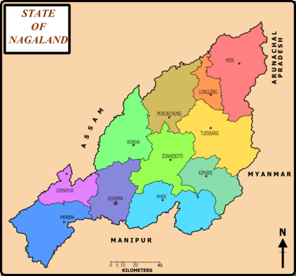
 Akuluto Location of Akuluto in North-East India | |
| Coordinates: 26°00′33″N 94°31′26″E / 26.0092901°N 94.5237637°ECoordinates: 26°00′33″N 94°31′26″E / 26.0092901°N 94.5237637°E | |
| Country |
|
| State | Nagaland |
| District | Zunheboto |
| Founded by | Sumi Naga |
| Government | |
| • Type | Town |
| Area | |
| • Total | 12 km2 (5 sq mi) |
| Area rank | 44th in Nagaland |
| Elevation | 1,252 m (4,108 ft) |
| Population (2011)[1] | |
| • Total | 11,567 |
| • Rank | 40th in Nagaland & 651 in India |
| • Density | 79/km2 (200/sq mi) |
| Languages | |
| • Official | English and Sumi |
| Time zone | UTC+5:30 (IST) |
| Vehicle registration | NL-06 |
| Website | http://Zunheboto.nic.in |
Akuluto (Pron:/ˌzʌnˈhiːbəʊtəʊ/) is a town and a town area committee in Zunheboto district in the state of Nagaland, India.
Climate
Average climatic Temperature in Akuluto is 25.7°C.[2]
Demographics
As of 2011 India census,[3] Akuluto had a population of 11,567. Males constitute 51% of the population and females 49%. Akuluto has an average literacy rate of 81%, higher than the national average of 76%: male literacy is 81%, and female literacy is 77%.
References
- ↑ http://www.censusindia.gov.in/pca/SearchDetails.aspx?Id=284710
- ↑ http://www.accuweather.com/Akuluto%5Bpermanent+dead+link%5D
- ↑ "Census of India 2011: Data from the 2011 Census, including cities, villages and towns (Provisional)". Census Commission of India. Archived from the original on 2004-06-16. Retrieved 2011-11-01.
This article is issued from
Wikipedia.
The text is licensed under Creative Commons - Attribution - Sharealike.
Additional terms may apply for the media files.