Adelegg
| Adelegg | |
|---|---|
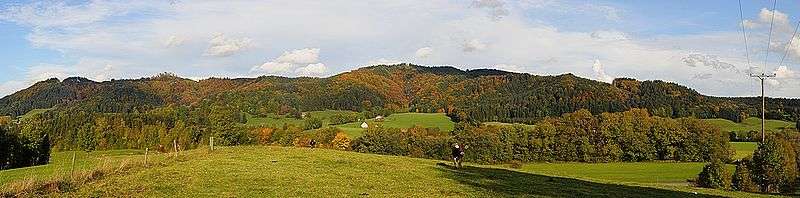
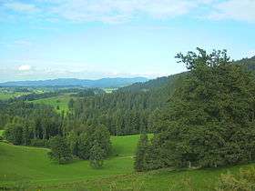 View from NE slope of the Laubenberg across the Eistobel valley and municipality of Maierhöfen looking NE towards the Adelegg | |
| Highest point | |
| Peak | Ursersberg |
| Elevation | 1,129 m above NN |
| Dimensions | |
| Area | 112 km2 (43 sq mi) |
| Geography | |
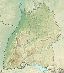 | |
| Country | Germany |
| States | Baden-Württemberg and Bavaria |
| Range coordinates | 47°41′33″N 10°07′32″E / 47.6925°N 10.12556°ECoordinates: 47°41′33″N 10°07′32″E / 47.6925°N 10.12556°E |
| Parent range | Allgäu Alps |
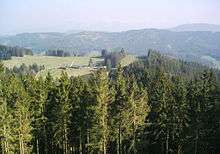
The Adelegg is a forested, mountain range, up to 1,129 m above sea level (NN)[1] and 112 km²[2] in area, which is part of the northern foothills of the Alps, within the Westallgäu in the south German districts of Ravensburg and Oberallgäu.
Geography
Location
The Adelegg forms the northernmost foothills of the Allgäu Alps in the southeastern part of the Bavarian Alps and extend a long way out into the Alpine Foreland. They lie between the Untere Argen near Isny to the southwest and west, and Leutkirch to the northwest (both in the Baden-Württemberg district of Ravensburg), and between Altusried to the northeast, Wiggensbach to the east, Buchenberg to the southeast and the Wengener Argen near Weitnau to the south (all in the Bavarian district of Oberallgäu).
The name Adelegg is generally only used for that part of the range located in Württemberg, but the landscape unit of the same name [3] also includes the Hohentanne Forest to the north-northeast, the Kürnach Forest to the northeast and the Buchenberg Forest to the east. To the south it is adjoined by the mountain ridge of Sonneck on the far side of the Wengener Argen, which is not however part of the Adelegg landscape unit.
Mountains
The highest mountain in the Adelegg range is the Schwarzer Grat, whose summit is located on Württemberg soil, just a few metres northwest of the Bavarian border, in the province of Tübingen. This peak and other mountains and hills, together with their foothills within the Adelegg range, and the landscape unit of Adelegg - which is higher in places –are sorted below by height in metres (m) above sea level (NN)[1] ; (BW = Baden-Württemberg; BV = Bavaria):
- Ursersberg (ca. 1,129 m), 1.4 km northwest of Buchenberg-Eschach, BV, highest mountain in the Kürnach Forest
- Hohenkapf (ca. 1,121.1 m), 2.3 km southwest of Buchenberg-Eschach, BV, highest mountain of the Buchenberg Forest
- Schwarzer Grat (1,118 m), 2.3 km north-northwest of Weitnau-Wengen, BW, highest mountain of the Adelegg
- unnamed summit (ca. 960 m), 2.2 km west-southwest of Kimratshofen-Walzlings, BV, highest of the Hohentanne Forest
Also only in the Adelegg range:
- Rote Fluh (1,090 m), 1 km northeast of the Schwarzer Grat, BW, Adelegg
- Schönbühl (1,074.8 m), 400 m north-northwest of the Schwarzer Grat, BW, Adelegg
- Raggenhorn (1,056.2 m), 1.4 km north-northwest of Weitnau-Wengen, BW und BV, Adelegg
- Hohkopf (1,035.2 m), 2.3 km east-southeast of Isny-Ratzenhofen, BW, Adelegg
- Wegmannshöhe (1,031.8 m), 2.4 km east of Isny-Ratzenhofen, BW, Adelegg
- Ochsenkapf (1,011.7 m), 1.8 km east-southeast of Isny-Ratzenhofen, BW, Adelegg
- Steinbergele (1,009.2 m), 2 km southeast of von Rohrdorf, BW, Adelegg
- Schafberg (1,008.9 m), 900 m south of Isny-Eisenbach, BW, Adelegg
- Rudershöhe (999.2 m), 2.3 km southeast of von Rohrdorf, BW, Adelegg
- Ölberg (961.8 m), 1.5 km east of Rohrdorf, BW, Adelegg
- Herrenberg (931.2 m), 1.8 km northeast of Rohrdorf, BW, Adelegg
- Bärenbühl (930.5 m), 1.2 km northeast of Rohrdorf, BW, Adelegg
- Heidenkopf (918.2 m), 800 m north-northeast of Rohrdorf, BW, Adelegg
- Kapf (885.7 m), 1 km west-southwest of Schmidsfelden, BW, Adelegg
Waterbodies and watersheds
The Eschach rises in the Buchenberg Forest that adjoins the Adelegg range and runs along the northeastern edge of the range in a mainly northwesterly direction before discharging into the Aitrach, whose waters make their way into the Danube via the northwards running Iller. At the southeastern end of the range is the little pond of Eschacher Weiher which, despite the name, is not connected to the Eschach. The Wengener Argen flows past the Adelegg to the south in an east-west direction and empties into the Untere Argen that runs past the southwestern end of the mountains from southeast to northwest, before its waters flow into Lake Constance and thence into the Rhine. The Adelegg is thus on the Rhine-Danube Watershed.
Nature reserves
Small areas of the Adelegg range, totalling 6.4 km² in area, belong to the Adelegg Special Area of Conservation Region (No. 8326-341). Large parts lie in the protected area of Adelegg and Associated Tertiary Hill Foreland (Adelegg und zugehöriges tertiäres Hügelvorland) (LSG No. 319441), which covers 68.14 km² and was founded on 31 March 1994.[1]
Economy and tourism
The Adelegg is used primarily for forestry and tourism. In the Modern Era, but possibly also in the Late Middle Ages, there were various glassworks here; one that may still be visited in the glassworks in the former glassmaking village of Schmidsfelden.
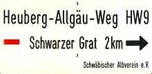
Hiking across the Adelegg is possible on the 320 km long Black Forest-Swabian Jura-Allgäu Way and the 185 km long Heuberg-Allgäu Way. There are also winter sports facilities, especially in the Buchenberg Forest area.
References
- 1 2 3 Map services of the Federal Agency for Nature Conservation
- ↑ Landschaftssteckbrief des BfN – Adelegg
- ↑ Geoinfo des BfN – Landschaft Adelegg
Sources
- Rudi Holzberger, Manfred Thierer: Die Adelegg, Das dunkle Herz des Allgäus, Wanderungen und Streifzüge 2009, ISBN 978-3-933614-50-6.
External links
| Wikimedia Commons has media related to Adelegg. |
- http://www.adelegg.info/ – Geology, People, Plants, Animals
- http://www.adelegg.de/