Addicks Reservoir
| Addicks Reservoir | |
|---|---|
| Location |
Houston, Texas, United States |
| Coordinates | 29°47′27″N 95°37′25″W / 29.7908°N 95.6236°WCoordinates: 29°47′27″N 95°37′25″W / 29.7908°N 95.6236°W |
| Type | Reservoir |
| Basin countries | United States |
The Addicks Reservoir and Addicks Dam in conjunction with the Barker Reservoir prevent downstream flooding of Buffalo Bayou in the City of Houston. Both reservoirs were authorized under the Rivers and Harbors Act of June 20, 1938, which was modified by the Flood Control Acts of August 11, 1938; September 3, 1954; and October 27, 1965. The U.S. Army Corps of Engineers completed construction of Addicks Dam and the outlet facility in 1948.[1]
Location
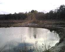
Addicks Reservoir is situated on the north side of Interstate 10. It extends slightly north of Clay Road, and between Barker-Cypress Road to the west and Sam Houston Tollway to the east. State Highway 6 bisects the reservoir north to south. In addition to the Reservoir's flood damage reduction mission, recreation and nature observation opportunities abound through the approximately 26,000 acres (105 km²) of land that makes up Addicks and Barker reservoirs, which are often dry wooded areas in normal times.[2] The West Houston Airport is located within the western edge of the Addicks reservoir, between Barker-Cypress Road and State Highway 6.
The Addicks Reservoir spillway is located at, 29°47′26″N 95°37′24″W / 29.79056°N 95.62333°W, and releases the remainder of Bear Creek just north of Buffalo Bayou.
Addicks Reservoir and Dam get their name from the former town of Addicks, TX.
Construction
Addicks Reservoir is formed by a rolled earthen dam 61,666 feet (18,796 m) long and above the streambed. A 12-foot-wide (3.7 m) gravel road extends along the top of the dam. The top of the dam has a maximum elevation of 121 feet (37 m) above the NAVD 1988 and is almost 50 feet high in points.[3][4] The maximum storage capacity of the reservoir is 201,000 acre feet (248,000,000 cubic metres; 248 gigalitres),[5] The record high water level for the reservoir prior to Hurricane Harvey was 123,100 acre feet (151,800,000 m3; 151.8 GL), set on April 24, 2016.[6]
During Hurricane Harvey, the level peaked at 109.1 feet on August 30, 2017; this is the highest recorded level for Addicks Reservoir.[7] Water retention at this level was 217,500 acre feet. Combined with the adjacent Barker Reservoir to the southwest, the total storage capacity is about 410,000 acre feet (510,000,000 m3; 510 GL).[8]
From 2008-2014, the U.S. Army Corps of Engineers Galveston District implemented $4.4 million in interim risk reduction measures (at Addicks and Barker dams) to address deficiencies until long-term solutions could be identified and executed. In 2014, staff completed a Dam Safety Modification Study to evaluate long-term repairs and address issues associated with the dams. Staff presented this information during a public meeting Oct. 29 at Bear Creek Community Center in Houston to discuss these plans and gather feedback. Construction is scheduled to begin May 2015 with an estimated completion date of 2019.
The northern and western ends of the dam consist of roller compacted concrete spillways. The existing ground at either end of Addicks Dam is lower than the top of dam elevation. Existing ground at the north end of Addicks Dam is at elevation 108 feet and ties into the concrete spillway crest at 112.5 feet. The existing ground at the western end is at elevation of 111.0 feet and ties into the concrete spillway which has a crest of 115.5 feet. (All elevations are NAVD 1988.)[4]
Controlled release
On August 28, 2017 during flooding from Hurricane Harvey, the U.S. Army Corps of Engineers began controlled water releases at both the Addicks and Barker Reservoirs, in an attempt to manage flood levels in the immediate area.[9] The waters continued to rise, and on August 29, after reaching pool elevation over 108 feet above NAVD 1988, the Addicks Reservoir began around the end of the dam near Tanner Rd. Flows less than 100 cubic feet per second were detected at the spillway. In the afternoon of August 29, 2017, the Army Corps of Engineers made the decision to raise the controlled release rates to 16,000 cubic feet per second. As of August 30, 2017, combined controlled discharge rates of Barker and Addicks were 13,700 cubic feet per second, and subdivisions surrounding the outlets and downstream past Beltway 8 experienced significantly increased flooding as Buffalo Bayou further overtopped its banks.[10]
Benefits
It is estimated the Addicks and Barker Reservoirs, along with other federal construction projects on Buffalo Bayou and its tributaries, prevent average annual flood damages of $16,372,000[11] to the city of Houston.
Recreation
Several parks are scattered throughout the reservoir, including Bear Creek Pioneers Park along with hike/bike/horse trails. There is a paved bicycle trail going alongside the reservoir, with the trail head being located next to Sherwood Elementary School.
References
- ↑ "Addicks Reservoir". Harris County Flood Control District. Retrieved 2018-10-05.
- ↑ Grabar, Henry (28 August 2017). "What Happened to the Two Reservoirs That Were Supposed to Protect Downtown Houston?". Slate. Retrieved 29 August 2017.
- ↑ Rogers, Adam (29 August 2017). "With Harvey, Imperfect Engineering Meets a Perfect Storm". Wired. Retrieved 31 August 2017.
- 1 2 Army Corps of Engineers (November 8, 2013). "REVIEW PLAN FOR ADDICKS AND BARKER DAMS" (PDF). Retrieved October 7, 2017.
- ↑ Addicks and Barker Reservoirs – Reservoir Information Archived 2009-06-18 at the Wayback Machine. United States Army Corps of Engineers. Last accessed July 18, 2012.
- ↑ USGS National Water Information System. U.S. Geological Survey. Last accessed April 27, 2016.
- ↑ National Water Information System (August 30, 2017). "USGS 08073000 Addicks Res nr Addicks, TX". Retrieved October 7, 2017.
- ↑ Addicks Reservoir, Handbook of Texas Online, 2008. Last accessed May 4, 2009.
- ↑ "Corps Releases at Addicks and Barker Dams to begin" (Press release). United States Army Corps of Engineers. August 28, 2017. Retrieved August 28, 2017.
- ↑ https://www.bbc.co.uk/news/world-us-canada-41081629
- ↑ U.S. Army Corp of Engineers, Galveston District Archived June 18, 2009, at the Wayback Machine., Last accessed January 1, 2011