Achilles, Kansas
| Achilles, Kansas | |
|---|---|
| Ghost town | |
| Coordinates: 39°42′43″N 100°50′11″W / 39.71194°N 100.83639°WCoordinates: 39°42′43″N 100°50′11″W / 39.71194°N 100.83639°W[1] | |
| Country | United States |
| State | Kansas |
| County | Rawlins |
| Elevation[1] | 2,844 ft (867 m) |
| Population | |
| • Total | 0 |
| Time zone | UTC-6 (CST) |
| • Summer (DST) | UTC-5 (CDT) |
| Area code | 785 |
| GNIS ID | 484547 [1] |


Achilles (/əˈtʃɪləs/ ə-CHIL-əs) is a ghost town in Rawlins County, Kansas, United States. Its heyday began in the 1870s and ended in roughly 1915 when the railroad bypassed Achilles and with more use of the automobile, Achilles declined. Most of the businesses were defunct by the mid- to late-1930s.
A post office was opened in Achilles in 1879, and remained in operation until it was discontinued in 1951.[2]
Over the years business in Achilles supported two general stores, including Hill General Store; a variety store; a blacksmith shop; a barbershop; a mechanics garage; and a creamery. These were lined along Main Street. These buildings are all gone. The blacksmith shop burned in 1922, and the hardware store was moved into Atwood and is used now for an antique shop. Several buildings were either moved or the wood was sold from the buildings. In about 1999 the last skeletal frame of a general store was burned, erasing all signs of Main Street. Now "Main Street" is part family garden, crop field, weeds, and overgrowth.
There were two houses actually in Achilles: Pearl (Hill) and Frank Bacon home and the Fields house. The Fields house remains; the Bacon home was moved. Off of Main Street stood a Methodist church, later moved to Atwood and used for a home. Also off Main Street stood the Achilles one-room schoolhouse, which is still standing and used for community events. Nearby Achilles Cemetery acknowledges many of the pioneers who settled the area.
In 1993 Achilles was still marked on Kansas State maps, but by 2001 it was no longer acknowledged on newly published maps.
Climate
| Climate data for Achilles | |||||||||||||
|---|---|---|---|---|---|---|---|---|---|---|---|---|---|
| Month | Jan | Feb | Mar | Apr | May | Jun | Jul | Aug | Sep | Oct | Nov | Dec | Year |
| Average high °F (°C) | 43.2 (6.2) |
40.3 (4.6) |
57.5 (14.2) |
66.2 (19) |
74.9 (23.8) |
82.7 (28.2) |
91.8 (33.2) |
91.2 (32.9) |
80.8 (27.1) |
73.4 (23) |
58.6 (14.8) |
46.0 (7.8) |
67.2 (19.6) |
| Average low °F (°C) | 11.5 (−11.4) |
9.2 (−12.7) |
24.5 (−4.2) |
34.2 (1.2) |
44.5 (6.9) |
53.5 (11.9) |
58.6 (14.8) |
57.2 (14) |
44.9 (7.2) |
36.1 (2.3) |
22.3 (−5.4) |
13.2 (−10.4) |
34.1 (1.2) |
| Average precipitation inches (mm) | 0.4 (10) |
0.7 (18) |
1.0 (25) |
1.8 (46) |
3.0 (76) |
3.0 (76) |
3.1 (79) |
2.5 (64) |
1.9 (48) |
1.0 (25) |
0.4 (10) |
0.5 (13) |
19.2 (488) |
| Source: Weatherbase [3] | |||||||||||||
References
- 1 2 3 Geographic Names Information System (GNIS) details for Achilles, Kansas; United States Geological Survey (USGS); October 13, 1978.
- ↑ "Kansas Post Offices, 1828-1961". Kansas Historical Society. Archived from the original on October 9, 2013. Retrieved 22 June 2014.
- ↑ "Weatherbase: Historical Weather for Achilles, Kansas". Weatherbase. 2011. Retrieved on November 24, 2011.
Municipalities and communities of Rawlins County, Kansas, United States | ||
|---|---|---|
| Cities | 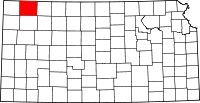 | |
| Unincorporated communities | ||
| Ghost town | ||