Aceguá, Uruguay
| Aceguá | |
|---|---|
| Town | |
 Aceguá Location in Uruguay | |
| Coordinates: 31°52′0″S 54°10′0″W / 31.86667°S 54.16667°WCoordinates: 31°52′0″S 54°10′0″W / 31.86667°S 54.16667°W | |
| Country |
|
| Department | Cerro Largo |
| Population (2011) | |
| • Total | 1,511 |
| Time zone | UTC -3 |
| Postal code | 37001 |
| Dial plan | +598 46 (+6 digits) |
Aceguá is the Uruguayan part of a town in the Cerro Largo Department of eastern Uruguay.
Location
It is located on Route 8, on the border with Brazil. The border between Uruguay and Brazil passes though the town and the two parts are separated by an international street.
History
Its status was raised from populated centre to "Pueblo" (village) on 23 December 1941 by decree Ley 10.101[1] and then to "Villa" (town) on 14 April 1986 by decree Ley 15.810.[2]
Population
In 2011 Aceguá had a population of 1,511.[3]
| Year | Population |
|---|---|
| 1908 | 3.766 |
| 1963 | 464 |
| 1975 | 929 |
| 1985 | 1,302 |
| 1996 | 1,432 |
| 2004 | 1,493 |
| 2011 | 1,511 |
Source: Instituto Nacional de Estadística de Uruguay[4]
Places of worship
- Parish Church of Christ the King (Roman Catholic)
References
- ↑ "LEY N° 10.101". República Oriental del Uruguay, Poder Legislativo. 1941. Archived from the original on 4 March 2016. Retrieved 3 September 2012.
- ↑ "LEY N° 15.810". República Oriental del Uruguay, Poder Legislativo. 1968. Archived from the original on 4 March 2016. Retrieved 3 September 2012.
- ↑ "Censos 2011 Cuadros Cerro Largo". INE. 2012. Archived from the original on 10 October 2012. Retrieved 25 August 2012.
- ↑ "Statistics of urban localities (1963–2004)". INE. 2012. Archived from the original (PDF) on 23 March 2015. Retrieved 3 September 2012.
External links
Capital: Melo | ||
| Towns and villages | 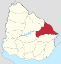 | |
| Sights | ||
This article is issued from
Wikipedia.
The text is licensed under Creative Commons - Attribution - Sharealike.
Additional terms may apply for the media files.