A635 road
| |
|---|---|
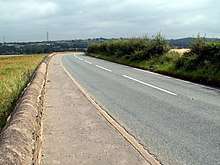
.jpg) A635 as Ashton Old Road in Beswick, Greater Manchester | |
| Major junctions | |
| West end |
|
|
| |
| East end |
|
| Location | |
| Primary destinations |
Manchester Ashton-under-Lyne Holmfirth Huddersfield Barnsley |
| Road network | |

The A635 is a main road that runs between Manchester and Scawsby running east–west through Stalybridge, Saddleworth Moor, Holmfirth, Barnsley and Doncaster. The section forming the eastern part of the Mancunian Way is in fact a motorway and is officially designated as the A635(M) though there is no road sign with this designation;[1] indeed the signs at the entrance of Mancunian Way westbound show A57(M).
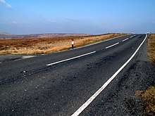
The section between Greenfield and Holmfirth, which passes across Saddleworth Moor, is known locally as the Isle of Skye Road after a public house that was at Wessenden Head until it was demolished in the 1950s after a fire. It passes over treeless high moor top for about 4 miles: Saddleworth Moor west of the county boundary and Wessenden Head Moor to the east. This section of the road is at high altitude and in winter months local snowfall usually results in closures of the road. In January 2010, as a result of the extreme winter, the road was closed for over a month, and other closures also occurred in the same winter.
Unlike the other Pennine passes in the area such as the A57 Snake Pass (Manchester to Sheffield), the A62 (Manchester to Huddersfield and Leeds) and the A58 (Rochdale to Halifax and Leeds), the section of the A635 over the Pennines enjoys much quieter traffic since the A628 Woodhead pass is much more direct when travelling between Manchester and Barnsley, connecting directly to the M1 junction 37 and passing through the centre of Barnsley. In 2012, after a recent increase of car incident rates over the moors, a 50mph speed limit was put in place between Greenfield and Holmfirth. In Barugh Green there's a small junction where the B6428 terminates. The road continues through Barnsley to Doncaster where it merges with the A638.
The road became infamous because of its connection with the 1960s Moors murders.
A section of the road at the Manchester end had to be closed in August 2015 after it collapsed following unusually torrential rain.[2]
References
- ↑ The City of Manchester (Mancunian Way A635(M) and A57(M) Mancunian Way Slip Roads) Special Road Scheme 1992 Confirmation Instrument 1995
- ↑ "Mancunian Way could be closed for WEEKS after 40ft deep hole appears - Manchester Evening News". Manchester Evening News. 14 August 2015. Archived from the original on 11 September 2015. Retrieved 14 August 2015.
External links
A roads in Zone 6 of the Great Britain road numbering scheme | ||
|---|---|---|