Aínsa-Sobrarbe
| Aínsa-Sobrarbe (Spanish) L'Aínsa-Sobrarbe (Aragonese) | ||
|---|---|---|
| municipality | ||
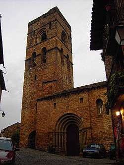 Parish church of Santa Maria. | ||
| ||
 Aínsa-Sobrarbe (Spanish) Location in Spain. | ||
| Coordinates: 42°25′2″N 0°8′19″E / 42.41722°N 0.13861°E | ||
| Country | Spain | |
| Autonomous community | Aragon | |
| Province | Huesca | |
| Comarca | Sobrarbe | |
| Government | ||
| • Mayor | José Miguel Cheliz Pérez | |
| Area | ||
| • Total | 285 km2 (110 sq mi) | |
| Elevation | 569 m (1,867 ft) | |
| Population (2010) | ||
| • Total | 2,180 | |
| • Density | 7.6/km2 (20/sq mi) | |
| Time zone | UTC+1 (CET) | |
| • Summer (DST) | UTC+2 (CEST) | |

Aínsa-Sobrarbe (in Aragonese: L'Aínsa-Sobrarbe) is a municipality located in the province of Huesca, Aragon, Spain. As of 2010 (INE), the municipality has a population of 2,180 inhabitants.
Aínsa is the economic development capital of the Sobrarbe comarca.
Villages
Besides the main Aínsa town there are the following villages within its municipal term:
- Arcusa
- Arro
- Banastón
- Las Bellostas
- Camporrotuno
- Castejón de Sobrarbe
- Castellazo
- Coscojuela de Sobrarbe
- El Coscollar
- Gerbe
- Griébal
- Guaso
- Jabierre de Olsón
- Latorre
- Latorrecilla
- Mondot
- Morillo de Tou
- Olsón
- La Pardina
- La Ripa
- Paúles de Sarsa
- Santa María de Buil
- Sarratillo
- Sarsa de Surta
- Urriales
Uninhabited villages and hamlets
The following formerly populated places are now uninhabited: Bagüeste, Pacinias, Cerollar, Casa Sierra, Casa Linás, Escapa, La Lecina, Linés, La Capana and Puibayeta.
There are also small hamlets that are inhabited only ocacasionally, like Casa Almunia, Molino López, Molino Villacampa, Molino Jabierre, Sarratiás, Sarrato, Coronillas, Pelegrín and Gabardilla.
Twin towns

External links
| Wikivoyage has a travel guide for Ainsa. |
| Wikimedia Commons has media related to Aínsa. |
Municipalities of Sobrarbe | ||
|---|---|---|
1Shared capitals of the comarca | ||
This article is issued from
Wikipedia.
The text is licensed under Creative Commons - Attribution - Sharealike.
Additional terms may apply for the media files.