1953 North Kyushu flood
| Date | 25 June 1953-29 June 1953 |
|---|---|
| Location | Fukuoka Prefecture, Saga Prefecture, Kumamoto Prefecture, Ōita Prefecture and other regions of Northern Kyushu |
| Cause | Cloudburst due to East Asian rainy season |
| Deaths | 759 |
| Property damage | 221.7 billion yen (Market price in 1953) |
The 1953 North Kyushu flood was the flood which hit Northern Kyushu, Japan (Fukuoka Prefecture, Saga Prefecture, Kumamoto Prefecture and Ōita Prefecture) in June 1953. The torrential rain of the rainy season, amounting to more than 1,000 mm on Aso and Hikosan mountains, produced the great flood to many rivers such as Chikugo River and the toll of more than 1,000 people dead and missing. 450,000 houses were flooded and 1,000,000 people suffered from the flood. The fundamental change of flood control in the Kyushu area was needed and the standards of flood control have been taken against further floods.
Name of the flood
The name of the flood remains unsettled. In Kumamoto Prefecture, Shirakawa Great Flood or 6.26 Flood is usually used, while the name of the flood differs from literature to literature. In Kitakyushu city, they use「北九州大水害」or North Kyushu Great Flood. In the Japanese Wikipedia article,「昭和28年西日本水害」(1953, Nishinippon Flood) is used, based on the decision of the Western Japan Branch of the Japan Society of Civil Engineers. In this article, 1953 North Kyushu Flood is used, based on the areas of the flood.
Weather
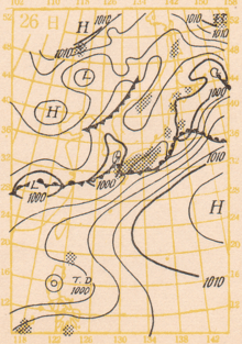
In the early part of June 1953, a rainy season front (baiyu zensen) stayed in the middle of Kyushu causing heavy rain, which went southward to Amami Oshima. On the other hand, a Pacific anticyclone present in the Philippines pressed the rainy season front to the Tsushima Strait. At the same time, an anticyclone from China moved to Kyushu pressing the front to Yakushima. The rainy season front was pressed both from west and south, and stayed in the Mountain Aso around June 23, and the front was stimulated by the high temperature air from the anticyclones. Low-pressure areas passed in succession from Korea and Tsushima, which usually would have stayed in Yakushima.
Flood
Flood in Kumamoto, 6.26 Great Flood
- In Kumamoto Prefecture, the central river Shirakawa flooded most severely, and people remember it by the name of 6.26 Suigai(flood). The factors of the 6.26 flood were: heavy rain in the Aso district(In Kurokawa mura), the rainfall reached 888.4 mm in 5 days, another factor being the soil of the areas; it contained layers rich in yona(volcanic ash) over lava; which easily liquefies on heavy rain.
- A similar event was seen in 1993 Kagoshima Heavy Rain. .
- On April 27, Mount Aso erupted and a great amount of volcanic ash which fell was mixed with rain; producing peculiar debris flow in the Kurokawa river and Shirakawa river merging into Shirakawa into Kumamoto.
- The third factor was the Kumamoto city; the river Shirakawa was the so-called tenjo-kawa, or a ceiling river, namely, the river bed is higher than its surroundings such as Shimotori. These factors worsened the damage of the flood.
- 70% of the then Kumamoto city was flooded, except the Kyomachi Hills and Kengun area. The central areas of Kumamoto City were 2.5 meters to 3 meters deep in muddy water. 15 bridges out of 17 in the city were carried away except Taiko Bridge and Choroku Bridge. Kokaibashi was carried away with 40 inhabitants.
- The disposal of 60,000,000,000 tons of muddy soil presented big problems; 116 areas including a moat of the Kumamoto Castle were used. The Kumamoto city gave subsidies to clean up the streets; 2000 yen for bicycle trailers, 4500 yen for 3-wheel cars and 10,750 yen for a truck; producing many small enterprises with trucks.[2]
- A house for the aged was destroyed and 52 people were killed.
- The damage amounted to 17,300,000,000 yen (121,930,000,000 yen,now)
- Even in the southern part of Aso gun, the dead and missing amounted to 66.
Flood in Fukuoka Prefecture:Chikugogawa Area
The Chikugo River (筑後川, Chikugo-gawa) flows through Kumamoto, Oita, Fukuoka and Saga prefectures in Japan. With a total length of 143 kilometres(89 mi), it is the longest river on Kyushu. It flows from Mount Aso and empties into the Ariake Sea. The river is important to industry, with twenty electrical power plants located along its banks, as well as the major city of Kurume in Fukuoka Prefecture.
- 147 people were killed in the areas of Chikugo River; all areas of Tsukushi plain were flooded, and the Yoake dam which was under construction, the bank of Kasegawa, and the bank of Yabegawa, the area of Homan Gawa were also flooded. 80 percent of Kurume city was flooded; in the center of the city, water was 1 meter deep, 3 meters deep at the deepest. This flood is called one of the three worst floods, including that of 1890 and that of 1921.
- The total damage amounted to 79,300,000,000 yen, which was equivalent to twice the yearly budget of Fukuoka Prefecture.
Amounts of Precipitation
| Point of Measurement | TotalAmount(June 25–29) | Amount on maximum precipitation day | |
|---|---|---|---|
| Uenoda, Ooita-ken | 1,148.5 | 400.0(June 26) | |
| Miyahara, Kumamoto-ken | 1,002.6 | 426.2(June 25) | |
| Oguni, Kumamoto-ken | 994.6 | 433.6(June 25) | |
| Yabe, Fukuoka-ken | 934.2 | 395,0(June 25) | |
| Nogami, Ooita-ken | 929.7 | 364.0(June 25) | |
| Kurokawa, Kumamoto-ken | 888.4 | 500.2(June 26) | |
| Hita, Ooita-ken | 705.6 | 292.4(June 25) | |
| Ooita,Ooita-ken | 698.5 | 223.1(June 26) | |
| Moji,Fukuoka-ken | 646.1 | 398.3(June 28) | |
| Fukuoka, Fukuoka-ken | 621.4 | 307.8(June 25) | |
| Kumamoto, Kumamoto-ken | 595.9 | 411.9(June 26) | |
| Saga,Saga-ken | 587.1 | 366.5(June 25) | |
| Kurume, Fukuoka-ken | 564.3 | 308.7(June 25) | |
| Iizuka, Fukuoka-ken | 534.8 | 235.5(June 25) |
Damage
The Japanese Government took appropriate measures comparable with those took for typhoons in 1948. The 5th Yoshida Cabinet (Government) placed " Nishinihon (West Japan) flood countermeasure center" in Fukuoka City. Not only National Safety Forces(which later became Land Force), but also American soldiers helped. The people in the flooded areas greatly appreciated the supply of free food and water, while they thought the flood was a natural disaster and could not be helped.
The damage published by the National Regional Police Fukuoka Center
| Prefecture | Dead Persons | Missing Persons | Injured Persons | Houses swept away | Half destroyed | Flooded above floor | Flooded partly | Amounts of damage(in 100,000,000yen) | |
|---|---|---|---|---|---|---|---|---|---|
| Fukuoka-ken | 259 | 27 | 1,402 | 1,321 | 829 | 12,116 | 92,532 | 119,127 | 793 |
| Saga-ken | 59 | 3 | 337 | 319 | 108 | 4,425 | 37,895 | 38,053 | 249 |
| Nagasaki-ken | 59 | 3 | 337 | 319 | 108 | 4,425 | 37,895 | 38,053 | 249 |
| Kumamoto-ken | 339 | 198 | 558 | 1,009 | 850 | 10,412 | 49,038 | 39,607 | 850 |
| Ooita-ken | 55 | 13 | 239 | 333 | 653 | 1,435 | 6,179 | 18,513 | 178 |
Countermeasures
1953 was the year of great disasters; the heavy rain in the south Kishu area, Wakayama Prefecture, with 1,046 people dead and missing and in the Minami Yamashiro area(105 people were killed). The causes were attributed to reckless deforestation, and the lack of water control after the second world war. The damaged Yoake Dam was investigated but the inadequate water control of the upper river was found to blame. The Japanese Government decided to follow America and its Tenessey Valley Corporation and started to build many dams such as, Matsubara Dam, Shimauch Tsutsumi (Chikugo River), Shimouke Dam (Tsue River), Ooishi, Harazuru, Sennenbunsuiro (Chikugo River), Chikugoooseki, Terauchi Dam (Sa ta River), Ishiharagawa Dam, Ooishi Dam, Jouharagawa Dam, Hyugakami Dam, Masubuchi Dam, Aburagi Dam, and Jin-ya Dam. In 2009, the countermeasures were again under review in view of the global warming and heat island phenomenon and the outbreaks of heavy rainfall in Northern Kyushu in 2009.
See also
Notes
- ↑ "Shirakawa Suigai in Japanese". Archived from the original on 2011-07-23. Retrieved 2010-12-25.
- ↑ 50 years have passed after the 6.26 Shirakawa Flood. Kumamoto Nichinichi Shimbun, 2003. p.61
References
- Kuniaki Sonoda, 1953 Great Flood Data and Photographs園田国昭 昭和28年大水害写真資料展
- 建設省九州地方建設局筑後川工事事務所『筑後川五十年史』:1976年
- 建設省河川局監修・財団法人ダム技術センター編『日本の多目的ダム 直轄編』1990年版:山海堂。1990年
- 建設省河川局監修・財団法人ダム技術センター編『日本の多目的ダム 補助編』1990年版:山海堂。1990年
- 園田国昭 「昭和28年西日本大水害」の概況:九州大学附属図書館。2003年 - 水害写真展
- 内閣府政府広報室 西日本水害に関する世論調査
- 北九州市 昭和28年の北九州大水害
- 災害伝承情報データベース 昭和28年西日本水害
- 西日本新聞 ワードBOX 昭和28年水害
- 熊本県 熊本県の災害要因と被災状況
- 新聞に見る世相熊本 昭和編 6.26水害 熊本を襲う 熊本日日新聞社 熊本. p. 178
- 6.26 白川水害50年(2003) 熊本日日新聞 熊本 ISBN 978-4-87755-149-0
- The records of the 6.26 great flood, in New Kumamoto City History(1995), Volume 8, p236-250.
Coordinates: 33°37′39″N 130°25′23″E / 33.627504°N 130.422935°E