1952 Damxung earthquake
 Lhasa | |
| UTC time | 1952-08-17 16:02:14 |
|---|---|
| ISC event | 893286 |
| USGS-ANSS | ComCat |
| Local date | August 18, 1952 |
| Local time | 00:02:14 |
| Magnitude | 7.5 Mw |
| Depth | 25 km (16 mi) |
| Epicenter | 30°38′53″N 91°36′4″E / 30.64806°N 91.60111°ECoordinates: 30°38′53″N 91°36′4″E / 30.64806°N 91.60111°E |
| Areas affected | China |
| Max. intensity | X (Extreme) |
| Casualties | 54+ |
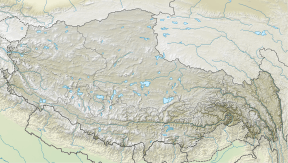
The 1952 Damxung earthquake struck Tibet with moment magnitude of 7.5 in the early morning hours of August 18.[1][2] The epicenter was located in the Nyenchen Tanglha Mountains in Damxung County, Lhasa Prefecture, Tibet Autonomous Region, People's Republic of China.[3] There was significant damage in Damxung (Dangquka) and nearby Nagqu County. It was felt in Lhasa, over 100 km (62 mi) to the south.[2]
The earthquake damaged Reting Monastery and 54 people died at Reting (Razheng) and Tangmu.[2] The total number of fatalities is unknown.
Damxung County suffered another significant earthquake in 2008, further southwest parallel to the Nyenchen Tanglha Mountains.
References
- ↑ National Physical Atlas of China. Beijing, China: China Cartographic Publishing House. 1999. ISBN 7503120401.
- 1 2 3 "Significant Earthquake". NOAA. National Oceanic and Atmospheric Administration. Retrieved 20 September 2017.
- ↑ "M 7.4 - eastern Xizang". Earthquake Hazards Program. USGS. Retrieved 20 September 2017.
This article is issued from
Wikipedia.
The text is licensed under Creative Commons - Attribution - Sharealike.
Additional terms may apply for the media files.