1918 Celebes Sea earthquake
.svg.png) .svg.png) | |
| UTC time | 1918-08-15 12:18:21 |
|---|---|
| ISC event | 913230 |
| USGS-ANSS | ComCat |
| Local date | August 15, 1918 |
| Local time | 20:18 |
| Magnitude | 8.3 Mw[1] |
| Depth | 20 km (12 mi)[1] |
| Epicenter | 5°58′01″N 124°22′37″E / 5.967°N 124.377°ECoordinates: 5°58′01″N 124°22′37″E / 5.967°N 124.377°E[1] |
| Max. intensity | X (Extreme) |
| Tsunami | Yes |
| Casualties | 52 |
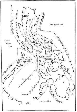
The Cotabato Trench in southern Mindanao and the Philippine Mobile Belt.
.svg.png)
Near the Cotabato Trench, two of the largest 20th century Philippine earthquakes: the 1918 Celebes Sea earthquake (8.3 Mw) and the 1976 Moro Gulf earthquake (8.0 Mw). Also included is the recent 2002 Mindanao earthquake (7.5 Mw). The Moro Gulf, part of the Celebes Sea, is labeled for context.
The 1918 Celebes Sea earthquake occurred on 15 August at 12:18 UTC.[2] It had a magnitude of 8.3 on the moment magnitude scale[3] and a maximum perceived intensity of X (Extreme) on the Mercalli intensity scale.
This event in the southern Philippines triggered a large tsunami, with a maximum run-up of 7.2 m,[4] which affected the coasts of the Celebes Sea, causing widespread damage. The combined effects of the earthquake and the tsunami caused 52 casualties.
See also
References
- 1 2 3 "M 8.3 - Mindanao, Philippines". United States Geological Survey. August 15, 1918. Retrieved August 27, 2017.
- ↑ "Comments for the Significant Earthquake". Significant Earthquake Database. National Geophysical Data Center. Retrieved 27 June 2015.
- ↑ ISC (27 June 2015), ISC-GEM Global Instrumental Earthquake Catalogue (1900–2009), Version 2.0, International Seismological Centre
- ↑ "Comments for the Tsunami Event". NGDC/WDS Tsunami Event Database. National Geophysical Data Center. Retrieved 27 June 2015.
External links
- The International Seismological Centre has a bibliography and/or authoritative data for this event.
This article is issued from
Wikipedia.
The text is licensed under Creative Commons - Attribution - Sharealike.
Additional terms may apply for the media files.