Švenčionys District Municipality
| Švenčionys District Municipality Švenčionių rajono savivaldybė | ||
|---|---|---|
| Municipality | ||
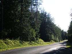 Labanoras Forest | ||
| ||
 Location of Švenčionys District Municipality | ||
| Coordinates: 55°07′30″N 26°10′34″E / 55.12500°N 26.17611°ECoordinates: 55°07′30″N 26°10′34″E / 55.12500°N 26.17611°E | ||
| Country |
| |
| Ethnographic region | Dzūkija/Aukštaitija | |
| County |
| |
| Capital | Švenčionys | |
| Elderships |
List
| |
| Area | ||
| • Total | 1,692 km2 (653 sq mi) | |
| Population (2017) | ||
| • Total | 24,608 | |
| • Density | 15/km2 (38/sq mi) | |
| Time zone | UTC+2 (EET) | |
| • Summer (DST) | UTC+3 (EEST) | |
| Website |
www | |

Švenčionys District Municipality is one of 60 municipalities in Lithuania.
International relations
Twin towns — Sister cities
Švenčionys district municipality is twinned with the following towns:
See also
References
External links
![]()

This article is issued from
Wikipedia.
The text is licensed under Creative Commons - Attribution - Sharealike.
Additional terms may apply for the media files.