Ōboke Station
Ōboke Station 大歩危駅 | |
|---|---|
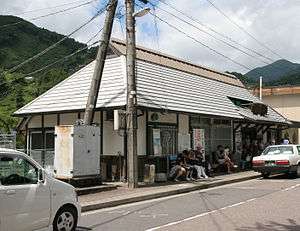 Ōboke Station in 2008 | |
| Location |
Nishiiyayamamura Tokuzennishi, Miyoshi-shi, Tokushima-ken 778-0105 Japan |
| Coordinates | 33°52′35″N 133°46′02″E / 33.8765°N 133.767264°ECoordinates: 33°52′35″N 133°46′02″E / 33.8765°N 133.767264°E |
| Operated by |
|
| Line(s) | ■ Dosan Line |
| Distance | 65.5 km from Tadotsu |
| Platforms | 1 side + 1 island platforms |
| Tracks | 3 and 1 siding |
| Connections | Bus stop |
| Construction | |
| Parking | Available |
| Bicycle facilities | Bike shed |
| Disabled access | Yes - level crossing connects to all platforms |
| Other information | |
| Status | unstaffed |
| Station code | D27 |
| Website | Official website |
| History | |
| Opened | 28 November 1935 |
| Previous names | Awa-Akano (until 1950) |
| Location | |
 Ōboke Station Location within Japan | |
Ōboke Station (大歩危駅 Ōboke-eki) is a railway station on the Dosan Line in Miyoshi, Tokushima Prefecture, Japan. It is operated by JR Shikoku and has the station number "D27".[1][2]
Lines
The station is served by the JR Shikoku Dosan Line and is located 65.5 km from the beginning of the line at Tadotsu.[3] Besides the local trains on the Dosan Line, the Nanpū limited express from Okayama to Kōchi, Nakamura, and Sukumo, and the Shimanto limited express from Takamatsu to Kōchi, Nakamura, and Sukumo also stop at the station.[4]
Layout
The station, which is unstaffed, consists of an island platform and a side platform serving three tracks. A building by the access road serves as a waiting room. From there, a pedestrian level crossing connects to the island platform and, across two more tracks, to the side platform.[2]
.jpg) A view of the station platforms in 2015. A wheelchair user can be seen crossing the tracks at the level crossing.
A view of the station platforms in 2015. A wheelchair user can be seen crossing the tracks at the level crossing.
Adjacent stations
| « | Service | » | ||
|---|---|---|---|---|
| Dosan Line | ||||
| Koboke | - | Tosa-Iwahara | ||
History
The station opened on 28 November 1935 when the then Kōchi Line was extended northwards from Toyonaga to Minawa and the line was renamed the Dosan Line. At this time the station was named Awa-Akano Station (阿波赤野駅) and was operated by Japanese Government Railways, later becoming Japanese National Railways (JNR). On 1 October 1950, the station was renamed Ōboke Station. With the privatization of JNR on 1 April 1987, control of the station passed to JR Shikoku.[3][5]
Surrounding area
- Yoshino River - the second longest river in Shikoku. The track runs on the left bank and a scenic view of the river is available from the side platform.
- National Route 32 - this main trunk route runs parallel to the track on the other side of the Yoshino River.
- Ōboke Gorge - a scenic gorge on the Yoshino River. Boat excursions are available near the station.[6]
Bus services
A bus stop for buses operated by the Shikoku Transportation Company is located near the front entrance of the station.[7]
See also
References
| Wikimedia Commons has media related to Ōboke Station. |
- ↑ "Shikoku Railway Route Map" (PDF). JR Shikoku. Retrieved 25 November 2017.
- 1 2 "大歩危" [Ōboke]. hacchi-no-he.net. Retrieved 14 December 2017.
- 1 2 Ishino, Tetsu et al. (eds.) (1998). 停車場変遷大事典 国鉄・JR編 [Station Transition Directory - JNR/JR] (in Japanese). II. Tokyo: JTB Corporation. p. 665. ISBN 4533029809.
- ↑ "Ōboke Station Timetable" (PDF). JR Shikoku. Retrieved 14 December 2017.
- ↑ Ishino, Tetsu et al. (eds.) (1998). 停車場変遷大事典 国鉄・JR編 [Station Transition Directory - JNR/JR] (in Japanese). I. Tokyo: JTB Corporation. pp. 217–218. ISBN 4533029809.
- ↑ "Oboke-kyo & Koboke-kyo (Oboke & Koboke gorges)". miyoshinavi.jp. Retrieved 15 December 2017.
- ↑ "四国交通ホーム" [Shikoku Transportation Company Homepage]. yonkoh.co.jp. Retrieved 15 December 2017.