Čeladná
| Čeladná | |||
| Village | |||
 Municipal office | |||
|
|||
| Country | Czech Republic | ||
|---|---|---|---|
| Region | Moravian-Silesian | ||
| District | Frýdek-Místek | ||
| Little District | Frýdlant nad Ostravicí | ||
| Center | municipal office | ||
| - elevation | 430 m (1,411 ft) | ||
| - coordinates | 49°32′51″N 18°20′14″E / 49.54750°N 18.33722°ECoordinates: 49°32′51″N 18°20′14″E / 49.54750°N 18.33722°E | ||
| Area | 59.05 km2 (22.80 sq mi) | ||
| Population | 2,229 (2006-07-03) | ||
| Density | 38/km2 (98/sq mi) | ||
| Founded | 1600 | ||
| Mayor | Pavol Lukša | ||
| Postal code | 739 12 | ||
  Location in the Czech Republic | |||
 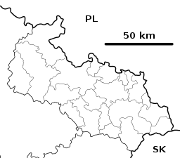 Location in the Moravian-Silesian Region | |||
| Wikimedia Commons: Čeladná | |||
| Website: www | |||


Čeladná is a village in the Moravian-Silesian Region of the Czech Republic. It lies under the Moravian-Silesian Beskids Range. There are many holiday houses in the large area of the village. In recent years it has become a popular holiday resorts with new hotels, a horse ranch, golf course and new apartment buildings are being built right in the centre.
| Wikimedia Commons has media related to Čeladná. |
This article is issued from
Wikipedia.
The text is licensed under Creative Commons - Attribution - Sharealike.
Additional terms may apply for the media files.