Île-des-Chênes
| Île-des-Chênes | |
|---|---|
| Village | |
| Nickname(s): Island of Oaks | |
 Île-des-Chênes Location of Île-des-Chênes in Manitoba. | |
| Coordinates: 49°42′38″N 96°59′18″W / 49.71056°N 96.98833°W | |
| Country | Canada |
| Province | Manitoba |
| Government | |
| • MP (Member of Parliament) | Ted Falk (CPC) |
| Area | |
| • Total | 2.03 km2 (0.78 sq mi) |
| Population | |
| • Total | 1,763[1] |
| • Density | 618.3/km2 (1,601/sq mi) |
| postal code | R0A 0T0 |
Île-des-Chênes is an unincorporated community in Manitoba, Canada, within the Rural Municipality of Ritchot. The community is located just east of Highway 59, approximately 10 minutes southeast of the provincial capital Winnipeg.
References
- ↑ "Ile des Chenes population data". Stats Canada. Retrieved April 23, 2014.
See also
External links
| Wikivoyage has a travel guide for Île-des-Chênes. |
Coordinates: 49°42′38″N 96°59′18″W / 49.71056°N 96.98833°W
| Cities | 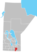 | ||
|---|---|---|---|
| Towns | |||
| Villages | |||
| Rural municipalities |
| ||
| First Nations | |||
| Indian reserves | |||
| Unincorporated communities | |||
This article is issued from
Wikipedia.
The text is licensed under Creative Commons - Attribution - Sharealike.
Additional terms may apply for the media files.