Étables-sur-Mer
| Étables-sur-Mer Staol | ||
|---|---|---|
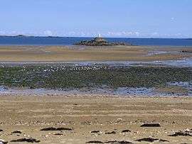 Plage du moulin | ||
| ||
 Étables-sur-Mer Location within Brittany region  Étables-sur-Mer | ||
| Coordinates: 48°37′38″N 2°50′02″W / 48.6272°N 2.8338°WCoordinates: 48°37′38″N 2°50′02″W / 48.6272°N 2.8338°W | ||
| Country | France | |
| Region | Brittany | |
| Department | Côtes-d'Armor | |
| Arrondissement | Saint-Brieuc | |
| Canton | Plouha | |
| Area1 | 9.38 km2 (3.62 sq mi) | |
| Population (2008)2 | 2,999 | |
| • Density | 320/km2 (830/sq mi) | |
| Time zone | UTC+1 (CET) | |
| • Summer (DST) | UTC+2 (CEST) | |
| INSEE/Postal code | 22055 /22680 | |
| Elevation | 0–82 m (0–269 ft) | |
|
1 French Land Register data, which excludes lakes, ponds, glaciers > 1 km2 (0.386 sq mi or 247 acres) and river estuaries. 2 Population without double counting: residents of multiple communes (e.g., students and military personnel) only counted once. | ||
.svg.png)
Étables-sur-Mer (Breton: Staol, Gallo: Establ) is a former commune in the Côtes-d'Armor department of Brittany in northwestern France. It is the seat of the commune of Binic-Étables-sur-Mer.
History
It is notable as the birthplace of Saint Théodore Guérin (Saint Theodora).[1]
On 1 March 2016, Binic and Étables-sur-Mer merged becoming one commune called Binic-Étables-sur-Mer.
Population
| Historical population | ||
|---|---|---|
| Year | Pop. | ±% |
| 1962 | 1,928 | — |
| 1968 | 1,954 | +1.3% |
| 1975 | 2,041 | +4.5% |
| 1982 | 2,039 | −0.1% |
| 1990 | 2,121 | +4.0% |
| 1999 | 2,514 | +18.5% |
| 2008 | 2,999 | +19.3% |
Inhabitants of Étables-sur-Mer are called tagarins or établais in French.
See also
References
- ↑ Mug, Mary Theodosia (1904). Life and Life-Work of Mother Theodore Guerin. New York: Benzinger Bros.
External links
| Wikimedia Commons has media related to Étables-sur-Mer. |
This article is issued from
Wikipedia.
The text is licensed under Creative Commons - Attribution - Sharealike.
Additional terms may apply for the media files.