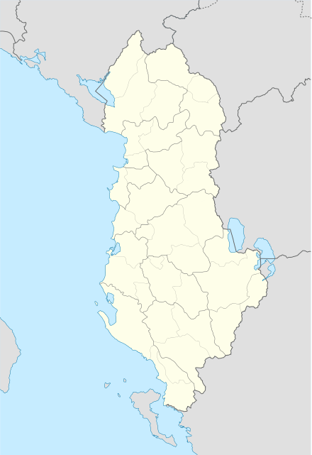
Çorovodë
| Çorovodë | ||
|---|---|---|
| Administrative Unit | ||
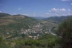 Çorovodë in the Distance | ||
| ||
 Çorovodë | ||
| Coordinates: 40°30′N 20°13′E / 40.500°N 20.217°ECoordinates: 40°30′N 20°13′E / 40.500°N 20.217°E | ||
| Country |
| |
| County | Berat | |
| Municipality(s) | Skrapar | |
| Elevation | 300 m (1,000 ft) | |
| Time zone | UTC+1 (CET) | |
| • Summer (DST) | UTC+2 (CEST) | |
| Website | http://bashkiacorovode.gov.al | |

Çorovodë, also written as Çorovoda is a town and a former municipality in Berat County, Albania. At the 2015 local government reform it became a subdivision and the seat of the municipality Skrapar.[1] The population at the 2011 census was 4,051.[2] The name of the town derives from the Slavic for "black water". It was the seat of the former Skrapar District.
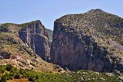
The river Osum passes through the city. Upstream it forms canyons and caves which are the highest and the longest in Albania. The river provides opportunities for kayaking and other aquatic sport.
Histoy
The smaller Çorovoda River also flows through the city and mouths into the Osum river. Five km northeast of Çorovodë it formed the Gradec Canyon. In one of its cliffs the presumably biggest cave of Albania named "Pirogosh" is located. Allegedly, two kings, Piro and Goshi, named it. Also of note is the Ottoman-era Kasabashi stone bridge over the Çorovoda river. Some archaeologists believe Çorovodë might be the oldest city in Albania. They have found ruins of some churches and a buried castle in Pristina which might be more ancient than the castle of Berat.
Tourism
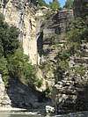
Çorovodë is known for activities like rafting and mountain hiking. The Osum river is a river that pass between canyons that makes rafting hard and hosts annual rafting contests and championships. The food in the town is the most organic food in Albania. There are many mountains and hikes in the area.
- Bogova Reserve
- Osum Canyon
- Pirogoshi Cave
Notable people
- Xhelal bej Koprencka, modern Albania's founding father
- Hajredin bej Carkani, modern Albania's founding father
See also
References
- ↑ Law nr. 115/2014 Archived 2015-09-24 at the Wayback Machine.
- ↑ 2011 census results Archived 2016-03-03 at the Wayback Machine.
Administrative Divisions of Berat County | ||
|---|---|---|
County Seat: Berat | ||
| Municipality of Berat |  | |
| Municipality of Kuçovë | ||
| Municipality of Poliçan | ||
| Municipality of Skrapar | ||
| Municipality of Ura Vajgurore | ||
Subdivisions of Skrapar Municipality | ||
|---|---|---|
Municipal Seat: Çorovodë | ||
| Administrative Unit of Bogovë |  | |
| Administrative Unit of Çepan | ||
| Administrative Unit of Çorovodë | ||
| Administrative Unit of Gjerbës | ||
| Administrative Unit of Leshnjë | ||
| Administrative Unit of Potom | ||
| Administrative Unit of Qendër Skrapar | ||
| Administrative Unit of Vendreshë | ||
| Administrative Unit of Zhepë | ||