Ålefjær

District Ålefjær
Village and District

Coat of arms

Map of Kristiansand with Ålefjær district highlighted in yellow
Coordinates: 58°14′15″N 8°02′06″E / 58.2374°N 08.0351°E / 58.2374; 08.0351Coordinates: 58°14′15″N 8°02′06″E / 58.2374°N 08.0351°E / 58.2374; 08.0351
Country Norway
Region Southern Norway
County Vest-Agder
Municipality Kristiansand
Borough Lund
Elevation[1] 13 m (43 ft)
Population (2014)
  Total 410
Time zone UTC+01:00 (CET)
  Summer (DST) UTC+02:00 (CEST)
ISO 3166 code NO-030112
Website kristiansand.kommune.no

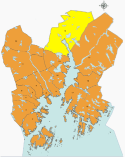
Ålefjær is a village and district in the municipality of Kristiansand in Vest-Agder county, Norway. The village and district lies in the far northern part of the municipality within the borough of Lund. The population of the district in 2014 was 410. Ålefjær borders the district of Tveit to the southeast, the district of Justvik to the southwest, the municipality of Vennesla to the northwest, and the municipality of Birkenes to the northeast. The village of Ålefjær is situated at the northern end of the Ålefjærfjorden, a branch off the Topdalsfjorden. The district is a very rural area, although it is only about 5 kilometres (3.1 mi) southeast of the large village of Vennesla and about 10 kilometres (6.2 mi) north of the city of Kristiansand.

Transportation

Bus transportation from/through Ålefjær
LineDestination [2]
22Ålefjær - Gimlekollen - Kvadraturen
23Ålefjær - Vollevannet - Kvadraturen
29Ålefjær - Justvik
220Ålefjær - Vennesla
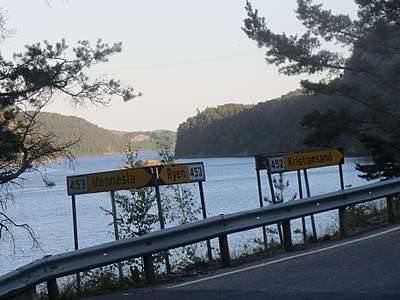
By the road crossing in Ålefjær (County roads 452 and 453)

References

  1. "Ålefjær, Kristiansand (Vest-Agder)". yr.no. Retrieved 2017-02-19.
  2. "AKT".
This article is issued from Wikipedia. The text is licensed under Creative Commons - Attribution - Sharealike. Additional terms may apply for the media files.