periplus
English
WOTD – 4 August 2016
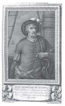
A 1791 engraving of the Spanish explorer Juan Sebastián Elcano (1476–1526), who completed the first periplus, or circumnavigation, of the Earth
Alternative forms
Etymology
From Latin periplūs, from Ancient Greek περίπλους (períplous, “circumnavigation”), from περί (perí, “around”) + πλέω (pléō, “I sail”).
Pronunciation
- IPA(key): /ˈpɛɹɪplʌs/
- Hyphenation: pe‧ri‧plus
Noun
periplus (plural peripli or periploi or peripluses)
- A circumnavigation; a sea voyage around a coastline.
- 1828, Viscount de Chateaubriand [François-René de Chateaubriand], “Preface: Sketch of Voyages and Travels”, in Travels in America and Italy, [...] In Two Volumes, volume I, London: Henry Colburn, […], OCLC 11267969, page 39:
- In the great Ocean, California, its gulph, and the Vermilion Sea were known to Cortes [Hernán Cortés]; [Juan Rodríguez] Cabrillo proceeded along the coast of New California as far as the 43d degree of north latitude; Galbi advanced to the 57th degree. Amidst so many real peripluses, [Alonso del Castillo] Maldonado, Juan de Fuca, and Admiral de Fonte, placed their chimerical voyages.
- 1884, Charles Deane, “The Voyages of the Cabots”, in Justin Winsor, editor, Narrative and Critical History of America, volume III, Boston, Mass.; New York, N.Y.: Houghton, Mifflin and Company, OCLC 833524097, page 2:
- On the spot where he [Sebastian Cabot] landed he planted a large cross, with the flags of England and of St. Mark, and took possession for the King of England. If the statement be true that he coasted three hundred leagues, he may have made a periplus of the Gulf of St. Lawrence, returning home through the Straits of Belle Isle.
- 1978, Raymond Queneau, Michael Edwards, editor, Raymond Queneau (Prospice; 8), Portree, Isle of Skye: Aquila Pub. Co., →ISBN, ISSN 0308-2776, page 12:
- Yes sir, I have seen vessels leaving there for distant peripluses – yes yes: peripluses. Some were going to the poles, and others to the antipodes. Whereas I – I have never even set foot on the boat that goes over the estuary to Trouville.
- 1997, Manfred Pfister, “‘Sailing after Knowledge’: The Logbook Aesthetics of Pound's Cantos”, in Andreas Fischer, Martin Heusser, and Thomas Herrmann, editors, Aspects of Modernism: Studies in Honour of Max Nänny, Tübingen: Gunter Narr Verlag, →ISBN, page 98:
- All the four books and the photograph are, in various degrees of literality or metaphoricity, about a periplus, the circumnavigation of an entire world, be that Homer's Mediterranean, Dante [Alighieri]'s hell, purgatory and paradise, [James] Joyce's Dublin, or the cosmos of [Ezra Pound's] The Cantos, stretching across all the continents and all periods of history, and they are, therefore, the logbook accounts of such a periplus.
-
- A record of such a voyage.
- 1738, Pierre Bayle; John Peter Bernard; Thomas Birch; John Lockman [et al.], “HUDSON (Dr. JOHN)”, in A General Dictionary, Historical and Critical: […], volume VI, London: Printed by James Bettenham, for G. Strahan, J. Clarke […] [et al.], OCLC 757563231, page 300, footnote B:
- Then follows a Periplus of the Euxine-Sea, which bears the name of Arrian, and was undoubtedly written by him in the time of Adrian, as the inſcription ſhews.
- 1800, William Vincent, The Periplus of the Erythrean Sea. Part the First. Containing, an Account of the Navigation of the Ancients, from the Sea of Suez to the Coast of Zanguebar. With Dissertations, volume I, London: Printed by A[ndrew] Strahan, Printers Street; for T[homas] Cadell, Jun. and W. Davies […], OCLC 54563433, page 3:
- The Periplûs of the Erythrêan Sea is the title prefixed to a work which contains the beſt account of the commerce carried on from the Red Sea and the coaſt of Africa to the Eaſt Indies, during the time that Egypt was a province of the Roman Empire.
- 1859, Leonhard Schmitz, “Period of Historical Geography, from about B.C. 450, the Age of Herodotus, down to B.C. 276, or the Time of Eratosthenes”, in A Manual of Ancient Geography [...] With a Map Showing the Retreat of the 10,000 Greeks under Xenophon, Philadelphia, Pa.: Blanchard and Lea, OCLC 780482658, page 25:
- Another great source of geographical information both for the ancients themselves and, so far as they still exist, for us also, are the Peripli (περίπλοι), that is, descriptions of the coasts of certain seas, in which the towns, ports, and promontories are enumerated, and often with their distances from one another. These peripli were drawn up for the guidance of sailors who had occasion to visit these seas for commercial and other purposes.
- 1974, Guy Davenport, Tatlin!: Six Stories, New York, N.Y.: Charles Scribner’s Sons, →ISBN:
- […] the map of the world Ptolemy followed in his geography, finding the longitude that passed through the Gates of Herakles and the island of Rhodes, and placing north and south of it the world as recorded on the periploi of the Phoenician merchants.
- 1978, “Periplus and Periegesis: Greek Maritime Writings”, in George Kish, editor, A Source Book in Geography (Source Books in the History of the Sciences), Cambridge, Mass.; London: Harvard University Press, →ISBN, page 24:
- A periplus of the Mediterranean: Greek sailing directions The following excerpt from one of the most complete periploi was attributed in the nineteenth century to the Greek merchant Scylax of Caryanda, known to have traded with settlements not only along the Red Sea but also on the shores of the Indian Ocean.
- 2016, Georgia L[ynette] Irby, “Greek and Roman Cartography”, in Georgia L. Irby, editor, A Companion to Science, Technology, and Medicine in Ancient Greece and Rome, volume II, Chichester, West Sussex; Hoboken, N.J.: John Wiley & Sons, →ISBN, page 827:
- Listing cities along a coast, periploi gave details about sailing conditions, harbors, what the area imported or exported, what tariffs to expect, whether the people were friendly or not, and what noteworthy landmarks and marvels (mirabilia) one might expect to see. Hanno, whose periplus of Africa (circa 480 bce) was aborted when supplies ran out, described strange peoples and animals, including Trogodytes clad in animal skins and wild men, called "gorillas."
-
Coordinate terms
Translations
Anagrams
This article is issued from
Wiktionary.
The text is licensed under Creative
Commons - Attribution - Sharealike.
Additional terms may apply for the media files.