Zonsverduistering van 18 mei 1901
De totale zonsverduistering van 18 mei 1901 trok veel over zee, maar was achtereenvolgens te zien op of in deze 5 (ei)landen : Madagaskar, Réunion, Mauritius, Indonesië en Papoea Nieuw-Guinea.[1][2]
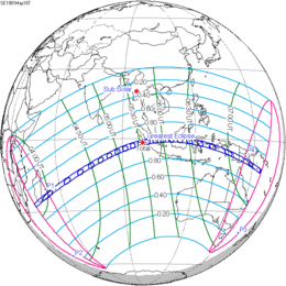
De zonsverduistering was te zien tussen de blauwe lijnen.
Lengte
Maximum
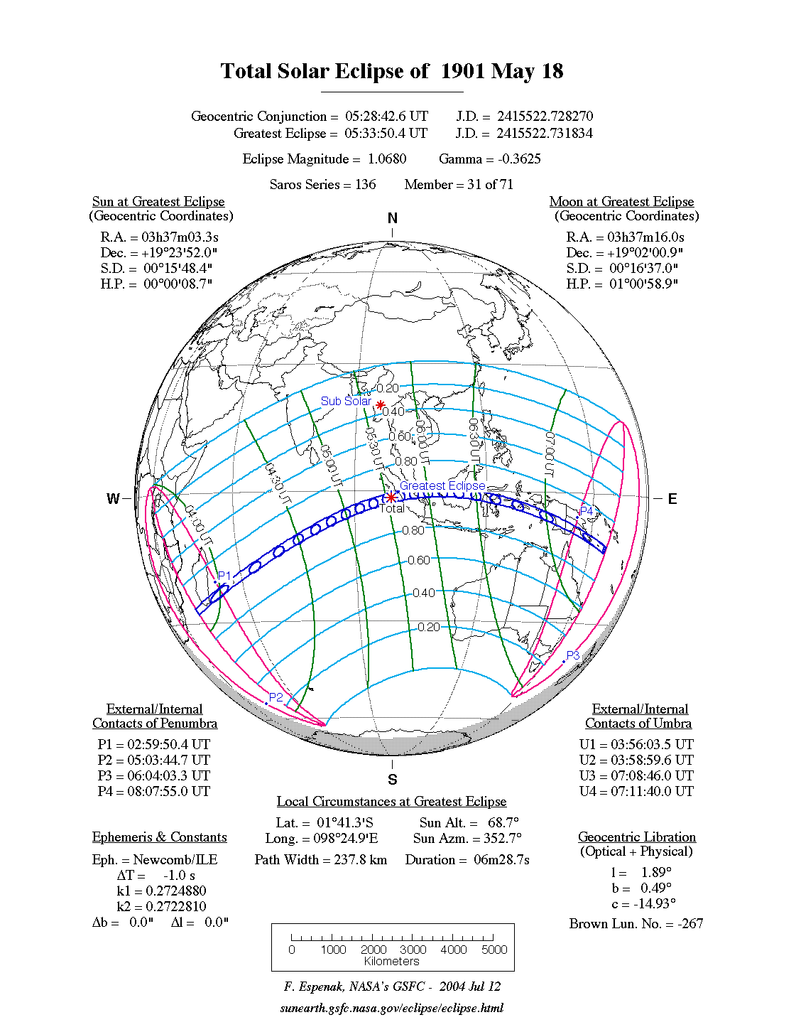
Het punt met maximale totaliteit lag in zee vlak voor de kust van het eiland Pulau Siberut, dat behoort tot de regio West-Sumatra van Indonesië, op coördinatenpunt 1.6905° Zuid, 98.4156° Oost en duurde 6m28,7s.
Limieten
| Fenomeen | Code | Tijdstip UTC |
|---|---|---|
| Eerste contact bijschaduw | P1 | 02:59:50.4 UT |
| Eerste contact kernschaduw | U1 | 03:56:03.5 UT |
| Kernschaduw compleet vanaf | U2 | 03:58:59.6 UT |
| Bijschaduw compleet vanaf | P2 | 05:03:44.7 UT |
| Maximum eclips | GE | 05:33:50.4 UT |
| Bijschaduw compleet t/m | P3 | 06:04:03.3 UT |
| Kernschaduw compleet t/m | U3 | 07:08:46.0 UT |
| Laatste contact kernschaduw | U4 | 07:11:40.0 UT |
| Laatste contact bijschaduw | P4 | 08:07:55.0 UT |
Zie ook
Externe links
- NASA Google map van deze verduistering
- NASA overzicht van alle verduisteringen
Bronnen, noten en/of referenties
|
This article is issued from
Wikipedia.
The text is licensed under Creative
Commons - Attribution - Sharealike.
Additional terms may apply for the media files.