Windsor and Maidenhead
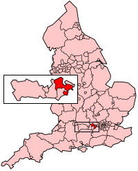
Windsor and Maidenhead is een unitary authority en een district in de Engelse regio South East England in het ceremoniële graafschap Berkshire en telt 151.000 inwoners. De oppervlakte bedraagt 197 km2.
| Unitaire autoriteit in Engeland | |||
 | |||
| Situering | |||
| Land | Engeland | ||
| Status | ceremonieel graafschap | ||
| Regio | South East England | ||
| Coördinaten | 51°28'0"NB, 0°40'0"WL | ||
| Algemeen | |||
| Oppervlakte | 196,5017[1] km² | ||
| Inwoners (2018[2]) | 150906 (768 inw./km²) | ||
| ONS-code | E06000040 | ||
| |||
Demografie
Van de bevolking is 15,4 % ouder dan 65 jaar. De werkloosheid bedraagt 2,0 % van de beroepsbevolking (cijfers volkstelling 2001).
Het aantal inwoners daalde van ongeveer 133.700 in 1991 naar 133.626 in 2001.
Civil parishes in district Windsor and Maidenhead
Bisham, Bray, Cookham, Cox Green, Datchet, Eton, Horton, Hurley, Old Windsor, Shottesbrooke, Sunningdale, Sunninghill and Ascot, Waltham St. Lawrence, White Waltham, Wraysbury.
Bronnen, noten en/of referenties
|
This article is issued from
Wikipedia.
The text is licensed under Creative
Commons - Attribution - Sharealike.
Additional terms may apply for the media files.