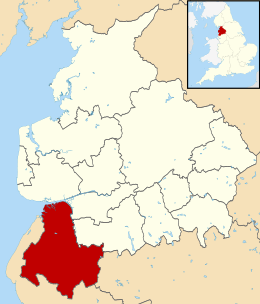
West Lancashire
West Lancashire is een Engels district in het shire-graafschap (non-metropolitan county OF county) Lancashire en telt 114.000 inwoners. De oppervlakte bedraagt 347 km².
| Niet-metropolitaans district in Engeland | |||
 | |||
| Situering | |||
| Land | Engeland | ||
| County | Lancashire | ||
| Regio | North West England | ||
| Coördinaten | 53°33'43"NB, 2°49'37"WL | ||
| Algemeen | |||
| Oppervlakte | 346,7849[1] km² | ||
| Inwoners (2018[2]) | 113949 (329 inw./km²) | ||
| ONS-code | E07000127 | ||
| |||
Van de bevolking is 15,6% ouder dan 65 jaar. De werkloosheid bedraagt 3,2% van de beroepsbevolking (cijfers volkstelling 2001).
Plaatsen in district West Lancashire
Civil parishes in district West Lancashire
Aughton, Bickerstaffe, Bispham, Burscough, Dalton, Downholland, Great Altcar, Halsall, Hesketh-with-Becconsall, Hilldale, Lathom, Lathom South, Newburgh, North Meols, Parbold, Rufford, Scarisbrick, Simonswood, Tarleton, Up Holland, Wrightington.
Bronnen, noten en/of referenties
|
This article is issued from
Wikipedia.
The text is licensed under Creative
Commons - Attribution - Sharealike.
Additional terms may apply for the media files.