Staffordshire Moorlands
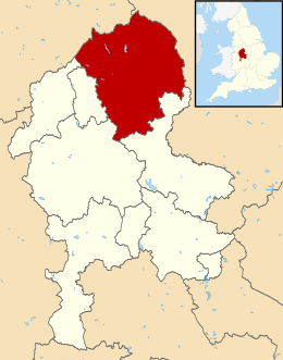
Staffordshire Moorlands is een Engels district in het shire-graafschap (non-metropolitan county OF county) Staffordshire en telt 98.000 inwoners. De oppervlakte bedraagt 576 km².
| Niet-metropolitaans district in Engeland | |||
 | |||
| Situering | |||
| Land | Engeland | ||
| County | Staffordshire | ||
| Regio | West Midlands | ||
| Coördinaten | 53°6'24"NB, 2°1'36"WL | ||
| Algemeen | |||
| Oppervlakte | 575,8498[1] km² | ||
| Inwoners (2018[2]) | 98397 (171 inw./km²) | ||
| ONS-code | E07000198 | ||
| |||
Van de bevolking is 17,4% ouder dan 65 jaar. De werkloosheid bedraagt 2,2% van de beroepsbevolking (cijfers volkstelling 2001).
Civil parishes in district Staffordshire Moorlands
Alstonefield, Alton, Bagnall, Biddulph, Blore with Swinscoe, Bradnop, Brown Edge, Butterton, Caverswall, Cheadle, Checkley, Cheddleton, Consall, Cotton, Dilhorne, Draycott in the Moors, Endon and Stanley, Farley, Fawfieldhead, Forsbrook, Grindon, Heathylee, Heaton, Hollinsclough, Horton, Ilam, Ipstones, Kingsley, Leek, Leekfrith, Longnor, Longsdon, Oakamoor, Onecote, Quarnford, Rushton, Sheen, Tittesworth, Warslow and Elkstones, Waterhouses, Werrington, Wetton.
Bronnen, noten en/of referenties
|