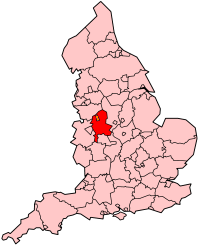
Stafford (district)
Stafford is een Engels district in het shire-graafschap (non-metropolitan county OF county) Staffordshire en is 598 km² groot.
| Niet-metropolitaans district in Engeland | |||
  | |||
| Situering | |||
| Land | Engeland | ||
| County | Staffordshire | ||
| Regio | West Midlands | ||
| Coördinaten | 52°48'18"NB, 2°7'0"WL | ||
| Algemeen | |||
| Oppervlakte | 598,1721[1] km² | ||
| Inwoners (2018[2]) | 135880 (227 inw./km²) | ||
| Hoofdplaats ONS-code | Stafford E07000197 | ||
| |||
Plaatsen in district Stafford
Woodseaves.
Civil parishes in district Stafford
Adbaston, Barlaston, Berkswich, Bradley, Brocton, Chebsey, Church Eaton, Colwich, Creswell, Doxey, Eccleshall, Ellenhall, Forton, Fradswell, Fulford, Gayton, Gnosall, Haughton, High Offley, Hilderstone, Hixon, Hopton and Coton, Hyde Lea, Ingestre, Marston, Milwich, Norbury, Ranton, Salt and Enson, Sandon and Burston, Seighford, Standon, Stone, Stone Rural, Stowe-by-Chartley, Swynnerton, Tixall, Weston, Whitgreave.
Bronnen, noten en/of referenties
|
This article is issued from
Wikipedia.
The text is licensed under Creative
Commons - Attribution - Sharealike.
Additional terms may apply for the media files.