Shire of Woodanilling
Shire of Woodanilling is een Local Government Area (LGA) in Australië in de staat West-Australië. Shire of Woodanilling telde 409 inwoners in 2016. De hoofdplaats is Woodanilling.
| Local Government Area van Australië | |||
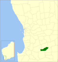 Locatie van Shire of Woodanilling in West-Australië | |||
| Situering | |||
| Staat | West-Australië | ||
| Hoofdplaats | Woodanilling | ||
| Coördinaten | 33°33'50"ZB, 117°25'55"OL | ||
| Algemene informatie | |||
| Oppervlakte | 1129,0 km² | ||
| Inwoners | 409 (2016)[1] | ||
| Overig | |||
| Wards | 3 | ||
| Website | (en) Shire of Woodanilling | ||
| |||
Geschiedenis
Het Woodanilling Road District werd op 2 februari 1906 opgericht. Op 23 juni 1961 veranderde het van naam in de Shire of Woodanilling.[2]
Plaatsen, dorpen en lokaliteiten
- Woodanilling
- Beaufort River
- Cartmeticup
Bevolking
| Jaar | Bevolkingsaantal |
|---|---|
| 1911 | 614 |
| 1921 | 639 |
| 1933 | 671 |
| 1947 | 697 |
| 1954 | 718 |
| 1961 | 639 |
| 1966 | 580 |
| 1971 | 529 |
| 1976 | 447 |
| 1981 | 461 |
| 1986 | 435 |
| 1991 | 391 |
| 1996 | 354 |
| 2001 | 394 |
| 2006 | 418 |
| 2011 | 419 |
| 2016 | 409 |
Bronnen, noten en/of referenties
|
Geplaatst op: 03-09-2008 |
Dit artikel is een beginnetje over landen & volken. U wordt uitgenodigd om op bewerken te klikken om uw kennis aan dit artikel toe te voegen. |
This article is issued from
Wikipedia.
The text is licensed under Creative
Commons - Attribution - Sharealike.
Additional terms may apply for the media files.