Shire of Irwin
Shire of Irwin is een Local Government Area (LGA) in de regio Mid West in West-Australië. Shire of Irwin telde 3.569 inwoners in 2016. De hoofdplaats is Dongara.
| Local Government Area van Australië | |||
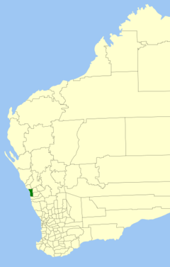 Locatie van Shire of Irwin in West-Australië | |||
| Situering | |||
| Staat | West-Australië | ||
| Hoofdplaats | Dongara | ||
| Coördinaten | 29°15'4"ZB, 114°55'52"OL | ||
| Algemene informatie | |||
| Oppervlakte | 2.374,4 km² | ||
| Inwoners | 3.569 (2016)[1] | ||
| Overig | |||
| Website | (en) Shire of Irwin | ||
| |||
Geschiedenis
Op 24 januari 1871 werd het Irwin Road District opgericht. Op 23 juni 1961 werd het Irwin Road District de Shire of Irwin.[2]
Beschrijving
De Shire of Irwin is meer dan 2.300 km² groot. Het ligt in de regio Mid West, ongeveer 360 kilometer ten noorden van de West-Australische hoofdstad Perth. Het telde 3.569 inwoners in 2016.
Plaatsen, dorpen en lokaliteiten
- Dongara
- Allanooka
- Arrowsmith
- Bookara
- Port Denison
- Springfield
- Yardarino
Bevolkingsaantal
| Jaar | Bevolkingsaantal |
|---|---|
| 1933 | 555 |
| 1947 | 465 |
| 1954 | 611 |
| 1961 | 657 |
| 1966 | 810 |
| 1971 | 941 |
| 1976 | 1.196 |
| 1981 | 1.578 |
| 1986 | 1.905 |
| 1991 | 2.100 |
| 1996 | 2.433 |
| 2001 | 2.810 |
| 2006 | 3.052 |
| 2011 | 3.567 |
| 2016 | 3.569 |
Bronnen, noten en/of referenties
|
Geplaatst op: 03-09-2008 |
Dit artikel is een beginnetje over landen & volken. U wordt uitgenodigd om op bewerken te klikken om uw kennis aan dit artikel toe te voegen. |
This article is issued from
Wikipedia.
The text is licensed under Creative
Commons - Attribution - Sharealike.
Additional terms may apply for the media files.