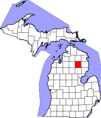
Oscoda County
Oscoda County is een county in de Amerikaanse staat Michigan.
| County in de Verenigde Staten | |||
 | |||
| Situering | |||
| Staat | Michigan | ||
| Coördinaten | 44°40'48"NB, 84°7'48"WL | ||
| Algemeen | |||
| Oppervlakte | 1.480 km² | ||
| - land | 1.463 km² | ||
| - water | 17 km² | ||
| Inwoners (2000) | 9.418 (6 inw./km²) | ||
| Overig | |||
| Zetel | Mio | ||
| FIPS-code | 26135 | ||
| Opgericht | 1840 | ||
| Foto's | |||
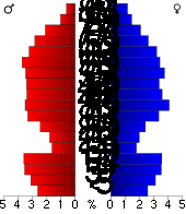 Bevolkingspiramide Oscoda County | |||
| Statistieken volkstelling Oscoda County | |||
| |||
De county heeft een landoppervlakte van 1.463 km² en telt 9.418 inwoners (volkstelling 2000). De hoofdplaats is Mio.
Bevolkingsontwikkeling
| Historische inwonertallen | |||
|---|---|---|---|
| Jaar | Inwoners | % ± | |
| 1900 | 1.468 | ||
| 1910 | 2.027 | 38,1% | |
| 1920 | 1.783 | −12,0% | |
| 1930 | 1.728 | −3,1% | |
| 1940 | 2.543 | 47,2% | |
| 1950 | 3.134 | 23,2% | |
| 1960 | 3.447 | 10,0% | |
| 1970 | 4.726 | 37,1% | |
| 1980 | 6.858 | 45,1% | |
| 1990 | 7.842 | 14,3% | |
| 2000 | 9.418 | 20,1% | |
| Bron: (en) Historical Decennial Census Population | |||
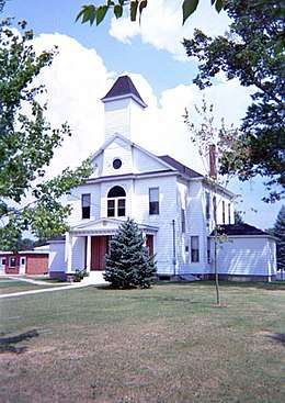
Oscoda County Courthouse
This article is issued from
Wikipedia.
The text is licensed under Creative
Commons - Attribution - Sharealike.
Additional terms may apply for the media files.