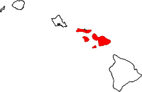
Maui County
Maui County is een county in de Amerikaanse staat Hawaï. Het omvat de eilanden Maui, Kahoolawe, Lanai, Molokai (behalve een klein deel met Kalawao County), en Molokini.
| County in de Verenigde Staten | |||
 | |||
| Situering | |||
| Staat | Hawaï | ||
| Coördinaten | 20°53'0"NB, 156°39'0"WL | ||
| Algemeen | |||
| Oppervlakte | 6.212 km² | ||
| - land | 3.002 km² | ||
| - water | 3.210 km² | ||
| Inwoners (2000) | 128.094 (43 inw./km²) | ||
| Overig | |||
| Zetel | Wailuku | ||
| FIPS-code | 15009 | ||
| Foto's | |||
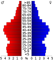 Bevolkingspiramide Maui County | |||
| Statistieken volkstelling Maui County | |||
| |||
De county heeft een landoppervlakte van 3.002 km² en telt 128.094 inwoners (volkstelling 2000). De hoofdplaats is Wailuku.
Stedenbanden

Bevolkingsontwikkeling
| Historische inwonertallen | |||
|---|---|---|---|
| Jaar | Inwoners | % ± | |
| 1900 | 26.743 | ||
| 1910 | 29.762 | 11,3% | |
| 1920 | 37.385 | 25,6% | |
| 1930 | 55.541 | 48,6% | |
| 1940 | 55.534 | −0,0% | |
| 1950 | 48.179 | −13,2% | |
| 1960 | 42.576 | −11,6% | |
| 1970 | 45.984 | 8,0% | |
| 1980 | 70.847 | 54,1% | |
| 1990 | 100.374 | 41,7% | |
| 2000 | 128.094 | 27,6% | |
| Bron: (en) Historical Decennial Census Population | |||
Externe link
This article is issued from
Wikipedia.
The text is licensed under Creative
Commons - Attribution - Sharealike.
Additional terms may apply for the media files.