Lijst van onroerend erfgoed in Heuvelland
Een overzicht van het onroerend erfgoed in de gemeente Heuvelland. Het onroerend erfgoed maakt deel uit van het cultureel erfgoed in België.
Bouwkundig erfgoed
| Object | Erfgoedstatus? | Bouwjaar of architect | Deelgemeente | Adres | Coördinaten | Nummer? | Afbeelding |
|---|---|---|---|---|---|---|---|
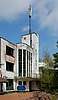
| Belvedère | Monument | Kemmel | Kemmelbergweg 38 | 50° 46' 45" NB, 2° 48' 57" OL | 32615 | Upload foto | |
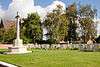
| Franse militaire begraafplaats Ossuaire en gedenkzuil Den Engel | Monument | Kemmel | Bergstraat | 50° 46' 42" NB, 2° 48' 38" OL | 32616 | 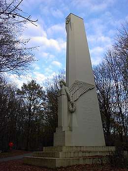 Franse militaire begraafplaats Ossuaire en gedenkzuil Den Engel | |
| De Warande, kasteel | Monument | 1925 | Kemmel | Bergstraat 24 | 50° 46' 50" NB, 2° 49' 25" OL | 32617 |  De Warande, kasteel |
| Hoeve | Kemmel | Briekeriestraat 1 | 50° 47' 24" NB, 2° 50' 59" OL | 32618 | Upload foto | ||
| Hoekhuis | Kemmel | Dries 21 | 50° 46' 57" NB, 2° 49' 34" OL | 32619 | Upload foto | ||
| Café Delobel | Kemmel | Dries 29 | 50° 46' 58" NB, 2° 49' 38" OL | 32620 | 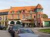 Café Delobel | ||
| Hoekhuizen, voormalige herberg en beenhouwerij | Kemmel | Kemmelstraat 3 | 50° 48' 5" NB, 2° 51' 8" OL | 32621 | Upload foto | ||
| Landhuis cottagestijl met historische site | Monument | Kemmel | Reningelststraat 10 | 50° 46' 60" NB, 2° 49' 56" OL | 32622 | Upload foto | |
| Restaurant Richelieu | Kemmel | Kemmelstraat 47 | 50° 47' 0" NB, 2° 49' 58" OL | 32623 | Upload foto | ||
| Hoeve | Kemmel | Kemmelstraat 17 | 50° 47' 20" NB, 2° 50' 29" OL | 32625 | Upload foto | ||
| Amerikaans oorlogsmonument | Kemmel | Ieperstraat | 50° 46' 22" NB, 2° 53' 36" OL | 32626 | Upload foto | ||
| Parochiekerk Sint-Laurentius | Kemmel | St.-Laurentiusplein | 50° 47' 2" NB, 2° 49' 34" OL | 32627 |  Parochiekerk Sint-Laurentius | ||
| Pastorie | Kemmel | St.-Laurentiusplein 2 | 50° 47' 1" NB, 2° 49' 32" OL | 32628 | 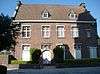 Pastorie | ||
| Hoeve | cultuurhistorisch landschap | Kemmel | Klareputstraat 2 | 50° 47' 10" NB, 2° 48' 10" OL | 32629 | Upload foto | |
| Hoeve | Kemmel | Kriekstraat 2 | 50° 47' 24" NB, 2° 49' 16" OL | 32630 | Upload foto | ||
| Frans oorlogsmonument | Kemmel | Kriekstraat | 50° 47' 55" NB, 2° 50' 4" OL | 32631 | Upload foto | ||
| Arbeidershuisje | Kemmel | Lokerstraat 4 | 50° 46' 60" NB, 2° 49' 29" OL | 32632 | Upload foto | ||
| Arbeidershuisje | Kemmel | Lokerstraat 2 | 50° 46' 60" NB, 2° 49' 32" OL | 32633 | Upload foto | ||
| Herenhoeve Traisnel | Monument | Kemmel | Lokerstraat 49 | 50° 46' 52" NB, 2° 48' 4" OL | 32634 | Upload foto | |
| Hoeve Busschaertlinde | Monument | Kemmel | Millekruisestraat 2 | 50° 47' 27" NB, 2° 49' 17" OL | 32635 | Upload foto | |
| Dubbelhuizen | Kemmel | Nieuwstraat 10-12 | 50° 47' 5" NB, 2° 49' 37" OL | 32636 | Upload foto | ||
| Burgerwoning | Kemmel | Kemmelstraat 40 | 50° 46' 54" NB, 2° 49' 48" OL | 32637 | Upload foto | ||
| Woonhuis | Kemmel | Kemmelstraat 42 | 50° 46' 53" NB, 2° 49' 47" OL | 32638 | Upload foto | ||
| Boerenarbeiderswoning | Kemmel | Kemmelstraat 44 | 50° 46' 53" NB, 2° 49' 47" OL | 32639 | Upload foto | ||
| Villa, La Joliette | Kemmel | Kemmelstraat 71 | 50° 46' 50" NB, 2° 49' 50" OL | 32640 | Upload foto | ||
| De groene Linde, dubbelhuis | Kemmel | Kemmelstraat 56 | 50° 46' 40" NB, 2° 49' 38" OL | 32641 | Upload foto | ||
| Tweegezinswoning | Kemmel | Kemmelstraat 68-70 | 50° 46' 38" NB, 2° 49' 35" OL | 32642 | Upload foto | ||
| Hoekhuis, gemeentehuis | Kemmel | Polenlaan 1 | 50° 47' 1" NB, 2° 49' 38" OL | 32643 | 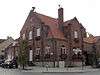 Hoekhuis, gemeentehuis | ||
| Casino-Hotel-Restaurant, rijhuis | Kemmel | Polenlaan 7 | 50° 47' 0" NB, 2° 49' 36" OL | 32644 | Upload foto | ||
| Streekhuis Malegijs, breedhuis | Kemmel | Polenlaan 12 | 50° 46' 59" NB, 2° 49' 38" OL | 32645 | Upload foto | ||
| Neoclassicistisch herenhuis | Kemmel | Reningelststraat 7 | 50° 46' 56" NB, 2° 49' 47" OL | 32646 | Upload foto | ||
| Dubbelhuis | Kemmel | Reningelststraat 15 | 50° 46' 58" NB, 2° 49' 45" OL | 32647 | Upload foto | ||
| Hoekhuizen | Kemmel | Reningelststraat 21-23 | 50° 46' 59" NB, 2° 49' 43" OL | 32648 | Upload foto | ||
| Boerenarbeiderswoningen | Kemmel | Wijtschatestraat 54-58 | 50° 46' 54" NB, 2° 50' 21" OL | 32651 | Upload foto | ||
| Ter Cruusstraete, wederopbouwhoeve | Dranouter | Hillestraat 2 | 50° 45' 42" NB, 2° 46' 54" OL | 32652 | Upload foto | ||
| Wederopbouwhoeve | Dranouter | Hillestraat 6 | 50° 45' 42" NB, 2° 46' 35" OL | 32653 | Upload foto | ||
| Hoeve | Dranouter | Hillestraat 8 | 50° 45' 38" NB, 2° 46' 16" OL | 32654 | Upload foto | ||
| Hoeve, De panele | Dranouter | Kruisabelestraat 24 | 50° 46' 8" NB, 2° 49' 30" OL | 32655 | Upload foto | ||
| Neogotische kapel | Dranouter | Kruisabelestraat | 50° 45' 56" NB, 2° 47' 21" OL | 32656 | Upload foto | ||
| Herenhoeve en brouwerij | waterpomp (monument) | Dranouter | Koudekotstraat 1 | 50° 45' 55" NB, 2° 46' 56" OL | 32657 | Upload foto | |
| Hoeve | cultuurhistorisch landschap | Dranouter | Gremmerslinde 21 | 50° 46' 30" NB, 2° 49' 10" OL | 32658 | Upload foto | |
| Gemeentehuis van Dranouter, pastorie en schoolmeesterswoning | Dranouter | Dikkebusstraat Dikkebusstraat 236-240, 244 | 50° 46' 1" NB, 2° 46' 54" OL | 32659 |  Gemeentehuis van Dranouter, pastorie en schoolmeesterswoning | ||
| Hoeve, Molenwalhof | Dranouter | Victoriastraat 2 | 50° 46' 5" NB, 2° 46' 46" OL | 32660 | Upload foto | ||
| Breedhuis | Dranouter | Dranouterstraat 77 | 50° 45' 57" NB, 2° 47' 7" OL | 32661 | Upload foto | ||
| Tweegezinswoning | Dranouter | Dranouterstraat 73-75 | 50° 45' 57" NB, 2° 47' 8" OL | 32662 | Upload foto | ||
| A ma campagne, herberg | Dranouter | Dranouterstraat 48 | 50° 45' 10" NB, 2° 48' 19" OL | 32663 | Upload foto | ||
| Parochiekerk Sint-Jan-Baptist | Dranouter | Planciusplein | 50° 45' 59" NB, 2° 46' 60" OL | 32664 | 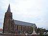 Parochiekerk Sint-Jan-Baptist | ||
| Tweegezinswoning | Dranouter | Planciusplein 20-22 | 50° 45' 57" NB, 2° 47' 5" OL | 32665 | Upload foto | ||
| Hoeve, Poorthof | Dranouter | Zwartemolenstraat 4 | 50° 45' 30" NB, 2° 46' 53" OL | 32666 | Upload foto | ||
| Arbeidershuizen | Loker | Douanestraat 1-7 | 50° 46' 50" NB, 2° 46' 21" OL | 32667 | Upload foto | ||
| Château de la Douve | Loker | Douanestraat 44-46 | 50° 46' 23" NB, 2° 45' 44" OL | 32668 | Upload foto | ||
| Tehuis Stichting Godtschalck | Loker | Godtschalckstraat 3 | 50° 46' 49" NB, 2° 45' 43" OL | 32669 | 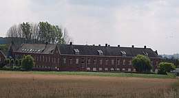 Tehuis Stichting Godtschalck | ||
| Hoeve | cultuurhistorisch landschap | Loker | Brulozestraat 7 | 50° 47' 35" NB, 2° 47' 50" OL | 32671 | Upload foto | |
| 't Hoekje, herberg | Loker | Dikkebusstraat 135-137 | 50° 46' 53" NB, 2° 46' 21" OL | 32672 | Upload foto | ||
| Dubbelhuis | Loker | Dikkebusstraat 176 | 50° 46' 53" NB, 2° 46' 19" OL | 32673 | Upload foto | ||
| Locrehof, historische hoeve | Loker | Dikkebusstraat 187 | 50° 46' 27" NB, 2° 46' 37" OL | 32674 | Upload foto | ||
| Parochiekerk Sint-Petrus | toren (monument) | Loker | Dikkebusstraat | 50° 46' 56" NB, 2° 46' 20" OL | 32675 | ||
| Kloosterschool | Loker | Dikkebusstraat 133, Petruswegel 2 | 50° 46' 58" NB, 2° 46' 22" OL | 32676 | Upload foto | ||
| Dubbelhuis, onderwijzerswoning | Loker | Dikkebusstraat 129-131 | 50° 47' 0" NB, 2° 46' 19" OL | 32677 | Upload foto | ||
| Neogotische pastorie | Loker | Dikkebusstraat 166 | 50° 46' 55" NB, 2° 46' 17" OL | 32678 | 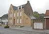 Neogotische pastorie | ||
| Tweegezinswoning, herberg | Loker | Dikkebusstraat 158 | 50° 46' 57" NB, 2° 46' 17" OL | 32679 | Upload foto | ||
| Wederopbouwhoeve met aansluitende bebouwing | Loker | Dikkebusstraat 150-156 | 50° 46' 58" NB, 2° 46' 17" OL | 32680 | Upload foto | ||
| Eenheidsbebouwingen | Loker | Dikkebusstraat 122, 130-142 | 50° 47' 6" NB, 2° 46' 17" OL | 32682 | Upload foto | ||
| Herberg De Monteberg | cultuurhistorisch landschap | Dranouter | Montebergstraat 4 | 50° 46' 31" NB, 2° 48' 7" OL | 32684 | Upload foto | |
| Wederopbouwhoevetje 1922 | Loker | Millekruisestraat 10 | 50° 48' 24" NB, 2° 48' 31" OL | 32685 | Upload foto | ||
| Villa | cultuurhistorisch landschap | Loker | Molenstraat | 50° 47' 39" NB, 2° 46' 55" OL | 32686 | Upload foto | |
| Dubbelhuizen | Loker | Rozenhillestraat 6 | 50° 48' 32" NB, 2° 46' 58" OL | 32687 | Upload foto | ||
| Diephuisje | Nieuwkerke | Seulestraat 15 | 50° 44' 42" NB, 2° 49' 26" OL | 32689 | Upload foto | ||
| Dubbelhuis | Nieuwkerke | Seulestraat 19 | 50° 44' 43" NB, 2° 49' 25" OL | 32690 | Upload foto | ||
| Woning en bedrijfsgebouwen | Nieuwkerke | Heirweg 2 | 50° 44' 43" NB, 2° 49' 22" OL | 32691 | Upload foto | ||
| Gemeenteschool en directeurswoning | Nieuwkerke | Dranouterstraat 16-18 | 50° 44' 46" NB, 2° 49' 22" OL | 32692 | Upload foto | ||
| Ouderlingentehuis | Nieuwkerke | Dranouterstraat 24 | 50° 44' 48" NB, 2° 49' 22" OL | 32693 | Upload foto | ||
| Historische hoeve Cense Westhove | Monument | Nieuwkerke | Westhovestraat 3 | 50° 44' 9" NB, 2° 47' 59" OL | 32695 | Upload foto | |
| Wegkruis | Monument | Nieuwkerke | Eikelstraat | 50° 44' 36" NB, 2° 48' 14" OL | 32696 | Upload foto | |
| Hoekhuis | Nieuwkerke | Nieuwkerkestraat 29 | 50° 44' 51" NB, 2° 49' 42" OL | 32697 | Upload foto | ||
| Hoeve XIXd | Nieuwkerke | Leeuwerkstraat 2 | 50° 45' 7" NB, 2° 50' 28" OL | 32698 | Upload foto | ||
| Parochiekerk Onze-Lieve-Vrouw | Nieuwkerke | Markt | 50° 44' 45" NB, 2° 49' 36" OL | 32699 | 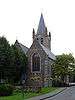 Parochiekerk Onze-Lieve-Vrouw | ||
| Café de la Régence, dubbelhuis | Nieuwkerke | Markt 5-7 | 50° 44' 42" NB, 2° 49' 32" OL | 32700 | Upload foto | ||
| Eenheidsbebouwing huizen | Nieuwkerke | Markt 11-15 | 50° 44' 43" NB, 2° 49' 31" OL | 32701 | Upload foto | ||
| Dubbelhuis | Nieuwkerke | Markt 14 | 50° 44' 44" NB, 2° 49' 36" OL | 32702 | Upload foto | ||
| Pastorie | Nieuwkerke | Markt 16 | 50° 44' 46" NB, 2° 49' 40" OL | 32703 | Upload foto | ||
| Gemeentehuis, diephuis Anno 1933 | Monument | Nieuwkerke | Markt 17 | 50° 44' 43" NB, 2° 49' 31" OL | 32704 | 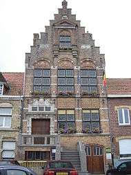 Gemeentehuis, diephuis Anno 1933 | |
| Herberg Breughelhof | Nieuwkerke | Markt 23-27 | 50° 44' 43" NB, 2° 49' 30" OL | 32705 | Upload foto | ||
| Herenhuis | Nieuwkerke | Markt 45 | 50° 44' 47" NB, 2° 49' 29" OL | 32706 | Upload foto | ||
| Cense du Don, hoeve | Nieuwkerke | Mitoyenstraat 5 | 50° 43' 9" NB, 2° 51' 15" OL | 32707 | Upload foto | ||
| Oosthove, historische hoeve | Nieuwkerke | Mitoyenstraat 17 | 50° 42' 43" NB, 2° 51' 33" OL | 32708 | Upload foto | ||
| Wederopbouwhoeve | Nieuwkerke | Niepkerkestraat 56 | 50° 44' 17" NB, 2° 49' 49" OL | 32709 | Upload foto | ||
| Dubbelhuis | Nieuwkerke | Niepkerkestraat 67 | 50° 44' 28" NB, 2° 49' 48" OL | 32710 | Upload foto | ||
| Hoeve Ingelshof | Nieuwkerke | Niepkerkestraat 73 | 50° 43' 53" NB, 2° 49' 57" OL | 32711 | Upload foto | ||
| Hoeve | Nieuwkerke | Rozestraat 1 | 50° 45' 10" NB, 2° 49' 6" OL | 32712 | Upload foto | ||
| Hoeve | Nieuwkerke | Rozestraat 5 | 50° 45' 25" NB, 2° 49' 9" OL | 32713 | Upload foto | ||
| Directeurswoning en gemeenteschool | Nieuwkerke | Seulestraat 43-45 | 32714 | Upload foto | |||
| Kloosterschool | Nieuwkerke | Seulestraat 38-40 | 50° 44' 39" NB, 2° 49' 18" OL | 32715 | Upload foto | ||
| Vier arbeiderswoningen | Nieuwkerke | Seulestraat 48-50, 50A, 52 | 50° 44' 37" NB, 2° 49' 18" OL | 32716 | Upload foto | ||
| Hoevetje | Nieuwkerke | Seulestraat 126 | 50° 44' 3" NB, 2° 48' 51" OL | 32717 | Upload foto | ||
| La Poulouche, hoeve | Nieuwkerke | Seulestraat 134 | 50° 43' 53" NB, 2° 48' 42" OL | 32718 | Upload foto | ||
| Hoeve | Nieuwkerke | Groenestraat 2 | 50° 43' 27" NB, 2° 49' 41" OL | 32719 | Upload foto | ||
| Wederopbouwhoeve 1922 | Nieuwkerke | Nieuwkerkestraat 88 | 50° 45' 17" NB, 2° 50' 49" OL | 32720 | Upload foto | ||
| Blauwpoorthoeve | Monument | Westouter | Blauwepoortstraat 2 | 50° 47' 56" NB, 2° 44' 58" OL | 32722 | Upload foto | |
| Wederopbouwhoeve | Westouter | Boeschepestraat 2 | 50° 47' 52" NB, 2° 44' 41" OL | 32723 | Upload foto | ||
| Hoeve,Neerhof | Westouter | Boeschepestraat 4 | 50° 47' 51" NB, 2° 44' 32" OL | 32724 | Upload foto | ||
| Hoeve | Westouter | Sulferbergstraat 28 | 50° 47' 49" NB, 2° 44' 59" OL | 32725 | Upload foto | ||
| Breedhuis | Westouter | Langedreef 4 | 50° 47' 46" NB, 2° 44' 45" OL | 32726 | Upload foto | ||
| Hoevetje | Westouter | Langedreef 11 | 50° 47' 15" NB, 2° 44' 11" OL | 32727 | Upload foto | ||
| Parochiekerk Sint-Eligius | Westouter | Sulferbergstraat | 50° 47' 51" NB, 2° 44' 48" OL | 32728 | 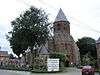 Parochiekerk Sint-Eligius | ||
| Eclectisch enkelhuis | Westouter | Sulferbergstraat 1 | 50° 47' 52" NB, 2° 44' 49" OL | 32729 | Upload foto | ||
| Kolen- en graanhandel | Westouter | Sulferbergstraat 12-14 | 50° 47' 49" NB, 2° 44' 50" OL | 32730 | Upload foto | ||
| Gemeentehuis, thans postgebouw | Westouter | Sulferbergstraat 9 | 50° 47' 52" NB, 2° 44' 52" OL | 32731 | 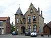 Gemeentehuis, thans postgebouw | ||
| Gemeenteschool en vroegere onderwijzerswoning | Westouter | Hellegatstraat 1-3 | 50° 47' 50" NB, 2° 44' 56" OL | 32732 | Upload foto | ||
| Pastorie, dubbelhuis | Westouter | Hellegatstraat 2 | 50° 47' 49" NB, 2° 44' 55" OL | 32733 | Upload foto | ||
| Standaardmolen Lijstermolen | Monument | Westouter | Lijstermolendreef | 50° 47' 2" NB, 2° 45' 24" OL | 32734 | 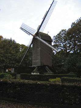 Standaardmolen Lijstermolen | |
| Brouwerij Cornblomme | Monument | Westouter | Poperingestraat 4 | 50° 47' 49" NB, 2° 44' 45" OL | 32735 | Upload foto | |
| Herberg In de Zwaan | Monument | Westouter | Poperingestraat 6 | 50° 47' 49" NB, 2° 44' 45" OL | 32736 | Upload foto | |
| Eclectisch dubbelhuis | Westouter | Poperingestraat 8 | 50° 47' 50" NB, 2° 44' 44" OL | 32737 | Upload foto | ||
| Bejaardentehuis, thans centrum jeugdtoerisme | Westouter | Poperingestraat 44 | 50° 47' 58" NB, 2° 44' 41" OL | 32738 | Upload foto | ||
| Hoeve losse bestanddelen | Westouter | Poperingestraat 49 | 50° 49' 18" NB, 2° 44' 8" OL | 32739 | Upload foto | ||
| Hoeve losse bestanddelen | Westouter | Poperingestraat 58 | 50° 49' 3" NB, 2° 44' 1" OL | 32740 | Upload foto | ||
| Sint-Godelievekapel | Monument | Westouter | Rodebergstraat | 50° 47' 4" NB, 2° 45' 12" OL | 32741 | Upload foto | |
| Belvedère, café-restaurant | Westouter | Rodebergstraat 49 | 50° 47' 9" NB, 2° 45' 40" OL | 32742 | Upload foto | ||
| Breedhuis | Westouter | Schomminkelstraat 8 | 50° 47' 48" NB, 2° 44' 49" OL | 32743 | Upload foto | ||
| Mariakapelletje | Westouter | Schomminkelstraat 26 | 50° 47' 20" NB, 2° 45' 15" OL | 32744 | Upload foto | ||
| 't Buitenbeentje, herberg | Westouter | Sint-Pietersstraat 21 | 50° 48' 16" NB, 2° 43' 26" OL | 32745 | Upload foto | ||
| Steen- en buizenbakkerij Dumoulin | Wijtschate | Gapaardstraat 4 | 50° 46' 7" NB, 2° 54' 15" OL | 32746 | Upload foto | ||
| Onderwijsgebouw | Wijtschate | Kaleutestraat 7-11 | 50° 47' 15" NB, 2° 55' 35" OL | 32747 | Upload foto | ||
| Klooster en school | Wijtschate | Schoolstraat 12, Guido Gezellestraat | 50° 47' 4" NB, 2° 52' 56" OL | 32748 | Upload foto | ||
| Diepemeershof, hoeve | Wijtschate | Hollebekestraat 25 | 50° 47' 58" NB, 2° 55' 6" OL | 32749 | Upload foto | ||
| Dubbelhuis | Wijtschate | Hospicestraat 4 | 50° 47' 10" NB, 2° 53' 0" OL | 32750 | Upload foto | ||
| Home Sint-Medard, ouderlingentehuis | Wijtschate | Hospicestraat 25 | 50° 47' 13" NB, 2° 52' 60" OL | 32751 | Upload foto | ||
| Hoeve | Wijtschate | Houthemstraat 4 | 50° 47' 1" NB, 2° 53' 35" OL | 32752 | Upload foto | ||
| Wederopbouwhoeve | Wijtschate | Katteputstraat 2 | 50° 45' 48" NB, 2° 52' 38" OL | 32753 | Upload foto | ||
| Parochiekerk Sint-Medardus | Wijtschate | Kerkplein | 50° 47' 11" NB, 2° 52' 56" OL | 32754 | 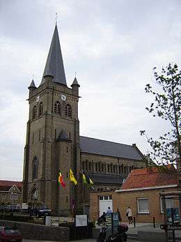 Parochiekerk Sint-Medardus | ||
| Twee enkelhuizen | Wijtschate | Kerkplein 4, 5 | 50° 47' 12" NB, 2° 52' 54" OL | 32755 | Upload foto | ||
| Pastorie, dubbelhuis | Wijtschate | Kerkplein 10 | 50° 47' 12" NB, 2° 52' 58" OL | 32756 | Upload foto | ||
| Gemeentehuis, breedhuis | Wijtschate | St.-Medardusplein 1 | 50° 47' 10" NB, 2° 52' 57" OL | 32757 | Upload foto | ||
| Hoeve, Pilgrimshof | Wijtschate | Pont Malletstraat 1 | 50° 47' 11" NB, 2° 56' 39" OL | 32758 | Upload foto | ||
| Wederopbouwhoeve | Wijtschate | Rijselstraat 62 | 50° 46' 32" NB, 2° 55' 30" OL | 32759 | Upload foto | ||
| Beenhouwerij, dubbelhuis | Wijtschate | Staanijzerstraat 4 | 50° 47' 8" NB, 2° 53' 1" OL | 32760 | Upload foto | ||
| Zeven arbeiderswoningen | Wijtschate | Staanijzerstraat 32-44 | 50° 47' 6" NB, 2° 53' 7" OL | 32761 | Upload foto | ||
| A la basse ville, herberg | Wulvergem | Dorpsstraat 2 | 50° 45' 37" NB, 2° 51' 7" OL | 32762 | Upload foto | ||
| Breedhuis, dubbelhuis | Wulvergem | Dorpsstraat 4 | 50° 45' 36" NB, 2° 51' 9" OL | 32763 | Upload foto | ||
| Pastorie, De Pelgrim, dagcentrum | Wulvergem | Dorpsstraat 22 | 50° 45' 33" NB, 2° 51' 15" OL | 32764 | Upload foto | ||
| Hoeve, Leeuwenburg | Wulvergem | Gremmerslinde 7 | 50° 46' 30" NB, 2° 50' 12" OL | 32765 | Upload foto | ||
| Breedhuis, jongensschool met schoolmeestershuis | Wulvergem | Hooghofstraat 4 | 50° 45' 38" NB, 2° 51' 7" OL | 32766 | Upload foto | ||
| Parochiekerk Sint-Machutus | Wulvergem | Sint Machutusweg | 50° 45' 35" NB, 2° 51' 16" OL | 32767 |  Parochiekerk Sint-Machutus | ||
| Wederopbouwhoeve | Wulvergem | Kemmelstraat 109 | 50° 45' 48" NB, 2° 49' 53" OL | 32769 | Upload foto | ||
| Hooghof-Oude Molen, herberg | Wulvergem | Kemmelstraat 95 | 50° 46' 4" NB, 2° 49' 41" OL | 32770 | Upload foto | ||
| De Speelberg, schooltje met zusterhuis | Wulvergem | Wulvergemstraat 42 | 50° 45' 36" NB, 2° 51' 18" OL | 32771 | Upload foto | ||
| Parochiekerk Onze-Lieve-Vrouw-Bezoeking | Monument | De Klijte | Dikkebusstraat | 50° 48' 0" NB, 2° 47' 58" OL | 84642 | 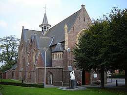 Parochiekerk Onze-Lieve-Vrouw-Bezoeking | |
| Gemeenteschool en klooster | De Klijte | Dikkebusstraat 53-55 | 50° 47' 57" NB, 2° 47' 53" OL | 84643 | Upload foto | ||
| Boerderij met winkel | De Klijte | Dikkebusstraat 44-46 | 50° 47' 59" NB, 2° 47' 52" OL | 84644 | Upload foto | ||
| Grote wederopbouwhoeve | dorpsgezicht | De Klijte | Dikkebusstraat 28 | 50° 48' 2" NB, 2° 48' 0" OL | 84645 | Upload foto | |
| Breedhuis | De Klijte | Dikkebusstraat 24 | 50° 48' 4" NB, 2° 48' 6" OL | 84646 | Upload foto | ||
| Dries | Monument | Kemmel | Dries | 50° 46' 58" NB, 2° 49' 33" OL | 200999 | 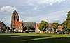 Dries | |
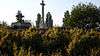
| Calvarie Christus aan het kruis | Monument | Dranouter | Kauwakkerstraat | 50° 44' 38" NB, 2° 47' 16" OL | 201000 | 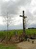 Calvarie Christus aan het kruis | |
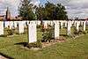
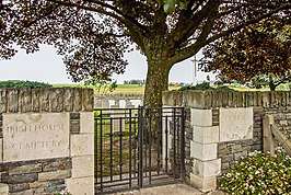
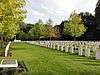
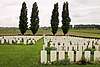
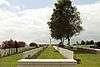
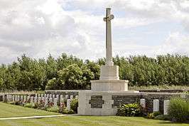
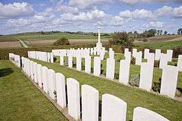
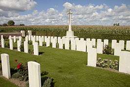
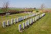
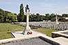
| Dranoutre Military Cemetery | Monument | Dranouter | Victoriastraat | 50° 46' 0" NB, 2° 46' 50" OL | 201001 | ||
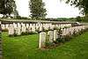
| Godezonne Farm Cemetery | Monument | Kemmel | Kriekstraat | 50° 48' 2" NB, 2° 50' 26" OL | 201002 | ||
| Irish House Cemetery | Monument | Kemmel | Savaardlindestraat | 50° 47' 4" NB, 2° 51' 14" OL | 201003 | ||
| Kemmel Chateau Military Cemetery | Monument | Kemmel | Nieuwstraat | 50° 47' 10" NB, 2° 49' 46" OL | 201004 | ||
| Kemmel No.1 French Cemetery | Monument | Kemmel | Vierstraat | 50° 48' 19" NB, 2° 50' 26" OL | 201005 | ||
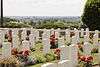
| Klein-Vierstraat British Cemetery | Monument | Kemmel | Molenstraat | 50° 48' 18" NB, 2° 50' 21" OL | 201007 | ||
| La Laiterie Military Cemetery | Monument | Kemmel | Kemmelstraat | 50° 47' 29" NB, 2° 50' 30" OL | 201008 | ||
| Lindenhoek Chalet Military Cemetery | Monument | Kemmel | Gremmerslinde | 50° 46' 36" NB, 2° 49' 25" OL | 201009 | ||
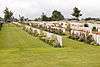
| Suffolk Cemetery | Monument | Kemmel | Kriekstraat | 50° 48' 12" NB, 2° 50' 40" OL | 201011 | ||
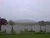
| Galooie-Mote | Monument | Loker | Douanestraat | 50° 46' 40" NB, 2° 46' 14" OL | 201012 | Upload foto | |
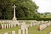
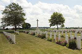
| La Clytte Military Cemetery | Monument | Loker | Reningelststraat | 50° 48' 5" NB, 2° 47' 58" OL | 201014 | ||
| Locre Hospice Cemetery | Monument | Loker | Godtschalckstraat | 50° 46' 44" NB, 2° 46' 49" OL | 201016 | ||
| Locre No.10 Cemetery | Monument | Loker | Dikkebusstraat | 50° 46' 19" NB, 2° 46' 37" OL | 201017 | ||
| Onze-Lieve-Vrouw-kapel | Monument | Nieuwkerke | Eikelstraat | 50° 44' 10" NB, 2° 48' 49" OL | 201018 | Upload foto | |
| Kandahar Farm Cemetery | Monument | Nieuwkerke | Nieuwkerkestraat | 50° 45' 17" NB, 2° 50' 52" OL | 201019 | ||
| Maple Leaf Cemetery | Monument | Nieuwkerke | Zakstraat | 50° 43' 15" NB, 2° 50' 20" OL | 201020 | ||
| Westhof Farm Cemetery | Monument | Nieuwkerke | Eikelstraat | 50° 44' 14" NB, 2° 48' 20" OL | 201021 | ||
| Hotel Kosmos | Monument | Westouter | Rodebergstraat 53 | 50° 47' 15" NB, 2° 45' 41" OL | 201024 | ||
| Onze-Lieve-Vrouw-wegkapel | Monument | Westouter | Boeschepestraat | 50° 47' 51" NB, 2° 44' 37" OL | 201025 | Upload foto | |
| Westoutre British Cemetery | Monument | Westouter | Poperingestraat | 50° 48' 1" NB, 2° 44' 43" OL | 201026 | ||
| Militaire site WOI Bayernwald | Monument | Wijtschate | Voormezelestraat | 50° 48' 4" NB, 2° 52' 40" OL | 201030 | 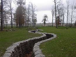 Militaire site WOI Bayernwald | |
| Wegkruis | Monument | Wijtschate | Houthemstraat | 50° 47' 11" NB, 2° 54' 25" OL | 201032 | Upload foto | |
| Cabin Hill Cemetery | Monument | Wijtschate | Waterputstraat | 50° 46' 26" NB, 2° 54' 17" OL | 201033 | ||
| Croonaert Chapel Cemetery | Monument | Wijtschate | Voormezelestraat | 50° 47' 60" NB, 2° 52' 23" OL | 201034 | ||
| Derry House Cemetery No.2 | Monument | Wijtschate | Voormezelestraat | 50° 46' 46" NB, 2° 54' 2" OL | 201035 | ||
| Lone Tree Cemetery | Monument | Wijtschate | Kruisstraat | 50° 46' 28" NB, 2° 51' 43" OL | 201036 | ||
| Oosttaverne Wood Cemetery | Monument | Wijtschate | Rijselstraat | 50° 47' 38" NB, 2° 54' 7" OL | 201037 | ||
| R.E. Farm Cemetery | Monument | Wijtschate | Wulvergemstraat | 50° 46' 2" NB, 2° 51' 38" OL | 201038 | ||
| Somer Farm Cemetery | Monument | Wijtschate | Hollebekestraat | 50° 47' 26" NB, 2° 53' 23" OL | 201039 | ||
| Spanbroekmolen British Cemetery | Monument | Wijtschate | Scheerstraat | 50° 46' 42" NB, 2° 52' 1" OL | 201041 | ||
| Torreken Farm Cemetery No.1 | Monument | Wijtschate | Langebunderstraat | 50° 46' 56" NB, 2° 53' 32" OL | 201042 | ||
| Wytschaete Military Cemetery | Monument | Wijtschate | Wijtschatestraat | 50° 47' 5" NB, 2° 52' 37" OL | 201043 | ||
| Packhorse Farm Shrine Cemetery | Monument | Wulvergem | Lindestraat | 50° 46' 13" NB, 2° 49' 60" OL | 201045 | ||
| Pond Farm Cemetery | Monument | Wulvergem | Vrooilandstraat | 50° 46' 8" NB, 2° 50' 42" OL | 201046 | ||
| Wulverghem-Lindenhoek Road Military Cemetery | Monument | Wulvergem | Hooghofstraat | 50° 45' 49" NB, 2° 50' 38" OL | 201049 | ||
| Demarcatiepaal nr. 7 | Monument | Loker | Dikkebusstraat | 50° 46' 34" NB, 2° 46' 30" OL | 201453 | Upload foto | |
| Demarcatiepaal nr. 8 | Monument | Loker | Kemmelbergweg | 50° 47' 1" NB, 2° 47' 30" OL | 201456 | Upload foto | |
| Demarcatiepaal nr. 14 | Monument | Kemmel | Reningelststraat | 50° 47' 33" NB, 2° 48' 43" OL | 201457 | Upload foto | |
| Demarcatiepaal nr. 15 | Monument | Kemmel | Vierstraat | 50° 48' 13" NB, 2° 50' 46" OL | 201458 | Upload foto | |
| Standbeeld burgerlijke en militaire doden | Dranouter | Dikkebusstraat | 213259 | Upload foto | |||
| Gedenksteen 27ste en 30ste Amerikaanse divisies | Kemmel | Kemmelstraat | 213260 | 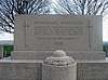 Gedenksteen 27ste en 30ste Amerikaanse divisies | |||
| Gedenkmuur militaire en burgerlijke doden | Kemmel | Polenlaan | 213261 | Upload foto | |||
| Gedenkzuil militaire en burgerlijke doden | Loker | Dikkebusstraat | 213262 | 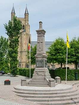 Gedenkzuil militaire en burgerlijke doden | |||
| Standbeeld militaire en burgerlijke doden | Nieuwkerke | Markt | 213263 | 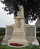 Standbeeld militaire en burgerlijke doden | |||
| Gedenkmuur militaire en burgerlijke doden | Westouter | Sulferbergstraat | 213264 | 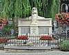 Gedenkmuur militaire en burgerlijke doden | |||
| Gedenkkruis 19th Western Division | Wijtschate | Hollebekestraat | 213265 | Upload foto | |||
| Gedenkzuil militaire en burgerlijke doden | Wijtschate | Markt | 213266 |  Gedenkzuil militaire en burgerlijke doden | |||
| Gedenksteen Lasnier en het 1er Bn. Chasseurs à Pied | Wijtschate | Voormezelestraat | 213267 | .jpg) Gedenksteen Lasnier en het 1er Bn. Chasseurs à Pied | |||
| Gedenksteen burgerlijke en militaire doden | Wulvergem | Dorpsstraat | 213268 | 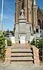 Gedenksteen burgerlijke en militaire doden | |||
| Dranouter Churchyard | Dranouter | Planciusplein | 50° 45' 58" NB, 2° 46' 59" OL | 213326 | 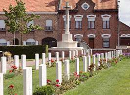 Dranouter Churchyard | ||
| Kemmel Churchyard | Kemmel | St.-Laurentiusplein | 50° 47' 3" NB, 2° 49' 35" OL | 213327 | 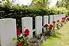 Kemmel Churchyard | ||
| Loker Churchyard | Loker | Dikkebusstraat | 50° 46' 55" NB, 2° 46' 21" OL | 213328 | 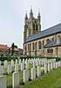 Loker Churchyard | ||
| Nieuwkerke Churchyard | Nieuwkerke | Markt | 50° 44' 46" NB, 2° 49' 34" OL | 213329 | _Churchyard-25.JPG) Nieuwkerke Churchyard | ||
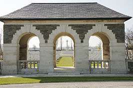
| Westouter Churchyard & Extension | Westouter | Poperingestraat | 50° 47' 53" NB, 2° 44' 47" OL | 213330 | 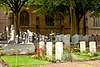 Westouter Churchyard & Extension | ||
| Wulverghem Churchyard | Wulvergem | Dorpsstraat | 50° 45' 35" NB, 2° 51' 17" OL | 213331 | 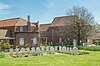 Wulverghem Churchyard | ||
| Gedenkplaat Spanbroekmolen | Wijtschate | Kruisstraat | 213353 | Upload foto | |||
| Betonconstructie 2 | Monument | Kemmel | Lokerstraat | 213364 | Upload foto | ||
| Betonconstructie 1 | Monument | Kemmel | Lokerstraat | 213365 | Upload foto | ||
| 4 Britse schuilplaatsen Lettenberg | Monument | Kemmel | Lokerstraat | 213366 |  4 Britse schuilplaatsen Lettenberg | ||
| Duitse artilleriebunker | Monument | Wijtschate | Gapaardstraat | 213367 | Upload foto | ||
| Duitse betonconstructie Oosttaverne Wood | Monument | Wijtschate | Hollebekestraat | 213368 | Upload foto | ||
| Duitse betonconstructie met golfplaat Oosttaverne Wood | Wijtschate | Houthemstraat | 213369 | Upload foto | |||
| Duitse bunker | Wijtschate | Ieperstraat 137 | 213370 | Upload foto | |||
| Duitse constructie Pick House | Monument | Wijtschate | Ieperstraat 158 | 213371 | Upload foto | ||
| Betonnen verdedigingsconstructie Onraet Farm 1 | Wijtschate | Ieperstraat | 213372 | Upload foto | |||
| Betonconstructie Huikerbossen | Wijtschate | Langwegelken | 213373 | Upload foto | |||
| Duitse bunker | Wijtschate | Neerwaastenstraat | 213374 | Upload foto | |||
| Duitse bunker | Wijtschate | Neerwaastenstraat | 213375 | Upload foto | |||
| Duitse constructie | Monument | Wijtschate | Rijselstraat | 213376 | Upload foto | ||
| Britse schuilplaats | Wijtschate | Rijselstraat | 213377 | Upload foto | |||
| 6 Britse schuilplaatsen | Monument | Loker | Scherpenbergweg | 213481 | Upload foto | ||
| Drie Britse betonnen verdedigingsconstructies | Loker | Zavelaarstraat | 213482 | Upload foto | |||
| Duitse betonnen verdedigingsconstructie Onraet Farm 2 | Wijtschate | Ieperstraat | 213483 | Upload foto | |||
| Duitse betonnen verdedigingsconstructie Onraet Farm 3 | Wijtschate | Ieperstraat | 213484 | Upload foto | |||
| Duitse betonnen constructie Petit Bois 1 | Wijtschate | Kroonaardstraat | 213485 | Upload foto | |||
| Duitse betonnen constructie nabij Petit Bois | Wijtschate | Kroonaardstraat | 213486 | Upload foto | |||
| Duitse betonnen constructie Petit Bois 2 | Wijtschate | Kroonaardstraat | 213487 | Upload foto | |||
| Duitse schuilplaats Spanbroekmolen | Wijtschate | Kruisstraat | 213488 | Upload foto | |||
| Duitse betonconstructie | Wijtschate | Rijselstraat | 213489 | Upload foto | |||
| Duitse verdedigingsconstructie Wijtschatebos (4) | Wijtschate | Vierstraat | 213490 | Upload foto | |||
| Duitse verdedigingsconstructie Wijtschatebos (5) | Wijtschate | Vierstraat | 213491 | Upload foto | |||
| Duitse verdedigingsconstructie Wijtschatebos (8) | Wijtschate | Vierstraat | 213492 | Upload foto | |||
| Duitse verdedigingsconstructie Wijtschatebos (9) | Wijtschate | Vierstraat | 213493 | Upload foto | |||
| Duitse verdedigingsconstructie Wijtschatebos (10) | Wijtschate | Vierstraat | 213494 | Upload foto | |||
| Duitse betonnen verdedigingsconstructie Unnamed Wood | Wijtschate | Vierstraat | 213495 | Upload foto | |||
| Duitse betonnen mijnschacht "Dietrich" Wijtschatebos (1) | Monument | Wijtschate | Vierstraat | 213496 | Upload foto | ||
| Duitse betonnen constructie Kroonaardbos (3) | Wijtschate | Voormezelestraat | 213497 | Upload foto | |||
| Duitse betonnen constructie Kroonaardbos (4) | Wijtschate | Voormezelestraat | 213498 | Upload foto | |||
| Duitse betonnen constructie Kroonaardbos (5) | Wijtschate | Voormezelestraat | 213499 | Upload foto | |||
| Duitse betonnen verdedigingsconstructie Kroonaardbos (6) | Wijtschate | Voormezelestraat | 213500 | Upload foto | |||
| Duitse betonstructie | Wijtschate | Wambekestraat 1 | 213501 | Upload foto | |||
| Britse betonconstructie | Monument | Wijtschate | Wulvergemstraat | 213502 | Upload foto | ||
| Resten Duitse betonnen verdedigingsconstructie Onraet Farm 4 | Wijtschate | Ieperstraat 4A | 213595 | Upload foto | |||
| Restanten van een Duitse betonnen verdedigingsconstructie Wijtschatebos (3) | Wijtschate | Vierstraat | 213596 | Upload foto | |||
| Restanten van een Duitse betonnen verdedigingsconstructie Wijtschatebos (6) | Wijtschate | Vierstraat | 213597 | Upload foto | |||
| Restanten van een Duitse betonnen verdedigingsconstructie Wijtschatebos (7) | Wijtschate | Vierstraat | 213598 | Upload foto | |||
| Restanten van een Duitse betonnen verdedigingsconstructie Wijtschatebos (2) | Wijtschate | Vierstraat | 213599 | Upload foto | |||
| Duitse betonnen constructie Kroonaardbos (1) | Wijtschate | Voormezelestraat | 213600 | Upload foto | |||
| Restanten van Duitse betonnen constructie Kroonaardbos (2) | Wijtschate | Voormezelestraat | 213601 | Upload foto | |||
| Betonnen constructie Westhof Farm | Monument | Nieuwkerke | Westhovestraat | 213650 | Upload foto | ||
| Restanten Britse betonnen shelter Oaten Wood | Wijtschate | Rijselstraat | 215694 | Upload foto | |||
| Restanten Britse betonnen post Oaten Wood | Wijtschate | Rijselstraat | 215695 | Upload foto | |||
| Britse brug over de Kemmelbeek | Monument | Kemmel | Vierstraat | 215701 | Upload foto | ||
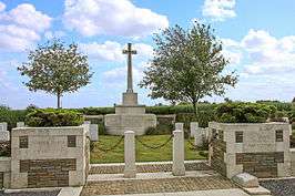
| Graf William Redmond | Monument | Loker | Godtschalckstraat | 50° 46' 44" NB, 2° 46' 46" OL | 301808 | 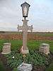 Graf William Redmond |


Zie ook
| Zie de categorie Onroerend erfgoed in Heuvelland van Wikimedia Commons voor mediabestanden over dit onderwerp. |
Bronnen, noten en/of referenties
|
This article is issued from
Wikipedia.
The text is licensed under Creative
Commons - Attribution - Sharealike.
Additional terms may apply for the media files.