Lijst van gemeentelijke monumenten in Dalfsen
De gemeente Dalfsen heeft 98 gemeentelijke monumenten, hieronder een overzicht. Zie ook de rijksmonumenten in Dalfsen.
Dalfsen
De plaats Dalfsen kent 67 gemeentelijke monumenten:
| Object | Bouwjaar | Architect | Locatie | Coördinaten | Nr. | Afbeelding |
|---|---|---|---|---|---|---|
| Boerderij | Aalshorsterpad 2 | 52° 29' 19" NB, 6° 14' 56" OL | 0148/WN001 |  | ||
| Boerderij | Blauwedijk 1 | 52° 28' 30" NB, 6° 14' 29" OL | 0148/WN002 | Upload foto | ||
| Boerderij | Blauwedijk 2 | 52° 28' 36" NB, 6° 14' 27" OL | 0148/WN003 | .jpg) | ||
| Boerderij | Blauwedijk 4 | 52° 28' 39" NB, 6° 14' 25" OL | 0148/WN004 | _GM0148WN004.jpg) | ||
| Herenhuis | Bloemendalstraat 14 | 52° 30' 19" NB, 6° 15' 34" OL | 0148/WN005 |  | ||
| Dubbel herenhuis | Bloemendalstraat 15 | 52° 30' 19" NB, 6° 15' 32" OL | 0148/WN006 |  | ||
| Postkantoor | Bloemendalstraat 16 | 52° 30' 19" NB, 6° 15' 33" OL | 0148/WN007 |  | ||
| Dubbel herenhuis | Bloemendalstraat 17 | 52° 30' 19" NB, 6° 15' 32" OL | 0148/WN008 | | ||
| Woonhuis | Bloemendalstraat 19 | 52° 30' 19" NB, 6° 15' 30" OL | 0148/WN009 |  | ||
| Herenhuis | Bloemendalstraat 20 | 52° 30' 20" NB, 6° 15' 30" OL | 0148/WN010 | 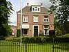 | ||
| Houtloods | Bloemendalstraat bij 19 | 0148/WN011 | 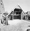 | |||
| Schaapskooi | Bosrandweg ong. (nabij 41) | 0148/WN012 | Upload foto | |||
| Sluiswachterswoning, sluis, kraan en kraan- loods (sluizencomplex Vechterweerd) | De Broekhuizen ong./ De Broekhuizen 3 | 52° 31' 9" NB, 6° 12' 42" OL | 0148/WN013 | 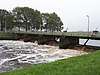 | ||
| Houten dijkstoel (sluizencomplex Vechterweerd) | De Broekhuizen ong./ De Broekhuizen 3 | 52° 31' 9" NB, 6° 12' 42" OL | 0148/WN014 | Upload foto | ||
| Boerderij | De Stokte 9 | 52° 30' 54" NB, 6° 17' 19" OL | 0148/WN015 | 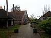 | ||
| Boerderij | Diezerstraat 7 | 52° 29' 41" NB, 6° 17' 26" OL | 0148/WN016 | Upload foto | ||
| Woonhuis / bedrijfspand | Emmastraat 5a | 52° 30' 21" NB, 6° 15' 33" OL | 0148/WN017 | 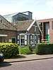 | ||
| Boerderij | Emmerweg 1 | 52° 29' 51" NB, 6° 13' 58" OL | 0148/WN018 |  | ||
| Joodse Begraafplaats | Gerner Es ong. | 0148/WN019 | 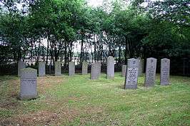 | |||
| Boerderij met hooiberg en schuur | Heinoseweg 8 | 52° 29' 30" NB, 6° 15' 8" OL | 0148/WN020 |  | ||
| Vm. School | Heinoseweg bij 32 | 0148/WN021 | Upload foto | |||
| Boerderij | Hessenweg 2 | 52° 31' 21" NB, 6° 11' 30" OL | 0148/WN022 |  | ||
| Synagoge | Julianastraat 18 | 52° 30' 18" NB, 6° 15' 31" OL | 0148/WN023 |  | ||
| Boerderij | Kemminckhorstweg 3 | 52° 31' 35" NB, 6° 20' 32" OL | 0148/WN024 | 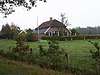 | ||
| Woonhuis | Kerkplein 29 | 52° 30' 17" NB, 6° 15' 37" OL | 0148/WN025 | 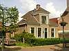 | ||
| Woon-/winkelpand | Kerkplein 4 | 52° 30' 16" NB, 6° 15' 40" OL | 0148/WN026 | 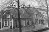 | ||
| Woonhuisje | Kerkplein 5 | 52° 30' 16" NB, 6° 15' 40" OL | 0148/WN027 | | ||
| Woonhuis | Kerkplein 6 | 52° 30' 16" NB, 6° 15' 40" OL | 0148/WN028 | 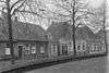 | ||
| Woonhuis | Kerkstraat 10 | 52° 29' 10" NB, 6° 13' 43" OL | 0148/WN029 | Upload foto | ||
| Winkel annex café | Kerkstraat 7 | 52° 29' 10" NB, 6° 13' 44" OL | 0148/WN030 |  | ||
| Woonhuis | Kerkstraat 8 | 52° 29' 10" NB, 6° 13' 42" OL | 0148/WN031 |  | ||
| Pastoorswoning | Kerkstraat 16 | 52° 29' 8" NB, 6° 13' 46" OL | 0148/WN032 |  | ||
| Boerderij | Kringsloot Oost 12 | 52° 34' 0" NB, 6° 19' 30" OL | 0148/WN033 |  | ||
| Voormalige boerderij | Markeweg 22 | 52° 30' 40" NB, 6° 19' 19" OL | 0148/WN034 | Upload foto | ||
| Hallehuisboerderij | Marshoekersteeg 3 | 52° 30' 2" NB, 6° 12' 32" OL | 0148/WN035 | Upload foto | ||
| Hallehuisboerderij | Marshoekersteeg 22 | 52° 30' 37" NB, 6° 11' 50" OL | 0148/WN036 |  | ||
| Dwarshuisboerderij | Marshoerkersteeg 5-7 | 52° 30' 4" NB, 6° 12' 29" OL | 0148/WN037 |  | ||
| Boerderij | Millingersteeg 1 | 52° 29' 29" NB, 6° 16' 16" OL | 0148/WN038 |  | ||
| Dwarshuisboerderij met bakhuisje | Molenhoekweg 1-3 | 52° 29' 3" NB, 6° 11' 58" OL | 0148/WN039 | Upload foto | ||
| Toegangshek begraafplaats | Mulertlaan ong. | 0148/WN040 |  | |||
| Huis met koetshuis | Poppenallee 1a | 52° 29' 60" NB, 6° 15' 5" OL | 0148/WN041 |  | ||
| Villa | Poppenallee 6 | 52° 29' 59" NB, 6° 14' 32" OL | 0148/WN042 | Upload foto | ||
| Boerderij | Poppenallee 23 | 52° 29' 53" NB, 6° 12' 54" OL | 0148/WN043 |  | ||
| Café-restaurant | Prinsenstraat 2 | 52° 30' 12" NB, 6° 15' 35" OL | 0148/WN044 |  | ||
| Villa | Rechterensedijk 4 | 52° 29' 46" NB, 6° 17' 13" OL | 0148/WN045 | Upload foto | ||
| Woonhuis met aangebouwde schuur | Rechterensedijk 6 | 52° 29' 46" NB, 6° 17' 12" OL | 0148/WN046 | Upload foto | ||
| Woonhuis met aangeb. bedrijfsgedeelte | Rechterensedijk 8 | 52° 29' 47" NB, 6° 17' 15" OL | 0148/WN047 | Upload foto | ||
| Kantoor | Rechterensedijk 8a | 52° 29' 47" NB, 6° 17' 15" OL | 0148/WN048 | Upload foto | ||
| Woonhuis | Ruitenborghstraat 13 | 52° 30' 18" NB, 6° 15' 26" OL | 0148/WN049 |  | ||
| Vm. dorpsboerderij | Ruitenborghstraat 21-23 | 52° 30' 19" NB, 6° 15' 23" OL | 0148/WN050 |  | ||
| Woonhuis | Ruitenborghstraat 25 | 52° 30' 19" NB, 6° 15' 21" OL | 0148/WN051 | 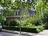 | ||
| Tolhuis | Ruitenborghweg 12 | 52° 30' 57" NB, 6° 14' 3" OL | 0148/WN052 | 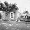 | ||
| Stationsgebouw | Stationsweg 4 | 52° 29' 54" NB, 6° 15' 34" OL | 0148/WN053 | 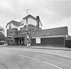 | ||
| Kleine woning behorend bij Landgoed Rechteren | Tolhuisweg 2 | 52° 29' 47" NB, 6° 17' 24" OL | 0148/WN054 | Upload foto | ||
| Hallehuisboerderij | Tolhuisweg 8 | 52° 29' 59" NB, 6° 18' 15" OL | 0148/WN055 | Upload foto | ||
| Woonhuis | Vechtstraat 1 | 52° 30' 14" NB, 6° 15' 43" OL | 0148/WN056 | 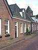 | ||
| Woonhuis | Vechtstraat 3 | 52° 30' 14" NB, 6° 15' 42" OL | 0148/WN057 |  | ||
| Dubbel woonhuis | Vechtstraat 5 | 52° 30' 15" NB, 6° 15' 42" OL | 0148/WN058 |  | ||
| Dubbel woonhuis | Vechtstraat 7 | 52° 30' 15" NB, 6° 15' 42" OL | 0148/WN059 | | ||
| Woonhuis | Vechtstraat 9 | 52° 30' 15" NB, 6° 15' 42" OL | 0148/WN060 |  | ||
| Woonhuis | Vechtstraat 11-13 | 52° 30' 15" NB, 6° 15' 42" OL | 0148/WN061 |  | ||
| Landhuis Huize Ankum | Vossersteeg 93 | 52° 31' 17" NB, 6° 14' 20" OL | 0148/WN062 |  | ||
| Hallehuisboerderij | Wagteveldweg 8 | 52° 31' 31" NB, 6° 16' 51" OL | 0148/WN063 |  | ||
| Boerderij | Welsummerweg 38 | 52° 31' 28" NB, 6° 17' 46" OL | 0148/WN064 |  | ||
| RK kerk | Wilhelminastraat 23 | 52° 30' 23" NB, 6° 15' 37" OL | 0148/WN065 |  | ||
| Boerderij | Zuidelijke Vechtdijk 1 | 52° 30' 21" NB, 6° 14' 2" OL | 0148/WN066 | Upload foto | ||
| Hallehuisboerderij "'t Maria-hofke" | Zwarteweg 9 | 52° 29' 37" NB, 6° 13' 42" OL | 0148/WN067 |  |
Lemelerveld
De plaats Lemelerveld kent 7 gemeentelijke monumenten:
| Object | Bouwjaar | Architect | Locatie | Coördinaten | Nr. | Afbeelding |
|---|---|---|---|---|---|---|
| Villa | Blikman Kikkertweg 2 | 52° 26' 42" NB, 6° 20' 45" OL | 0148/WN068 | Upload foto | ||
| Villa "Klein Statum" met koetshuis | Blikman Kikkertweg 3 | 52° 26' 42" NB, 6° 20' 48" OL | 0148/WN069 | Upload foto | ||
| Geref. Kerk | Kerkstraat 17 | 52° 26' 46" NB, 6° 20' 44" OL | 0148/WN070 | Upload foto | ||
| Pastorie | Kerkstraat 18 | 52° 26' 46" NB, 6° 20' 45" OL | 0148/WN071 | Upload foto | ||
| RK kerk | Posthoornweg 5 | 52° 26' 39" NB, 6° 20' 6" OL | 0148/WN072 | 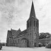 | ||
| Villa | Schoolstraat-Lemelerveld | 52° 26' 38" NB, 6° 20' 28" OL | 0148/WN073 | Upload foto | ||
| Krukhuisboerderij | Weerdhuisweg 40 | 52° 26' 53" NB, 6° 19' 11" OL | 0148/WN074 | Upload foto |
Nieuwleusen
De plaats Nieuwleusen kent 24 gemeentelijke monumenten:
| Object | Bouwjaar | Architect | Locatie | Coördinaten | Nr. | Afbeelding |
|---|---|---|---|---|---|---|
| Voormalige smederij | Burg. Backxlaan 1 | 52° 34' 24" NB, 6° 17' 32" OL | 0148/WN075 | Upload foto | ||
| Pastorie bij Geref. kerk | Burg. Backxlaan 267 | 52° 35' 3" NB, 6° 17' 8" OL | 0148/WN076 | Upload foto | ||
| Geref. Kerk | Burg. Backxlaan 269 | 52° 35' 4" NB, 6° 17' 7" OL | 0148/WN077 | Upload foto | ||
| Dubbel woonhuis | Burg. Backxlaan 317 | 52° 35' 23" NB, 6° 16' 58" OL | 0148/WN078 | Upload foto | ||
| Dubbel woonhuis | Burg. Backxlaan 319 | 52° 35' 23" NB, 6° 16' 58" OL | 0148/WN079 | Upload foto | ||
| Villa Ab Syrtus | Burg. Backxlaan 321 | 52° 35' 24" NB, 6° 16' 57" OL | 0148/WN080 | Upload foto | ||
| Villa | Burg. Backxlaan 325 | 52° 35' 25" NB, 6° 16' 57" OL | 0148/WN081 | Upload foto | ||
| Villa | Den Hulst 23 | 52° 35' 29" NB, 6° 17' 10" OL | 0148/WN082 | Upload foto | ||
| Directeurswoning Union "Het Franse Huis" | Den Hulst 46A | 52° 35' 32" NB, 6° 17' 9" OL | 0148/WN083 | Upload foto | ||
| Magazijn en dienstwoning Union | Den Hulst 46B | 52° 35' 32" NB, 6° 17' 7" OL | 0148/WN084 | Upload foto | ||
| Notariswoning met kantoor, "Huize Christina | Den Hulst 120 | 52° 35' 33" NB, 6° 16' 24" OL | 0148/WN085 | Upload foto | ||
| Den Hulst 182 | 52° 35' 34" NB, 6° 15' 53" OL | 0148/WN086 | Upload foto | |||
| Schoolmeesterswoning | Meeleweg 82 | 52° 35' 6" NB, 6° 14' 30" OL | 0148/WN087 | Upload foto | ||
| Boerderij | Meeleweg 83 | 52° 35' 0" NB, 6° 14' 26" OL | 0148/WN088 | Upload foto | ||
| Lagere school | Meeleweg 84 | 52° 35' 6" NB, 6° 14' 28" OL | 0148/WN089 | Upload foto | ||
| Boerderij | Oosterveen 97-99 | 52° 34' 54" NB, 6° 19' 37" OL | 0148/WN090 |  | ||
| Schaapskooi | Oosterveen t.o. 97-99 | 0148/WN091 | Upload foto | |||
| Boerderij | Ruitenveen 38 | 52° 33' 51" NB, 6° 14' 45" OL | 0148/WN092 | Upload foto | ||
| Gemeentehuis | Westeinde 2 | 52° 34' 23" NB, 6° 17' 31" OL | 0148/WN093 | 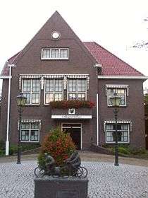 | ||
| Dokterswoning met praktijk en koetshuis | Westeinde 4 | 52° 34' 23" NB, 6° 17' 30" OL | 0148/WN094 | Upload foto | ||
| Ambtswoning burgemeester "'t Olde Ambt" | Westeinde 7 | 52° 34' 20" NB, 6° 17' 28" OL | 0148/WN095 | Upload foto | ||
| Winkel-woonhuis | Westeinde 12 | 52° 34' 22" NB, 6° 17' 27" OL | 0148/WN096 | Upload foto | ||
| Winkel-woonhuis | Westeinde 14 | 52° 34' 21" NB, 6° 17' 26" OL | 0148/WN097 | Upload foto | ||
| Begraafplaats | Westeinde achter 7 | 0148/WN098 | Upload foto |
| Zie de categorie Gemeentelijke monumenten in Dalfsen van Wikimedia Commons voor mediabestanden over dit onderwerp. |
Bronnen, noten en/of referenties
|
| Gemeentelijke monumenten in Overijssel | ||
|---|---|---|
|
Almelo · Borne · Dalfsen · Dinkelland · Deventer · Enschede · Haaksbergen · Hardenberg · Hellendoorn · Hengelo · Hof van Twente · Kampen · Losser · Oldenzaal · Olst-Wijhe · Ommen · Raalte · Rijssen-Holten · Staphorst · Steenwijkerland · Twenterand · Wierden · Zwartewaterland · Zwolle | ||
This article is issued from
Wikipedia.
The text is licensed under Creative
Commons - Attribution - Sharealike.
Additional terms may apply for the media files.