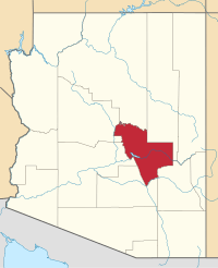
Gila County
Gila County is een county in de Amerikaanse staat Arizona.
| County in de Verenigde Staten | |||
 | |||
| Situering | |||
| Staat | Arizona | ||
| Coördinaten | 33°47'28"NB, 110°50'11"WL | ||
| Algemeen | |||
| Oppervlakte | 12.421 km² | ||
| - land | 12.348 km² | ||
| - water | 73 km² | ||
| Inwoners (2000) | 51.335 (4 inw./km²) | ||
| Overig | |||
| FIPS-code | 04007 | ||
| Foto's | |||
 Bevolkingspiramide Gila County | |||
| Statistieken volkstelling Gila County | |||
| |||
De county heeft een landoppervlakte van 12.348 km² en telt 51.335 inwoners (volkstelling 2000).
This article is issued from
Wikipedia.
The text is licensed under Creative
Commons - Attribution - Sharealike.
Additional terms may apply for the media files.