City of Canterbury (Engeland)
Canterbury is een district met de officiële titel van city, in Kent en telt circa 165.000 inwoners. Hoofdplaats is Canterbury.
| Niet-metropolitaans district in Engeland | |||
  | |||
| Situering | |||
| Land | Engeland | ||
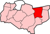
| County | Kent | ||
| Regio | South East England | ||
| Coördinaten | 51°16'48"NB, 1°4'48"OL | ||
| Algemeen | |||
| Oppervlakte | 308,8836[1] km² | ||
| Inwoners (2018[2]) | 164553 (533 inw./km²) | ||
| ONS-code | E07000106 | ||
| |||
Civil parishes in district Canterbury
Adisham, Barham, Bekesbourne-with-Patrixbourne, Bishopsbourne, Bridge, Chartham, Chestfield, Chislet, Fordwich, Hackington, Harbledown and Rough Common, Herne and Broomfield, Hoath, Ickham and Well, Kingston, Littlebourne, Lower Hardres, Petham, St. Cosmus and St. Damian in the Blean, Sturry, Thanington Without, Upper Hardres, Waltham, Westbere, Wickhambreaux, Womenswold.
Plaatsen in district City of Canterbury
Bronnen, noten en/of referenties
|
This article is issued from
Wikipedia.
The text is licensed under Creative
Commons - Attribution - Sharealike.
Additional terms may apply for the media files.