Charnwood (district)
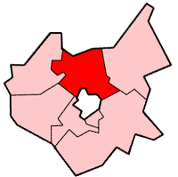
Charnwood is een Engels district in het shire-graafschap (non-metropolitan county OF county) Leicestershire en telt 183.000 inwoners. De oppervlakte bedraagt 279 km². Het administratieve centrum van het district ligt in Loughborough.
| Niet-metropolitaans district in Engeland | |||
 | |||
| Situering | |||
| Land | Engeland | ||
| County | Leicestershire | ||
| Regio | East Midlands | ||
| Coördinaten | 52°46'8"NB, 1°12'14"WL | ||
| Algemeen | |||
| Oppervlakte | 279,0426[1] km² | ||
| Inwoners (2018[2]) | 182643 (655 inw./km²) | ||
| ONS-code | E07000130 | ||
| |||
Van de bevolking is 14,9% ouder dan 65 jaar. De werkloosheid bedraagt 2,6% van de beroepsbevolking (cijfers volkstelling 2001).
Plaatsen in district Charnwood
Civil parishes in district Charnwood
Anstey, Barkby, Barkby Thorpe, Barrow upon Soar, Beeby, Birstall, Burton on the Wolds, Cossington, Cotes, East Goscote, Hathern, Hoton, Mountsorrel, Newtown Linford, Prestwold, Queniborough, Quorndon, Ratcliffe on the Wreake, Rearsby, Rothley, Seagrave, Shepshed, Sileby, South Croxton, Swithland, Syston, Thrussington, Thurcaston and Cropston, Thurmaston, Ulverscroft, Walton on the Wolds, Wanlip, Woodhouse, Wymeswold.
Bronnen, noten en/of referenties
|