List of civil parishes in Somerset
The ceremonial county of Somerset, England is divided into 418 areas known as civil parishes, which are lowest unit of local government in England. Parishes arose from Church of England divisions, and were given their current powers and responsibilities by the Local Government Act 1894.[1] The Local Government Act 1972 retained civil parishes in rural areas. Many former urban districts and municipal boroughs were replaced by new successor parishes; urban areas that were considered too large to be single parishes became unparished areas.[2]
| Districts of Somerset Areas shown in yellow are the unitary authorities and those in pink are districts administered by Somerset County Council |
|---|
 |
| 1 South Somerset |
| 2 Taunton Deane |
| 3 West Somerset |
| 4 Sedgemoor |
| 5 Mendip |
| 6 Bath and North East Somerset (unitary) |
| 7 North Somerset (unitary) |
The county of Somerset consists of a non-metropolitan county administered by Somerset County Council, divided into five districts and two unitary authorities. The districts of Somerset are West Somerset, South Somerset, Taunton Deane, Mendip and Sedgemoor. The two administratively independent unitary authorities, which were established on 1 April 1996 following the break-up of the county of Avon, are North Somerset and Bath and North East Somerset. These unitary authorities include areas that were part of Somerset before the creation of Avon in 1974.[3]
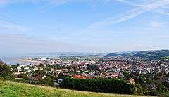
The city of Bath is the largest centre of population in Bath and North East Somerset. Areas of the city that were formerly within the Bath County Borough are now unparished, but the rest of the authority is divided into 49 parishes. All of North Somerset, the other unitary authority, is covered by its 39 parishes ranging from the village Loxton with a population of 192,[4] to the town of Weston-super-Mare with 76,143 inhabitants.[4]
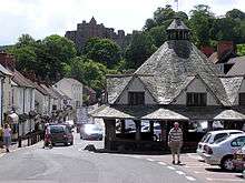
South Somerset is the largest of Somerset's five districts, covering an area of 958 square kilometres (370 sq mi) from the borders with Devon and Dorset to the edge of the Somerset Levels.[5] It has a population of about 156,100.[5] The largest settlement in the district is Yeovil, with a population of 30,378.[6] Part of Taunton formerly within Taunton Municipal Borough is unparished, but the rest of Taunton Deane is divided into 49 parishes. Tolland has just 81 residents,[7] compared to the town of Wellington which has 12,979.[7] West Somerset is a largely rural area, with a population of 35,712[8] in an area of 740 square kilometres (290 sq mi).[9] According to figures released by the Office for National Statistics in 2009, the population of West Somerset has the highest average age of any district in the United Kingdom at 52,[10] living in 43 parishes with 11,981 living in its most populous town, Minehead.[6] Sedgemoor has 54 parishes ranging in population from Greinton with 71[11] to Bridgwater with 33,698.[11] The Mendip district covers a largely rural area of 738 square kilometres (285 sq mi),[12] ranging from the Mendip Hills through on to the Somerset Levels. It has a population of about 108,300,[12] living in 62 parishes, the largest of which, Frome has 24,510 residents;[13] the smallest, Sharpham has a population of 71.[13]
History
Parishes arose from Church of England divisions, and were originally purely ecclesiastical divisions. Over time they acquired civil administration powers.[14] The Highways Act 1555 made parishes responsible for the upkeep of roads. Every adult inhabitant of the parish was obliged to work four days a year on the roads, providing their own tools, carts and horses; the work was overseen by an unpaid local appointee, the Surveyor of Highways. The poor were looked after by the monasteries, until their dissolution. In 1572, magistrates were given power to 'survey the poor' and impose taxes for their relief. This system was made more formal by the Poor Law Act 1601, which made parishes responsible for administering the Poor Law; overseers were appointed to charge a rate to support the poor of the parish.[15] The 19th century saw an increase in the responsibility of parishes, although the Poor Law powers were transferred to Poor Law Unions.[16] The Public Health Act 1872 grouped parishes into Rural Sanitary Districts, based on the Poor Law Unions; these subsequently formed the basis for Rural Districts.[17] Parishes were run by vestries, meeting annually to appoint officials, and were generally identical to ecclesiastical parishes,[18] although some townships in large parishes administered the Poor Law themselves; under the Parishes Act 1882, all extra-parochial areas and townships that levied a separate rate became independent civil parishes.[19]
Civil parishes in their modern sense date from the Local Government Act 1894, which abolished vestries; established elected parish councils in all rural parishes with more than 300 electors; grouped rural parishes into Rural Districts; and aligned parish boundaries with county and borough boundaries.[19] Urban civil parishes continued to exist, and were generally coterminous with the Urban District, Municipal Borough or County Borough in which they were situated; many large towns contained a number of parishes, and these were usually merged into one. Parish councils were not formed in urban areas, and the only function of the parish was to elect guardians to Poor Law Unions; with the abolition of the Poor Law system in 1930 the parishes had only a nominal existence.[20] The Local Government Act 1972 retained civil parishes in rural areas, and many former Urban Districts and Municipal Boroughs that were being abolished, were replaced by new successor parishes; urban areas that were considered too large to be single parishes became unparished areas.[21]
Current position
Recent governments have encouraged the formation of town and parish councils in unparished areas, and the Local Government and Rating Act 1997 gave local residents the right to demand the creation of a new civil parish.[22] A parish council can become a town council unilaterally, simply by resolution;[21] and a civil parish can also gain city status, but only if that is granted by the Crown.[21] The chairman of a town or city council is called a mayor.[21] There are currently 28 civil parishes in the county with the status of a town, and one (Wells) with city status. The Local Government and Public Involvement in Health Act 2007 introduced alternative names: a parish council can now chose to be called a community; village; or neighbourhood council.[23]
Bath and North East Somerset
The area of the city of Bath which was part of Bath County Borough is unparished.
| Image | Name | Status | Population | Former local authority | Coordinates | Refs |
|---|---|---|---|---|---|---|
 | Bathampton | Civil parish | 1,603 | Bathavon Rural District | 51.39°N 2.32°W | [24][25] |
 | Batheaston | Civil parish | 2,735 | Bathavon Rural District | 51.41°N 2.31°W | [25][26] |
 | Bathford | Civil parish | 1,759 | Bathavon Rural District | 51.39°N 2.30°W | [25][27] |
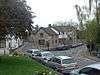
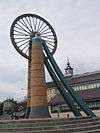
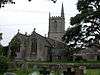
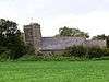
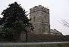
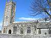
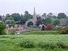
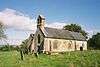
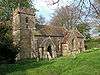
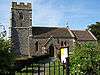
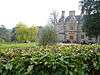
_St_Peter's_Church_-_geograph.org.uk_-_67585.jpg) | Camerton | Civil parish | 655 | Bathavon Rural District | 51.32°N 2.45°W | [25][28] |
 | Charlcombe | Civil parish | 422 | Bathavon Rural District | 51.41°N 2.36°W | [25][29] |
 | Chelwood | Civil parish | 148 | Clutton Rural District | 51.35°N 2.52°W | [30][31] |
 | Chew Magna | Civil parish | 1,149 | Clutton Rural District | 51.37°N 2.61°W | [31][32] |
 | Chew Stoke | Civil parish | 991 | Clutton Rural District | 51.35°N 2.64°W | [31][33] |
 | Claverton | Civil parish | 115 | Bathavon Rural District | 51.38°N 2.31°W | [25][34] |
 | Clutton | Civil parish | 1,602 | Clutton Rural District | 51.33°N 2.54°W | [31][35] |
 | Combe Hay | Civil parish | 147 | Bathavon Rural District | 51.34°N 2.38°W | [25][36] |
 | Compton Dando | Civil parish | 579 | Keynsham Urban District | 51.38°N 2.51°W | [37][38] |
 | Compton Martin | Civil parish | 508 | Clutton Rural District | 51.31°N 2.65°W | [31][39] |
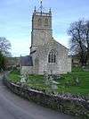
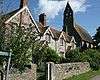
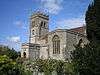
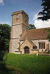
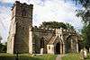
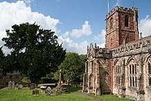
_All_Saints_Church_-_geograph.org.uk_-_67722.jpg) | Corston | Civil parish | 494 | Bathavon Rural District | 51.39°N 2.44°W | [25][40] |
 | Dunkerton and Tunley | Civil parish | 502 | Bathavon Rural District | 51.33°N 2.41°W | [25][41] |
 | East Harptree | Civil parish | 644 | Clutton Rural District | 51.30°N 2.62°W | [31][42] |
 | Englishcombe | Civil parish | 318 | Bathavon Rural District | 51.36°N 2.41°W | [25][43] |
 | Farmborough | Civil parish | 1,035 | Clutton Rural District | 51.34°N 2.48°W | [31][44] |
 | Farrington Gurney | Civil parish | 901 | Clutton Rural District | 51.29°N 2.53°W | [31][45] |
 | Freshford | Civil parish | 551 | Bathavon Rural District | 51.34°N 2.31°W | [25][46] |
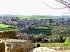
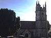
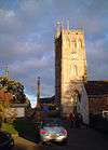
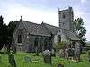
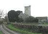
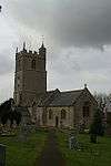
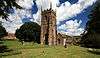
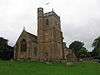
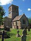
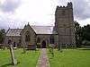
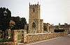
_Holy_Trinity_Church_-_geograph.org.uk_-_67726.jpg) | High Littleton | Civil parish | 2,104 | Clutton Rural District | 51.32°N 2.51°W | [31][47] |
 | Hinton Blewett | Civil parish | 308 | Clutton Rural District | 51.31°N 2.58°W | [31][48] |
 | Hinton Charterhouse | Civil parish | 515 | Bathavon Rural District | 51.33°N 2.32°W | [25][49] |
 | Kelston | Civil Parish | 248 | Bathavon Rural District | 51.40°N 2.43°W | [25][50] |
 | Keynsham | Town | 15,641 | Keynsham Urban District | 51.41°N 2.49°W | [38][51] |
 | Marksbury | Civil parish | 397 | Bathavon Rural District | 51.36°N 2.48°W | [25][52] |
 | Midsomer Norton | Town | 10,997 | Norton Radstock | 51.28°N 2.48°W | [53][54] |
 | Monkton Combe | Civil parish | 554 | Bathavon Rural District | 51.36°N 2.33°W | [25][55] |
 | Nempnett Thrubwell | Civil parish | 177 | Clutton Rural District | 51.34°N 2.68°W | [31][56] |
 | Newton St Loe | Civil parish | 681 | Bathavon Rural District | 51.38°N 2.43°W | [25][57] |
 | Norton Malreward | Civil parish | 246 | Clutton Rural District | 51.39°N 2.57°W | [31][58] |
 | Paulton | Civil parish | 5,302 | Clutton Rural District | 51.31°N 2.50°W | [31][59] |
 | Peasedown St John | Civil parish | 6,446 | Bathavon Rural District | 51.32°N 2.44°W | [25][60] |
 | Priston | Civil parish | 232 | Bathavon Rural District | 51.34°N 2.44°W | [25][61] |
| Publow | Civil parish | 1,119 | Clutton Rural District | 51.37°N 2.55°W | [31][62] | |
 | Radstock | Town | 5,620 | Norton Radstock Town Council | 51.29°N 2.4477°W | [54][63] |
 | Saltford | Civil parish | 4,073 | Keynsham Urban District | 51.40°N 2.46°W | [38][64] |
 | Shoscombe | Civil parish | 443 | Bathavon Rural District | 51.30°N 2.41°W | [25][65] |
 | Southstoke | Civil parish | 460 | Bathavon Rural District | 51.35°N 2.36°W | [25][66] |
 | Stanton Drew | Civil parish | 787 | Clutton Rural District | 51.37°N 2.58°W | [31][67] |
| Stowey-Sutton | Civil parish | 1,361 | Clutton Rural District | 51.34°N 2.59°W | [31][68] | |
 | Swainswick | Civil parish | 265 | Bathavon Rural District | 51.41°N 2.35°W | [25][69] |
 | Temple Cloud with Cameley | Civil parish | 1,292 | Clutton Rural District | 51.32°N 2.56°W | [31][70] |
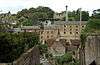
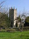
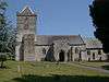
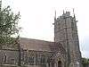
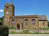
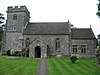
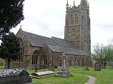
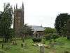
_St_Mary's_Church_-_geograph.org.uk_-_67849.jpg) | Timsbury | Civil parish | 2,624 | Clutton Rural District | 51.33°N 2.48°W | [31][71] |
 | Ubley | Civil parish | 331 | Clutton Rural District | 51.32°N 2.68°W | [31][72] |
| Wellow | Civil parish | 529 | Bathavon Rural District | 51.32°N 2.37°W | [25][73] | |
 | Westfield | Civil parish | 5,854 | Norton Radstock Town Council | 51.29°N 2.448°W | [54][74] |
 | West Harptree | Civil parish | 439 | Clutton Rural District | 51.31°N 2.63°W | [31][75] |
 | Whitchurch | Civil parish | 1,354 | Bathavon Rural District | 51.41°N 2.56°W | [25][76] |
Mendip
The whole of the district is parished.
| Image | Name | Status | Population[13] | Former local authority | Coordinates | Refs |
|---|---|---|---|---|---|---|
 | Ashwick | Civil parish | 1,352 | Shepton Mallet Rural District | 51.23°N 2.52°W | [77][78] |
 | Baltonsborough | Civil parish | 864 | Wells Rural District | 51.11°N 2.64°W | [79][80] |
 | Batcombe | Civil parish | 439 | Shepton Mallet Rural District | 51.15°N 2.44°W | [78][81] |
 | Beckington | Civil parish | 983 | Frome Rural District | 51.26°N 2.28°W | [82][83] |
 | Berkley | Civil parish | 344 | Frome Rural District | 51.24°N 2.27°W | [83][84] |
 | Binegar | Civil parish | 313 | Shepton Mallet Rural District | 51.24°N 2.55°W | [78][85] |
 | Buckland Dinham | Civil parish | 381 | Frome Rural District | 51.26°N 2.35°W | [83][86] |
 | Butleigh | Civil parish | 823 | Wells Rural District | 51.09°N 2.68°W | [80][87] |
 | Chewton Mendip | Civil parish | 585 | Wells Rural District | 51.28°N 2.58°W | [80][88] |
 | Chilcompton | Civil parish | 2,062 | Clutton Rural District | 51.27°N 2.50°W | [31][89] |
 | Coleford | Civil parish | 2,313 | Frome Rural District | 51.24°N 2.45°W | [83][90] |
 | Cranmore | Civil parish | 667 | Shepton Mallet Rural District | 51.19°N 2.48°W | [78][91] |
 | Croscombe | Civil parish | 603 | Shepton Mallet Rural District | 51.20°N 2.58°W | [78][92] |
 | Ditcheat | Civil parish | 725 | Shepton Mallet Rural District | 51.13°N 2.54°W | [78][93] |
 |
Downhead | Civil parish | 88 | Shepton Mallet Rural District | 51.211°N 2.443°W | [78] |
 | Doulting | Civil parish | 618 | Shepton Mallet Rural District | 51.19°N 2.51°W | [78][94] |
 | East Pennard | Civil parish | 348 | Shepton Mallet Rural District | 51.14°N 2.62°W | [78][95] |
 | Emborough | Civil parish | 148 | Shepton Mallet Rural District | 51.26°N 2.55°W | [78][96] |
 | Evercreech | Civil parish | 2,334 | Shepton Mallet Rural District | 51.14°N 2.51°W | [78][97] |
 | Frome | Town | 26,203 | Frome Rural District Frome Urban District | 51.23°N 2.32°W | [83][98] |
 | Glastonbury | Town | 8,932 | Glastonbury Municipal Borough | 51.15°N 2.71°W | [99][100] |
 | Godney | Civil parish | 237 | Wells Rural District | 51.18°N 2.74°W | [80][101] |
 | Great Elm | Civil parish | 171 | Frome Rural District | 51.24°N 2.36°W | [83][102] |
 | Hemington | Civil parish | 640 | Frome Rural District | 51.28°N 2.39°W | [83][103] |
 | Holcombe | Civil parish | 947 | Shepton Mallet Rural District | 51.24°N 2.46°W | [78][104] |
 | Kilmersdon | Civil parish | 541 | Frome Rural District | 51.27°N 2.44°W | [83][105] |
 | Lamyatt | Civil parish | 183 | Shepton Mallet Rural District | 51.12°N 2.49°W | [78][106] |
 | Leigh-on-Mendip | Civil parish | 514 | Frome Rural District | 51.23°N 2.44°W | [83][107] |
 | Litton | Civil parish | 240 | Clutton Rural District | 51.29°N 2.58°W | [31][108] |
 | Lullington | Civil parish | 162 | Frome Rural District | 51.26°N 2.31°W | [83][109] |
 | Lydford-on-Fosse | Civil parish | 511 | Shepton Mallet Rural District | 51.07°N 2.62°W | [78][110] |
 | Meare | Civil parish | 1,304 | Wells Rural District | 51.17°N 2.77°W | [80][111] |
 | Mells | Civil parish | 638 | Frome Rural District | 51.24°N 2.39°W | [83][112] |
 | North Wootton | Civil parish | 317 | Wells Rural District | 51.17°N 2.62°W | [80][113] |
 | Norton St Philip | Civil Parish | 858 | Frome Rural District | 51.29°N 2.32°W | [83][114] |
 | Nunney | Civil parish | 844 | Frome Rural District | 51.21°N 2.38°W | [83][115] |
 | Pilton | Civil parish | 998 | Shepton Mallet Rural District | 51.17°N 2.59°W | [78][116] |
| Priddy | Civil parish | 624 | Wells Rural District | 51.25°N 2.68°W | [80][117] | |
 | Pylle | Civil parish | 160 | Shepton Mallet Rural District | 51.14°N 2.56°W | [78][118] |
 | Rode | Civil parish | 1,025 | Frome Rural District | 51.28°N 2.2°W | [83][119] |
 | Rodney Stoke | Civil parish | 1,326 | Wells Rural District | 51.25°N 2.74°W | [80][120] |
| – | Selwood | Civil parish | 798 | Frome Rural District | 51.24°N 2.31°W | [83][121] |
 | Sharpham | Civil parish | 130 | Wells Rural District | 51.14°N 2.77°W | [80][122] |
 | Shepton Mallet | Town | 10,369 | Shepton Mallet Urban District | 51.19°N 2.55°W | [123][124] |
 | St Cuthbert Out | Civil parish | 3,749 | Wells Rural District | 51.18°N 2.69°W | [80][125] |
 | Stoke St Michael | Civil parish | 926 | Shepton Mallet Rural District | 51.22°N 2.48°W | [78][126] |
 | Ston Easton | Civil parish | 550 | Clutton Rural District | 51.28°N 2.54°W | [31][127] |
 | Stratton on the Fosse | Civil parish | 1,108 | Shepton Mallet Rural District | 51.25°N 2.49°W | [78][128] |
 | Street | Civil parish | 11,805 | Street Urban District | 51.12°N 2.74°W | [129][130] |
 | Tellisford | Civil parish | 182 | Frome Rural District | 51.29°N 2.28°W | [83][131] |
 | Trudoxhill | Civil parish | 423 | Frome Rural District | 51.19°N 2.37°W | [83][132] |
 | Upton Noble | Civil parish | 128 | Frome Rural District | 51.15°N 2.41°W | [83][133] |
 | Walton | Civil parish | 1,106 | Wells Rural District | 51.14°N 2.77°W | [80][134] |
 | Wanstrow | Civil parish | 489 | Frome Rural District | 51.17°N 2.41°W | [83][135] |
 | Wells | City | 10,536 | Wells Municipal Borough | 51.21°N 2.65°W | [80][136] |
 | West Bradley | Civil parish | 277 | Shepton Mallet Rural District | 51.13°N 2.64°W | [78][137] |
 | West Pennard | Civil parish | 670 | Wells Rural District | 51.14°N 2.65°W | [80][138] |
 | Westbury | Civil parish | 801 | Wells Rural District | 51.24°N 2.71°W | [80][139] |
.jpg) | Whatley | Civil parish | 245 | Frome Rural District | 51.23°N 2.38°W | [83][140] |
 | Witham Friary | Civil parish | 399 | Frome Rural District | 51.17°N 2.37°W | [83][141] |
 | Wookey | Civil parish | 1,311 | Wells Rural District | 51.21°N 2.69°W | [80][142] |
North Somerset
The whole of the district is parished.
| Image | Name | Status | Population | Former local authority | Coordinates | Refs |
|---|---|---|---|---|---|---|
 | Abbots Leigh | Civil parish | 799 | Long Ashton Rural District | 51.46°N 2.65°W | [4][143] |
 | Backwell | Civil parish | 4,589 | Long Ashton Rural District | 51.41°N 2.73°W | [4][143] |
 | Banwell | Civil parish | 2,919 | Axbridge Rural District | 51.32°N 2.86°W | [4][144] |
 | Barrow Gurney | Civil parish | 349 | Long Ashton Rural District | 51.40°N 2.67°W | [4][143] |
 | Blagdon | Civil parish | 1,116 | Axbridge Rural District | 51.33°N 2.72°W | [4][144] |
 | Bleadon | Civil parish | 1,079 | Axbridge Rural District | 51.31°N 2.94°W | [4][144] |
 | Brockley | Civil parish | 277 | Long Ashton Rural District | 51.39°N 2.76°W | [4][143] |
 | Burrington | Civil parish | 464 | Axbridge Rural District | 51.33°N 2.74°W | [4][144] |
 | Butcombe | Civil parish | 218 | Axbridge Rural District | 51.35°N 2.69°W | [4][144] |
 | Churchill | Civil parish | 2,235 | Axbridge Rural District | 51.33°N 2.79°W | [4][144] |
 | Clapton in Gordano | Civil parish | 348 | Long Ashton Rural District | 51.46°N 2.75°W | [4][143] |
 | Cleeve | Civil parish | 902 | Long Ashton Rural District | 51.39°N 2.77°W | [4][143] |
 | Clevedon | Town | 21,281 | Clevedon Urban District | 51.43°N 2.85°W | [4][145] |
 | Congresbury | Civil parish | 3,497 | Axbridge Rural District | 51.37°N 2.81°W | [4][144] |
 | Dundry | Civil parish | 829 | Long Ashton Rural District | 51.39°N 2.64°W | [4][143] |
 | Flax Bourton | Civil parish | 715 | Long Ashton Rural District | 51.42°N 2.71°W | [4][143] |
 | Hutton | Civil parish | 2,582 | Axbridge Rural District | 51.32°N 2.93°W | [4][144] |
 | Kenn | Civil parish | 431 | Long Ashton Rural District | 51.42°N 2.84°W | [4][143] |
 | Kewstoke | Civil parish | 1,690 | Axbridge Rural District | 51.37°N 2.96°W | [4][144] |
 | Kingston Seymour | Civil parish | 388 | Long Ashton Rural District | 51.39°N 2.86°W | [4][143] |
 | Locking | Civil parish | 2,756 | Axbridge Rural District | 51.33°N 2.91°W | [4][144] |
 | Long Ashton | Civil parish | 6,044 | Long Ashton Rural District | 51.43°N 2.65°W | [4][143] |
 | Loxton | Civil parish | 192 | Axbridge Rural District | 51.29°N 2.89°W | [4][144] |
 | Nailsea | Town | 15,630 | Long Ashton Rural District | 51.43°N 2.76°W | [4][143] |
 | Pill and Easton-in-Gordano (until 2011 Easton in Gordano) | Civil parish | 4,828 | Long Ashton Rural District | 51.48°N 2.69°W | [4][143] |
 | Portbury | Civil parish | 827 | Long Ashton Rural District | 51.47°N 2.72°W | [4][143] |
 | Portishead | Town | 23,699 | Long Ashton Rural District Portishead Urban District | 51.48°N 2.77°W | [4][143][146] |
 | Puxton | Civil parish | 359 | Axbridge Rural District | 51.37°N 2.85°W | [4][144] |
 | St Georges | Civil parish | 3,379 | Axbridge Rural District | 51.36°N 2.90°W | [4][144] |
 | Tickenham | Civil parish | 910 | Long Ashton Rural District | 51.44°N 2.80°W | [4][144] |
 | Walton in Gordano | Civil parish | 273 | Axbridge Rural District | 51.45°N 2.83°W | [4][144] |
 | Weston in Gordano | Civil parish | 301 | Axbridge Rural District | 51.46°N 2.79°W | [4][144] |
 | Weston super Mare | Town | 76,143 | Axbridge Rural District Weston super Mare Municipal Borough | 51.35°N 2.97°W | [4][144] |
 | Wick St Lawrence | Civil parish | 1,331 | Axbridge Rural District | 51.38°N 2.91°W | [4][144] |
 | Winford | Civil parish | 2,153 | Long Ashton Rural District | 51.38°N 2.66°W | [4][143] |
 | Winscombe and Sandford | Civil parish | 4,546 | Axbridge Rural District | 51.31°N 2.83°W | [4][144] |
 | Wraxall and Failand | Civil parish | 2,302 | Long Ashton Rural District | 51.44°N 2.73°W | [4][143] |
 | Wrington | Civil parish | 2,633 | Axbridge Rural District | 51.36°N 2.76°W | [4][144] |
 | Yatton | Civil parish | 7,552 | Long Ashton Rural District | 51.39°N 2.83°W | [4][143] |
Sedgemoor
The whole of the district is parished.
| Image | Name | Status | Population[11] | Former local authority | Coordinates | Refs |
|---|---|---|---|---|---|---|
 | Ashcott | Civil parish | 1,186 | Bridgwater Rural District | 51.12°N 2.81°W | [6][147] |
 | Axbridge | Town | 2,057 | Axbridge Rural District | 51.29°N 2.82°W | [6][144] |
 | Badgworth | Civil parish | 525 | Axbridge Rural District | 51.27°N 2.87°W | [6][144] |
 | Bawdrip | Civil parish | 506 | Bridgwater Rural District | 51.15°N 2.94°W | [6][147] |
 | Berrow | Civil parish | 1,534 | Axbridge Rural District | 51.27°N 3.01°W | [6][144] |
 | Brean | Civil parish | 635 | Axbridge Rural District | 51.30°N 3.01°W | [6][144] |
 | Brent Knoll | Civil parish | 1,271 | Axbridge Rural District | 51.25°N 2.95°W | [6][144] |
 | Bridgwater | Town | 35,886 | Bridgwater Municipal Borough | 51.13°N 2.99°W | [6][147] |
 | Bridgwater Without | Civil parish | 428 | Bridgwater Rural District | 51.14°N 2.97°W | [6][147] |
 | Broomfield | Civil parish | 249 | Bridgwater Rural District | 51.08°N 3.11°W | [6][147] |
 | Burnham on Sea and Highbridge | Town | 19,576 | Burnham on Sea Urban District | 51.24°N 2.99°W | [6][148] |
 | Burnham Without | Civil Parish | 1,636 | Axbridge Rural District | 51.23°N 2.96°W | [6][144] |
 | Burtle | Civil parish | 388 | Bridgwater Rural District | 51.17°N 2.87°W | [6][147] |
 | Cannington | Civil parish | 2,271 | Bridgwater Rural District | 51.15°N 3.07°W | [6][147] |
 | Catcott | Civil parish | 531 | Bridgwater Rural District | 51.15°N 2.87°W | [6][147] |
 | Chapel Allerton | Civil parish | 401 | Axbridge Rural District | 51.25°N 2.85°W | [6][144] |
 | Cheddar | Civil parish | 5,755 | Axbridge Rural District | 51.28°N 2.78°W | [6][144] |
 | Chedzoy | Civil parish | 404 | Bridgwater Rural District | 51.13°N 2.95°W | [6][147] |
 | Chilton Polden | Civil parish | 698 | Bridgwater Rural District | 51.15°N 2.90°W | [6][147] |
 | Chilton Trinity | Civil parish | 260 | Bridgwater Rural District | 51.15°N 3.01°W | [6][147] |
 | Compton Bishop | Civil parish | 620 | Axbridge Rural District | 51.30°N 2.87°W | [6][144] |
 | Cossington | Civil parish | 564 | Bridgwater Rural District | 51.16°N 2.92°W | [6][147] |
 | Durleigh | Civil parish | 548 | Bridgwater Rural District | 51.12°N 3.04°W | [6][147] |
 | East Brent | Civil parish | 1,302 | Axbridge Rural District | 51.26°N 2.94°W | [6][144] |
 | East Huntspill | Civil parish | 1,146 | Bridgwater Rural District | 51.20°N 2.98°W | [6][147] |
 | Edington | Civil parish | 372 | Bridgwater Rural District | 51.15°N 2.88°W | [6][147] |
 | Enmore | Civil parish | 247 | Bridgwater Rural District | 51.11°N 3.09°W | [6][147] |
 | Fiddington | Civil parish | 298 | Bridgwater Rural District | 51.16°N 3.12°W | [6][147] |
 | Goathurst | Civil parish | 193 | Bridgwater Rural District | 51.10°N 3.06°W | [6][147] |
 | Greinton | Civil Parish | 71 | Bridgwater Rural District | 51.12°N 2.84°W | [147] |
 | Lympsham | Civil parish | 960 | Axbridge Rural District | 51.29°N 2.95°W | [6][144] |
 | Lyng | Civil parish | 338 | Bridgwater Rural District | 51.05°N 2.96°W | [6][147] |
 | Mark | Civil parish | 1,478 | Axbridge Rural District | 51.23°N 2.89°W | [6][144] |
 | Middlezoy | Civil parish | 725 | Bridgwater Rural District | 51.09°N 2.89°W | [6][147] |
 | Moorlinch | Civil parish | 408 | Bridgwater Rural District | 51.13°N 2.86°W | [6][147] |
 | Nether Stowey | Civil parish | 1,373 | Bridgwater Rural District | 51.15°N 3.15°W | [6][147] |
 | North Petherton | Town | 6,730 | Bridgwater Rural District | 51.09°N 3.01°W | [6][147] |
 | Othery | Civil parish | 642 | Bridgwater Rural District | 51.08°N 2.88°W | [6][147] |
 | Otterhampton | Civil parish | 831 | Bridgwater Rural District | 51.18°N 3.08°W | [6][147] |
 | Over Stowey | Civil parish | 352 | Bridgwater Rural District | 51.15°N 3.15°W | [6][147] |
 | Pawlett | Civil Parish | 1,038 | Bridgwater Rural District | 51.18°N 3.00°W | [6][147] |
 | Puriton | Civil parish | 1,068 | Bridgwater Rural District | 51.17°N 2.97°W | [6][147] |
 | Shapwick | Civil parish | 536 | Bridgwater Rural District | 51.14°N 2.83°W | [6][147] |
 | Shipham | Civil parish | 1,087 | Axbridge Rural District | 51.31°N 2.80°W | [6][144] |
 | Spaxton | Civil parish | 1,012 | Bridgwater Rural District | 51.13°N 3.11°W | [6][147] |
 | Stawell | Civil parish | 386 | Bridgwater Rural District | 51.14°N 2.91°W | [6][147] |
 | Stockland Bristol | Civil parish | 165 | Bridgwater Rural District | 51.19°N 3.08°W | [6][147] |
 | Thurloxton | Civil parish | 153 | Bridgwater Rural District | 51.07°N 3.04°W | [6][147] |
 | Weare | Civil parish | 658 | Axbridge Rural District | 51.27°N 2.84°W | [6][144] |
 | Wedmore | Civil Parish | 3,318 | Axbridge Rural District | 51.23°N 2.81°W | [6][144] |
 | Wembdon | Civil parish | 3,613 | Bridgwater Rural District | 51.13°N 3.02°W | [6][147] |
 | West Huntspill | Civil parish | 1,414 | Bridgwater Rural District | 51.20°N 2.98°W | [6][147] |
 | Westonzoyland | Civil parish | 1,801 | Bridgwater Rural District | 51.11°N 2.92°W | [6][147] |
 | Woolavington | Civil parish | 2,115 | Bridgwater Rural District | 51.17°N 2.93°W | [6][147] |
South Somerset
The whole of the district is parished.
| Image | Name | Status | Population | Former local authority | Coordinates | Refs |
|---|---|---|---|---|---|---|
 | Abbas and Templecombe | Civil parish | 1,560 | Wincanton Rural District | 50.99°N 2.41°W | [6][149] |
 | Alford | Civil parish | 63 | Wincanton Rural District | 51.08°N 2.57°W | [149] |
 | Aller | Civil parish | 410 | Langport Rural District | 51.05°N 2.85°W | [6][150] |
 | Ansford | Civil parish | 1,085 | Wincanton Rural District | 51.09°N 2.51°W | [6][149] |
 | Ash | Civil parish | 626 | Yeovil Rural District | 50.98°N 2.75°W | [6][151] |
 | Ashill | Civil parish | 529 | Chard Rural District | 50.94°N 2.96°W | [6][152] |
 | Babcary | Civil parish | 248 | Langport Rural District | 51.05°N 2.62°W | [6][150] |
 | Barrington | Civil parish | 438 | Langport Rural District | 50.96°N 2.87°W | [6][150] |
 | Barton St David | Civil parish | 561 | Langport Rural District | 51.08°N 2.65°W | [6][150] |
 | Barwick | Civil parish | 1,221 | Yeovil Rural District | 50.92°N 2.62°W | [6][151] |
 | Beercrocombe | Civil parish | 134 | Langport Rural District | 50.98°N 2.97°W | [6][150] |
 | Compton Pauncefoot | Civil parish | 130 | Wincanton Rural District | 51.03°N 2.50°W | [149] |
 | Bratton Seymour | Civil parish | 104 | Wincanton Rural District | 51.07°N 2.47°W | [6][149] |
 | Brewham | Civil parish | 441 | Wincanton Rural District | 51.13°N 2.40°W | [6][149] |
 | Broadway | Civil parish | 740 | Chard Rural District | 50.93°N 2.97°W | [6][152] |
 | Bruton | Town | 2,907 | Wincanton Rural District | 51.11°N 2.45°W | [6][149] |
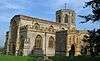
.jpg) | Brympton | Civil parish | 7,308 | Yeovil Rural District | 50.94°N 2.68°W | [6][151] |
 | Buckland St Mary | Civil parish | 521 | Chard Rural District | 50.91°N 3.04°W | [6][152][152] |
 | Castle Cary | Town | 2,276 | Wincanton Rural District | 51.09°N 2.51°W | [6][149] |
 | Chaffcombe | Civil parish | 229 | Chard Rural District | 50.89°N 2.92°W | [6][152] |
 | Chard Town | Town | 13,074 | Chard Municipal Borough | 50.87°N 2.96°W | [6][152] |
 | Charlton Horethorne | Civil parish | 591 | Wincanton Rural District | 51.01°N 2.48°W | [6] |
 | Charlton Musgrove | Civil parish | 398 | Wincanton Rural District | 51.08°N 2.39°W | [6][149] |
 | Chillington | Civil parish | 164 | Chard Rural District | 50.89°N 2.87°W | [6][152] |
 | Chilthorne Domer | Civil parish | 574 | Yeovil Rural District | 50.97°N 2.68°W | [6][151] |
 | Chilton Cantelo | Civil parish | 445 | Yeovil Rural District | 51.00°N 2.60°W | [6][151] |
 | Chiselborough | Civil parish | 275 | Yeovil Rural District | 50.93°N 2.76°W | [6][151] |
 | Closworth | Civil parish | 220 | Yeovil Rural District | 50.89°N 2.62°W | [6][151] |
 | Combe St Nicholas | Civil parish | 1,373 | Chard Rural District | 50.89°N 2.99°W | [6][152] |
 | Compton Dundon | Civil parish | 705 | Langport Rural District | 51.09°N 2.73°W | [6][150] |
 | Corton Denham | Civil parish | 189 | Wincanton Rural District | 51.00°N 2.52°W | [6][149] |
 | Crewkerne | Town | 7,000 | Crewkerne Urban District | 50.88°N 2.79°W | [6][153] |
 | Cricket St Thomas | Civil parish | 50 | Chard Rural District | 50.87°N 2.89°W | [152] |
 | Cucklington | Civil parish | 173 | Wincanton Rural District | 51.05°N 2.35°W | [6][149] |
 | Cudworth | Civil parish | 69 | Chard Rural District | 50.89°N 2.89°W | [152] |
 | Curry Mallet | Civil parish | 306 | Langport Rural District | 50.99°N 2.96°W | [6][150] |
 | Curry Rivel | Civil parish | 2,148 | Langport Rural District | 51.03°N 2.86°W | [6][150] |
 | Dinnington | Civil parish | 65 | Chard Rural District | 50.91°N 2.85°W | [152] |
 | Donyatt | Civil parish | 347 | Chard Rural District | 50.93°N 2.95°W | [6][152] |
 | Dowlish Wake | Civil parish | 277 | Chard Rural District | 50.91°N 2.89°W | [6][152] |
 | Drayton | Civil parish | 379 | Langport Rural District | 51.019°N 2.85°W | [6][150] |
 | East Chinnock | Civil parish | 479 | Yeovil Rural District | 50.92°N 2.72°W | [6][151] |
 | East Coker | Civil parish | 1,667 | Yeovil Rural District | 50.91°N 2.65°W | [6][151] |
 | Fivehead | Civil parish | 609 | Langport Rural District | 50.99°N 2.92°W | [6][150] |
 | Hambridge and Westport | Civil parish | 514 | Langport Rural District | 50.99°N 2.86°W | [6][150] |
 | Hardington Mandeville | Civil parish | 585 | Yeovil Rural District | 50.90°N 2.69°W | [6][151] |
 | Haselbury Plucknett | Civil parish | 744 | Yeovil Rural District | 50.89°N 2.75°W | [6][151] |
 | Henstridge | Civil parish | 1,814 | Wincanton Rural District | 50.97°N 2.39°W | [6] |
 | High Ham | Civil parish | 909 | Langport Rural District | 51.08°N 2.82°W | [6][150] |
 | Hinton St George | Civil parish | 442 | Chard Rural District | 50.91°N 2.82°W | [6][152] |
 | Holton | Civil parish | 238 | Wincanton Rural District | 51.04°N 2.45°W | [6][149] |
 | Horsington | Civil parish | 571 | Wincanton Rural District | 51.01°N 2.43°W | [6][149] |
 | Horton | Civil parish | 812 | Chard Rural District | 50.93°N 2.97°W | [6][152] |
 | Huish Episcopi | Civil parish | 2,095 | Langport Rural District | 51.04°N 2.81°W | [6][150] |
 | Ilchester | Civil parish | 2,153 | Yeovil Rural District | 51.00°N 2.68°W | [6][151] |
 | Ilminster | Town | 5,808 | Chard Rural District Ilminster Urban District | 50.93°N 2.91°W | [6][152] |
 | Ilton | Civil parish | 854 | Chard Rural District | 50.95°N 2.92°W | [6][152] |
 | Isle Abbots | Civil parish | 205 | Langport Rural District | 50.98°N 2.92°W | [6][150] |
 | Isle Brewers | Civil parish | 150 | Langport Rural District | 50.99°N 2.90°W | [6] |
 | Keinton Mandeville | Civil parish | 1,068 | Langport Rural District | 51.07°N 2.65°W | [6][150] |
 | Kingsbury Episcopi | Civil parish | 1,307 | Langport Rural District | 50.99°N 2.81°W | [6][150] |
 | Kingsdon | Civil parish | 303 | Langport Rural District | 51.04°N 2.69°W | [6][150] |
 | Kingstone | Civil parish | 83 | Chard Rural District | 50.92°N 2.89°W | [152] |
 | Kingweston | Civil parish | 128 | Langport Rural District | 51.08°N 2.68°W | [150] |
 | Knowle St Giles | Civil parish | 244 | Chard Rural District | 50.90°N 2.93°W | [6][152] |
 | Langport | Town | 1,081 | Langport Rural District | 51.04°N 2.83°W | [6][150] |
 | Limington | Civil parish | 199 | Yeovil Rural District | 50.99°N 2.65°W | [151] |
 | Long Load | Civil parish | 332 | Yeovil Rural District | 51.01°N 2.76°W | [6][151] |
| Long Sutton | Civil parish | 833 | Langport Rural District | [6][150] | |
 | Lopen | Civil parish | 260 | Chard Rural District | 50.93°N 2.82°W | [6][152] |
 | Lovington | Civil parish | 141 | Wincanton Rural District | 51.07°N 2.58°W | [6][149] |
 | Maperton | Civil parish | 140 | Wincanton Rural District | 51.04°N 2.46°W | [6][149] |
 | Marston Magna | Civil parish | 523 | Yeovil Rural District | 51.00°N 2.58°W | [6][151] |
 | Martock | Civil parish | 4,766 | Yeovil Rural District | 50.97°N 2.77°W | [6][151] |
 | Merriott | Civil parish | 1,979 | Chard Rural District | 50.91°N 2.79°W | [6][152] |
 | Milborne Port | Civil parish | 2,802 | Wincanton Rural District | 50.97°N 2.46°W | [6][149] |
 | Misterton | Civil parish | 826 | Chard Rural District | 50.87°N 2.78°W | [6][152] |
 | Montacute | Civil parish | 831 | Yeovil Rural District | 50.95°N 2.72°W | [6][151] |
 | Muchelney | Civil parish | 195 | Langport Rural District | 51.021°N 2.82°W | [6][150] |
 | Mudford | Civil parish | 696 | Yeovil Rural District | 50.97°N 2.61°W | [6][151] |
 | North Barrow | Civil parish | 233 | Wincanton Rural District | 51.06°N 2.57°W | [6][149] |
 | North Cadbury | Civil parish | 950 | Wincanton Rural District | 51.05°N 2.52°W | [6][149] |
 | North Cheriton | Civil parish | 208 | Wincanton Rural District | 51.03°N 2.44°W | [6][149] |
 | North Perrott | Civil parish | 246 | Yeovil Rural District | 50.88°N 2.75°W | [6][151] |
 | Norton sub Hamdon | Civil parish | 743 | Yeovil Rural District | 50.94°N 2.76°W | [6][151] |
 | Odcombe | Civil parish | 759 | Yeovil Rural District | 50.94°N 2.70°W | [6][151] |
 | Penselwood | Civil parish | 273 | Wincanton Rural District | 51.08°N 2.35°W | [6][149] |
 | Pitcombe | Civil parish | 532 | Wincanton Rural District | 51.10°N 2.47°W | [6][149] |
 | Pitney | Civil parish | 374 | Langport Rural District | 51.05°N 2.79°W | [6][150] |
 | Puckington | Civil parish | 117 | Langport Rural District | 50.96°N 2.89°W | [6][150] |
 | Queen Camel | Civil parish | 908 | Wincanton Rural District | 51.02°N 2.58°W | [6][149] |
 | Rimpton | Civil parish | 235 | Yeovil Rural District | 50.99°N 2.56°W | [6][151] |
 | Seavington St Mary | Civil parish | 384 | Chard Rural District | 50.93°N 2.86°W | [6][152] |
 | Seavington St Michael | Civil parish | 127 | Chard Rural District | 50.93°N 2.84°W | [6][152] |
 | Shepton Beauchamp | Civil parish | 728 | Chard Rural District | 50.95°N 2.85°W | [6][152] |
 | Shepton Montague | Civil parish | 208 | Wincanton Rural District | 51.08°N 2.47°W | [6][149] |
 | Somerton | Town | 4,697 | Langport Rural District | 51.05°N 2.74°W | [6][150] |
 | South Barrow | Civil parish | 162 | Wincanton Rural District | 51.05°N 2.56°W | [6][149] |
 | South Cadbury and Sutton Montis | Civil parish | 284 | Wincanton Rural District | 51.03°N 2.52°W | [6][149] |
 | South Petherton | Civil parish | 3,367 | Yeovil Rural District | 50.95°N 2.81°W | [6][151] |
 | Sparkford | Civil parish | 617 | Wincanton Rural District | 51.04°N 2.57°W | [6][149] |
 | Stocklinch | Civil parish | 154 | Chard Rural District | 50.95°N 2.88°W | [6][152] |
 | Stoke sub Hamdon | Civil parish | 1,068 | Yeovil Rural District | 50.95°N 2.75°W | [6][151] |
 | Stoke Trister | Civil parish | 313 | Wincanton Rural District | 51.06°N 2.38°W | [6][149] |
 | Tatworth and Forton | Civil parish | 2,660 | Chard Rural District | 50.85°N 2.96°W | [6][152] |
 | The Charltons | Civil parish | 1,073 | Langport Rural District | 51.05°N 2.68°W | [6][150][154] |
 | Tintinhull | Civil parish | 902 | Yeovil Rural District | 50.97°N 2.71°W | [6][151] |
 | Wambrook | Civil parish | 184 | Chard Rural District | 50.86°N 3.00°W | [6][152] |
 | Wayford | Civil parish | 114 | Chard Rural District | 50.85°N 2.85°W | [152] |
 | West Camel | Civil parish | 459 | Yeovil Rural District | 51.02°N 2.60°W | [6][151] |
 | West and Middle Chinnock | Civil parish | 592 | Yeovil Rural District | 50.92°N 2.76°W | [6][151] |
 | West Coker | Civil parish | 2,018 | Yeovil Rural District | 50.92°N 2.69°W | [6][151] |
| West Crewkerne | Civil parish | 631 | Chard Rural District | 50.88°N 2.79°W | [6][152] |
 | Whitelackington | Civil parish | 209 | Chard Rural District | 50.94°N 2.88°W | [6][152] |
 | Whitestaunton | Civil parish | 256 | Chard Rural District | 50.89°N 3.02°W | [6][152] |
 | Wincanton | Town | 5,272 | Wincanton Rural District | 51.06°N 2.41°W | [6][149] |
 | Winsham | Civil parish | 748 | Chard Rural District | 50.85°N 2.89°W | [6][152] |
 | Yarlington | Civil parish | 123 | Wincanton Rural District | 51.06°N 2.49°W | [6][149] |
 | Yeovil | Town | 30,378 | Yeovil Municipal Borough | 50.95°N 2.64°W | [6][155] |
 | Yeovil Without | Civil parish | 6,834 | Yeovil Rural District | 50.96°N 2.65°W | [6][151] |
 | Yeovilton | Civil parish | 1,226 | Yeovil Rural District | 51.00°N 2.65°W | [6][151] |
Taunton Deane
Part of the former Taunton Municipal Borough is unparished.
| Image | Name | Status | Population[7] | Former local authority | Coordinates | Refs |
|---|---|---|---|---|---|---|
 | Ashbrittle | Civil parish | 225 | Wellington Rural District | 50.98°N 3.35°W | [6][156] |
 | Ash Priors | Civil parish | 155 | Taunton Rural District | 51.06°N 3.21°W | [6][157] |
 | Bathealton | Civil parish | 194 | Wellington Rural District | 51.01°N 3.31°W | [6][156] |
 | Bickenhall | Civil parish | 122 | Taunton Rural District | 50.96°N 3.03°W | [157] |
 | Bishop's Hull | Civil parish | 2,975 | Taunton Rural District | 51.02°N 3.14°W | [6][157] |
 | Bishops Lydeard | Civil parish | 2,839 (includes Cotford St Luke) | Taunton Rural District | 51.06°N 3.19°W | [6][157] |
 | Bradford-on-Tone | Civil parish | 622 | Wellington Rural District | 51.00°N 3.18°W | [6][156] |
 | Burrowbridge | Civil parish | 508 | Taunton Rural District | 51.07°N 2.92°W | [6][157] |
 | Cheddon Fitzpaine | Civil parish | 1,929 | Taunton Rural District | 51.04°N 3.08°W | [6][157] |
 | Chipstable | Civil parish | 309 | Wellington Rural District | 51.04°N 3.37°W | [6][156] |
 | Churchstanton | Civil parish | 752 | Taunton Rural District | 50.92°N 3.15°W | [6][157] |
 | Combe Florey | Civil parish | 261 | Taunton Rural District | 51.08°N 3.21°W | [6][157] |
 | Comeytrowe | Civil parish | 5,463 | Taunton Municipal Borough Taunton Rural District | 51.01°N 3.13°W | [6][157] |
 | Corfe | Civil parish | 253 | Taunton Rural District | 50.97°N 3.09°W | [6][157] |
 | Cotford St Luke | Civil parish | created post-census | Taunton Rural District | 51.0392°N 3.1886°W | [157] |
 | Cothelstone | Civil parish | 111 | Taunton Rural District | 51.08°N 3.16°W | [6][157] |
 | Creech St Michael | Civil parish | 2,416 | Taunton Rural District | 51.02°N 3.04°W | [6][157] |
 | Curland | Civil parish | 225 | Taunton Rural District | 50.95°N 3.03°W | [6][157] |
 | Durston | Civil parish | 136 | Taunton Rural District | 51.05°N 3.01°W | [6][157] |
 | Fitzhead | Civil parish | 264 | Wellington Rural District | 51.05°N 3.26°W | [6][156] |
 | Halse | Civil parish | 290 | Taunton Rural District | 51.04°N 3.23°W | [6][157] |
 | Hatch Beauchamp | Civil parish | 620 | Taunton Rural District | 50.98°N 2.99°W | [157] |
 | Kingston St Mary | Civil parish | 921 | Taunton Rural District | 51.06°N 3.11°W | [6][157] |
 | Langford Budville | Civil parish | 535 | Wellington Rural District | 51.00°N 3.27°W | [6][156] |
 | Lydeard St Lawrence | Civil parish | 506 | Taunton Rural District | 51.09°N 3.25°W | [6][157] |
 | Milverton | Civil parish | 1,438 | Wellington Rural District | 51.02°N 3.25°W | [6][156] |
 | North Curry | Civil parish | 1,640 | Taunton Rural District | 51.02°N 2.96°W | [6][157] |
 | Norton Fitzwarren | Civil parish | 3,046 | Taunton Rural District | 51.02°N 3.15°W | [6][157] |
 | Nynehead | Civil parish | 415 | Wellington Rural District | 50.99°N 3.23°W | [6][156] |
 | Oake | Civil parish | 765 | Wellington Rural District | 51.02°N 3.21°W | [6][156] |
 | Orchard Portman | Civil parish | 150 | Taunton Rural District | 50.99°N 3.08°W | [6][157] |
 | Otterford | Civil parish | 356 | Taunton Rural District | 50.92°N 3.10°W | [6][157] |
 | Pitminster | Civil parish | 956 | Taunton Rural District | 50.97°N 3.11°W | [6][157] |
 | Ruishton | Civil parish | 1,473 | Taunton Rural District | 51.02°N 3.05°W | [6][157] |
 | Sampford Arundel | Civil parish | 268 | Wellington Rural District | 50.96°N 3.28°W | [6][156] |
 | Staple Fitzpaine | Civil parish | 189 | Taunton Rural District | 50.96°N 3.05°W | [6][157] |
 | Staplegrove | Civil parish | 1,649 | Taunton Rural District | 51.03°N 3.12°W | [6][157] |
 | Stawley | Civil parish | 279 | Wellington Rural District | 51.00°N 3.33°W | [6][156] |
 | Stoke St Gregory | Civil parish | 942 | Taunton Rural District | 51.04°N 2.94°W | [6][157] |
 | Stoke St Mary | Civil parish | 421 | Taunton Rural District | 50.99°N 3.05°W | [6][157] |
 | Thornfalcon | Civil parish | 119 | Taunton Rural District | 51.01°N 3.02°W | [6][157] |
 | Tolland | Civil parish | 81 | Taunton Rural District | 51.08°N 3.28°W | [157] |
 | Trull | Civil parish | 2,288 | Taunton Rural District | 51.00°N 3.12°W | [6][157] |
 | Wellington | Town | 13,822 | Wellington Urban District | 50.98°N 3.22°W | [6][158] |
| – | Wellington Without | Civil parish | 727 | Wellington Rural District | 50.96°N 3.23°W | [6][156] |
 | West Bagborough | Civil parish | 358 | Taunton Rural District | 51.09°N 3.18°W | [6][157] |
 | West Buckland | Civil parish | 1,189 | Wellington Rural District | 50.98°N 3.18°W | [6][156] |
 | West Hatch | Civil parish | 306 | Taunton Rural District | 50.98°N 3.02°W | [6][157] |
 | West Monkton | Civil parish | 2,787 | Taunton Rural District | 51.05°N 3.05°W | [6][157] |
 | Wiveliscombe | Town | 2,893 | Wellington Rural District | 51.04°N 3.31°W | [6][156] |
West Somerset
The whole of the district is parished.
| Image | Name | Status | Population | Former local authority | Coordinates | Refs |
|---|---|---|---|---|---|---|
 | Bicknoller | Civil parish | 371 | Williton Rural District | 51.15°N 3.27°W | [6][159] |
 | Brompton Ralph | Civil parish | 287 | Williton Rural District | 51.08°N 3.31°W | [6][159] |
 | Brompton Regis | Civil parish | 449 | Dulverton Rural District | 51.07°N 3.49°W | [6][160] |
 | Brushford | Civil parish | 519 | Dulverton Rural District | 51.02°N 3.53°W | [6][160] |
 | Carhampton | Civil parish | 865 | Williton Rural District | 51.17°N 3.42°W | [6][159] |
 | Clatworthy | Civil parish | 101 | Williton Rural District | 51.07°N 3.35°W | [159] |
 | Crowcombe | Civil parish | 489 | Williton Rural District | 51.12°N 3.23°W | [6][159] |
 | Cutcombe | Civil parish | 361 | Williton Rural District | 51.14°N 3.53°W | [6][159] |
 | Dulverton | Town | 1,408 | Dulverton Rural District | 51.05°N 3.55°W | [6][160] |
 | Dunster | Civil parish | 817 | Williton Rural District | 51.18°N 3.45°W | [6] |
 | East Quantoxhead | Civil parish | 104 | Williton Rural District | 51.18°N 3.24°W | [6] |
 | Elworthy | Civil parish | 103 | Williton Rural District | 51.11°N 3.31°W | [159] |
 | Exford | Civil parish | 405 | Dulverton Rural District | 51.13°N 3.64°W | [6][160] |
 | Exmoor | Civil parish | 251 | Dulverton Rural District | 51.14°N 3.75°W | [6][160] |
 | Exton | Civil parish | 243 | Dulverton Rural District | 51.09°N 3.54°W | [6][160] |
 | Holford | Civil parish | 392 | Williton Rural District | 51.16°N 3.21°W | [6][159] |
 | Huish Champflower | Civil parish | 301 | Dulverton Rural District | 51.06°N 3.36°W | [6][160] |
 | Kilve | Civil parish | 344 | Williton Rural District | 51.18°N 3.22°W | [6][159] |
 | Luccombe | Civil parish | 157 | Williton Rural District | 51.19°N 3.56°W | [6][159] |
 | Luxborough | Civil parish | 237 | Williton Rural District | 51.13°N 3.46°W | [6][159] |
 | Minehead | Town | 11,981 | Williton Rural District Minehead Urban District | 51.20°N 3.47°W | [6][159][161] |
 | Minehead Without | Civil parish | 60 | Williton Rural District | 51.20°N 3.51°W | [159] |
 | Monksilver | Civil parish | 113 | Williton Rural District | 51.13°N 3.33°W | [6][159] |
 | Nettlecombe | Civil parish | 174 | Williton Rural District | 51.13°N 3.35°W | [6][159] |
 | Oare | Civil parish | 68 | Williton Rural District | 51.20°N 3.71°W | [159] |
 | Old Cleeve | Civil parish | 1,672 | Williton Rural District | 51.17°N 3.38°W | [6][159] |
 | Porlock | Civil parish | 1,440 | Williton Rural District | 51.21°N 3.60°W | [6][159] |
 | Sampford Brett | Civil parish | 270 | Williton Rural District | 51.16°N 3.31°W | [6][159] |
 | Selworthy | Civil parish | 477 | Williton Rural District | 51.21°N 3.55°W | [6][159] |
 | Skilgate | Civil parish | 100 | Dulverton Rural District | 51.04°N 3.45°W | [160] |
 | Stogumber | Civil parish | 702 | Williton Rural District | 51.13°N 3.29°W | [6][159] |
 | Stogursey | Civil parish | 1,385 | Williton Rural District | 51.18°N 3.14°W | [6][159] |
 | Stringston | Civil parish | 116 | Williton Rural District | 51.18°N 3.18°W | [159] |
 | Timberscombe | Civil parish | 402 | Williton Rural District | 51.13°N 3.54°W | [6][159] |
 | Treborough | Civil parish | 51 | Williton Rural District | 51.12°N 3.41°W | [159] |
 | Upton | Civil parish | 250 | Dulverton Rural District | 51.10°N 3.44°W | [6][160] |
| Watchet | Town | 3,785 | Watchet Urban District | 51.18°N 3.33°W | [6][162] | |
 | West Quantoxhead | Civil parish | 343 | Williton Rural District | 51.17°N 3.27°W | [6][159] |
 | Williton | Civil parish | 2,607 | Williton Rural District | 51.16°N 3.31°W | [6][159] |
 | Winsford | Civil parish | 321 | Dulverton Rural District | 51.10°N 3.57°W | [6][160] |
 | Withycombe | Civil parish | 293 | Williton Rural District | 51.16°N 3.41°W | [6][159] |
 | Withypool and Hawkridge | Civil parish | 201 | Dulverton Rural District | 51.11°N 3.65°W | [6][160] |
 | Wootton Courtenay | Civil parish | 264 | Williton Rural District | 51.18°N 3.52°W | [6][159] |
See also
- List of civil parishes in England
- List of ecclesiastical parishes in the Diocese of Bath and Wells
References
- The Parish Councils Bill. The Times. 27 March 1893:8.
- HMSO. Local Government Act 1972. 1972 c.70
- The Avon (Structural Change) Order 1995 [archived 4 November 2010; Retrieved 9 December 2007].
- "2011 Census Profile" (Excel). North Somerset Council. Archived (PDF) from the original on 29 January 2017. Retrieved 29 January 2017.
- South Somerset District Council. An introduction to South Somerset [PDF] [archived 29 November 2014; Retrieved 4 January 2014].
- "Statistics for Wards, LSOAs and Parishes — SUMMARY Profiles" (Excel). Somerset Intelligence. Archived from the original on 4 January 2014. Retrieved 4 January 2014.
- Somerset County Council. Taunton Deane [archived 21 November 2009; Retrieved 14 November 2009].
- Somerset Intelligence Network. Community Profile [archived 2 February 2017; Retrieved 29 January 2017].
- Office for National Statistics. West Somerset (Local Authority): Key Figures for Physical Environment [archived 29 July 2014; Retrieved 23 April 2009].
- Maps chart UK's ageing population. 1 October 2009 [Retrieved 3 October 2009]. BBC News.
- Somerset County Council. Sedgemoor parish population estimates for 2002; 2002 [archived 21 November 2009; Retrieved 17 October 2009].
- "A Portrait of Mendip". Mendip Council. Archived from the original on 4 January 2014. Retrieved 4 January 2014.
- Somerset County Council. Mendip Parish Population Statistics [archived 21 November 2009; Retrieved 3 July 2008].
- Discovering Parish Boundaries. Princes Risborough: Shire Publications; 2000. ISBN 978-0-7478-0470-3.
- The Victorian Web. The Poor Law : Introduction [archived 11 April 2010; Retrieved 22 August 2009].
- The Workhouse. The New Poor Law [archived 12 October 2016; Retrieved 29 January 2017].
- Great Britain Historical GIS Project 2004/University of Portsmouth. Data Office for National Statistics, for England and Wales. A Vision of Britain Through Time : Status Details for Rural Sanitary District [archived 14 May 2011; Retrieved 22 August 2009].
- The Reformation and the Towns in England: Politics and Political Culture, c.1540–1640. Oxford University Press; 1998. ISBN 978-0-19-820718-4.
- Modern British Surnames : Selected Events in the History of Civil Registration and Boundary Changes 1801–1996 [archived 20 August 2008; Retrieved 22 August 2009].
- The Local Government Act 1894 and the Subsequent Statutes Affecting Parish Councils. London: Butterworth and Co; 1907.
- Office of Public Sector Information. Local Government Act 1972 [Retrieved 22 August 2009].
- Office of Public Sector Information. Local Government and Rating Act 1997 [archived 8 May 2016; Retrieved 29 January 2017].
- Office of Public Sector Information. Local Government and Public Involvement in Health Act 2007 [archived 1 February 2017; Retrieved 29 January 2017].
- "Bathampton Parish". Neighbourhood Statistics. Office for National Statistics. Archived from the original on 1 January 2014. Retrieved 31 December 2013.
- "Bathavon RD". A vision of Britain Through Time. University of Portsmouth. Archived from the original on 13 October 2013. Retrieved 4 January 2014.
- "Batheaston Parish". Neighbourhood Statistics. Office for National Statistics. Archived from the original on 1 January 2014. Retrieved 31 December 2013.
- "Bathford Parish". Neighbourhood Statistics. Office for National Statistics. Archived from the original on 1 January 2014. Retrieved 31 December 2013.
- "Camerton Parish". Neighbourhood Statistics. Office for National Statistics. Archived from the original on 1 January 2014. Retrieved 31 December 2013.
- "Charlcombe Parish". Neighbourhood Statistics. Office for National Statistics. Archived from the original on 1 January 2014. Retrieved 31 December 2013.
- "Chelwood Parish". Neighbourhood Statistics. Office for National Statistics. Archived from the original on 1 January 2014. Retrieved 31 December 2013.
- "Clutton RD". A vision of Britain Through Time. University of Portsmouth. Archived from the original on 13 October 2013. Retrieved 4 January 2014.
- "Chew Magna Parish". Neighbourhood Statistics. Office for National Statistics. Retrieved 31 December 2013.
- "Chew Stoke Parish". Neighbourhood Statistics. Office for National Statistics. Retrieved 31 December 2013.
- "Claverton Parish". Neighbourhood Statistics. Office for National Statistics. Archived from the original on 1 January 2014. Retrieved 31 December 2013.
- "Clutton Parish". Neighbourhood Statistics. Office for National Statistics. Archived from the original on 1 January 2014. Retrieved 31 December 2013.
- "Combe Hay Parish". Neighbourhood Statistics. Office for National Statistics. Retrieved 31 December 2013.
- "Compton Dando Parish". Neighbourhood Statistics. Office for National Statistics. Retrieved 31 December 2013.
- "Keynsham UD". A vision of Britain Through Time. University of Portsmouth. Archived from the original on 13 October 2013. Retrieved 4 January 2014.
- "Compton Martin Parish". Neighbourhood Statistics. Office for National Statistics. Retrieved 31 December 2013.
- "Corston Parish". Neighbourhood Statistics. Office for National Statistics. Archived from the original on 1 January 2014. Retrieved 31 December 2013.
- "Dunkerton Parish". Neighbourhood Statistics. Office for National Statistics. Archived from the original on 1 January 2014. Retrieved 31 December 2013.
- "East Harptree Parish". Neighbourhood Statistics. Office for National Statistics. Retrieved 31 December 2013.
- "Englishcombe Parish". Neighbourhood Statistics. Office for National Statistics. Archived from the original on 1 January 2014. Retrieved 31 December 2013.
- "Farmborough Parish". Neighbourhood Statistics. Office for National Statistics. Archived from the original on 1 January 2014. Retrieved 31 December 2013.
- "Farrington Gurney Parish". Neighbourhood Statistics. Office for National Statistics. Retrieved 31 December 2013.
- "Freshford Parish". Neighbourhood Statistics. Office for National Statistics. Archived from the original on 1 January 2014. Retrieved 31 December 2013.
- "High Littleton Parish". Neighbourhood Statistics. Office for National Statistics. Retrieved 31 December 2013.
- "Hinton Blewett Parish". Neighbourhood Statistics. Office for National Statistics. Retrieved 31 December 2013.
- "Hinton Charterhouse Parish". Neighbourhood Statistics. Office for National Statistics. Retrieved 31 December 2013.
- "Kelston Parish". Neighbourhood Statistics. Office for National Statistics. Archived from the original on 1 January 2014. Retrieved 31 December 2013.
- "Keynsham Parish". Neighbourhood Statistics. Office for National Statistics. Archived from the original on 1 January 2014. Retrieved 31 December 2013.
- "Marksbury Parish". Neighbourhood Statistics. Office for National Statistics. Archived from the original on 1 January 2014. Retrieved 31 December 2013.
- "Midsomer Norton Parish". Neighbourhood Statistics. Office for National Statistics. Retrieved 31 December 2013.
- "Norton Radstock UD". A vision of Britain Through Time. University of Portsmouth. Archived from the original on 5 January 2014. Retrieved 4 January 2014.
- "Monkton Combe Parish". Neighbourhood Statistics. Office for National Statistics. Retrieved 31 December 2013.
- "Nempnett Thrubwell Parish". Neighbourhood Statistics. Office for National Statistics. Retrieved 31 December 2013.
- "Newton St Loe Parish". Neighbourhood Statistics. Office for National Statistics. Archived from the original on 1 January 2014. Retrieved 31 December 2013.
- "Norton Malreward Parish". Neighbourhood Statistics. Office for National Statistics. Retrieved 31 December 2013.
- "Paulton Parish". Neighbourhood Statistics. Office for National Statistics. Archived from the original on 1 January 2014. Retrieved 31 December 2013.
- "Peasedown St John Parish". Neighbourhood Statistics. Office for National Statistics. Archived from the original on 1 January 2014. Retrieved 31 December 2013.
- "Priston Parish". Neighbourhood Statistics. Office for National Statistics. Archived from the original on 1 January 2014. Retrieved 31 December 2013.
- "Publow Parish". Neighbourhood Statistics. Office for National Statistics. Archived from the original on 1 January 2014. Retrieved 31 December 2013.
- "Radstock Parish". Neighbourhood Statistics. Office for National Statistics. Archived from the original on 1 January 2014. Retrieved 31 December 2013.
- "Saltford Parish". Neighbourhood Statistics. Office for National Statistics. Archived from the original on 1 January 2014. Retrieved 31 December 2013.
- "Shoscombe Parish". Neighbourhood Statistics. Office for National Statistics. Archived from the original on 1 January 2014. Retrieved 31 December 2013.
- "Southstoke Parish". Neighbourhood Statistics. Office for National Statistics. Archived from the original on 1 January 2014. Retrieved 31 December 2013.
- "Stanton Drew Parish". Neighbourhood Statistics. Office for National Statistics. Retrieved 31 December 2013.
- "Stowey-Sutton Parish". Neighbourhood Statistics. Office for National Statistics. Archived from the original on 1 January 2014. Retrieved 31 December 2013.
- "Swainswick Parish". Neighbourhood Statistics. Office for National Statistics. Archived from the original on 1 January 2014. Retrieved 31 December 2013.
- "Cameley Parish". Neighbourhood Statistics. Office for National Statistics. Archived from the original on 1 January 2014. Retrieved 31 December 2013.
- "Timsbury Parish". Neighbourhood Statistics. Office for National Statistics. Archived from the original on 1 January 2014. Retrieved 31 December 2013.
- "Ubley Parish". Neighbourhood Statistics. Office for National Statistics. Archived from the original on 1 January 2014. Retrieved 31 December 2013.
- "Wellow Parish". Neighbourhood Statistics. Office for National Statistics. Archived from the original on 1 January 2014. Retrieved 31 December 2013.
- "Westfield Parish". Neighbourhood Statistics. Office for National Statistics. Archived from the original on 1 January 2014. Retrieved 31 December 2013.
- "West Harptree Parish". Neighbourhood Statistics. Office for National Statistics. Retrieved 31 December 2013.
- "Whitchurch Parish". Neighbourhood Statistics. Office for National Statistics. Archived from the original on 1 January 2014. Retrieved 31 December 2013.
- "Ashwick Parish". Neighbourhood Statistics. Office for National Statistics. Archived from the original on 2 January 2014. Retrieved 1 January 2014.
- "Shepton Mallet RD". A vision of Britain Through Time. University of Portsmouth. Archived from the original on 5 January 2014. Retrieved 4 January 2014.
- "Baltonsborough Parish". Neighbourhood Statistics. Office for National Statistics. Archived from the original on 2 January 2014. Retrieved 1 January 2014.
- "Wells RD". A vision of Britain Through Time. University of Portsmouth. Archived from the original on 5 January 2014. Retrieved 4 January 2014.
- "Batcombe Parish". Neighbourhood Statistics. Office for National Statistics. Archived from the original on 2 January 2014. Retrieved 1 January 2014.
- "Beckington Parish". Neighbourhood Statistics. Office for National Statistics. Archived from the original on 2 January 2014. Retrieved 1 January 2014.
- "Frome RD". A vision of Britain Through Time. University of Portsmouth. Archived from the original on 16 October 2013. Retrieved 4 January 2014.
- "Berkley Parish". Neighbourhood Statistics. Office for National Statistics. Archived from the original on 2 January 2014. Retrieved 1 January 2014.
- "Binegar Parish". Neighbourhood Statistics. Office for National Statistics. Archived from the original on 2 January 2014. Retrieved 1 January 2014.
- "Buckland Dinham Parish". Neighbourhood Statistics. Office for National Statistics. Retrieved 1 January 2014.
- "Butleigh Parish". Neighbourhood Statistics. Office for National Statistics. Archived from the original on 2 January 2014. Retrieved 1 January 2014.
- "Chewton Mendip Parish". Neighbourhood Statistics. Office for National Statistics. Retrieved 1 January 2014.
- "Chilcompton Parish". Neighbourhood Statistics. Office for National Statistics. Archived from the original on 2 January 2014. Retrieved 1 January 2014.
- "Coleford Parish". Neighbourhood Statistics. Office for National Statistics. Archived from the original on 2 January 2014. Retrieved 1 January 2014.
- "Cranmore Parish". Neighbourhood Statistics. Office for National Statistics. Archived from the original on 2 January 2014. Retrieved 1 January 2014.
- "Croscombe Parish". Neighbourhood Statistics. Office for National Statistics. Archived from the original on 2 January 2014. Retrieved 1 January 2014.
- "Ditcheat Parish". Neighbourhood Statistics. Office for National Statistics. Archived from the original on 2 January 2014. Retrieved 1 January 2014.
- "Doulting Parish". Neighbourhood Statistics. Office for National Statistics. Archived from the original on 2 January 2014. Retrieved 1 January 2014.
- "East Pennard Parish". Neighbourhood Statistics. Office for National Statistics. Retrieved 1 January 2014.
- "Emborough Parish". Neighbourhood Statistics. Office for National Statistics. Archived from the original on 2 January 2014. Retrieved 1 January 2014.
- "Evercreech Parish". Neighbourhood Statistics. Office for National Statistics. Archived from the original on 2 January 2014. Retrieved 1 January 2014.
- "Frome Parish". Neighbourhood Statistics. Office for National Statistics. Archived from the original on 2 January 2014. Retrieved 1 January 2014.
- "Glastonbury Parish". Neighbourhood Statistics. Office for National Statistics. Archived from the original on 2 January 2014. Retrieved 1 January 2014.
- "Glastonbury MB". A vision of Britain Through Time. University of Portsmouth. Archived from the original on 5 January 2014. Retrieved 4 January 2014.
- "Godney Parish". Neighbourhood Statistics. Office for National Statistics. Archived from the original on 6 September 2015. Retrieved 1 January 2014.
- "Great Elm Parish". Neighbourhood Statistics. Office for National Statistics. Retrieved 1 January 2014.
- "Hemington Parish". Neighbourhood Statistics. Office for National Statistics. Archived from the original on 2 January 2014. Retrieved 1 January 2014.
- "Holcombe Parish". Neighbourhood Statistics. Office for National Statistics. Archived from the original on 2 January 2014. Retrieved 1 January 2014.
- "Kilmersdon Parish". Neighbourhood Statistics. Office for National Statistics. Archived from the original on 2 January 2014. Retrieved 1 January 2014.
- "Lamyat Parish". Neighbourhood Statistics. Office for National Statistics. Archived from the original on 2 January 2014. Retrieved 1 January 2014.
- "Leigh-on-Mendip Parish". Neighbourhood Statistics. Office for National Statistics. Archived from the original on 2 January 2014. Retrieved 1 January 2014.
- "Litton Parish". Neighbourhood Statistics. Office for National Statistics. Archived from the original on 2 January 2014. Retrieved 1 January 2014.
- "Lullington Parish". Neighbourhood Statistics. Office for National Statistics. Archived from the original on 2 January 2014. Retrieved 1 January 2014.
- "Lydford-on-Fosse Parish". Neighbourhood Statistics. Office for National Statistics. Archived from the original on 2 January 2014. Retrieved 1 January 2014.
- "Meare Parish". Neighbourhood Statistics. Office for National Statistics. Archived from the original on 2 January 2014. Retrieved 1 January 2014.
- "Mells Parish". Neighbourhood Statistics. Office for National Statistics. Archived from the original on 2 January 2014. Retrieved 1 January 2014.
- "North Wootton Parish". Neighbourhood Statistics. Office for National Statistics. Retrieved 1 January 2014.
- "Norton St Philip Parish". Neighbourhood Statistics. Office for National Statistics. Retrieved 1 January 2014.
- "Nunney Parish". Neighbourhood Statistics. Office for National Statistics. Archived from the original on 2 January 2014. Retrieved 1 January 2014.
- "Pilton Parish". Neighbourhood Statistics. Office for National Statistics. Archived from the original on 2 January 2014. Retrieved 1 January 2014.
- "Priddy Parish". Neighbourhood Statistics. Office for National Statistics. Archived from the original on 2 January 2014. Retrieved 1 January 2014.
- "Pylle Parish". Neighbourhood Statistics. Office for National Statistics. Archived from the original on 2 January 2014. Retrieved 1 January 2014.
- "Rode Parish". Neighbourhood Statistics. Office for National Statistics. Archived from the original on 2 January 2014. Retrieved 1 January 2014.
- "Rodney Stoke Parish". Neighbourhood Statistics. Office for National Statistics. Retrieved 1 January 2014.
- "Selwood Parish". Neighbourhood Statistics. Office for National Statistics. Archived from the original on 2 January 2014. Retrieved 1 January 2014.
- "Sharpham Parish". Neighbourhood Statistics. Office for National Statistics. Archived from the original on 2 January 2014. Retrieved 1 January 2014.
- "Shepton Mallet Parish". Neighbourhood Statistics. Office for National Statistics. Retrieved 1 January 2014.
- "Shepton Mallet UD". A vision of Britain Through Time. University of Portsmouth. Archived from the original on 13 October 2013. Retrieved 4 January 2014.
- "St Cuthbert Out Parish". Neighbourhood Statistics. Office for National Statistics. Retrieved 1 January 2014.
- "Stoke St Michael Parish". Neighbourhood Statistics. Office for National Statistics. Retrieved 1 January 2014.
- "Ston Easton Parish". Neighbourhood Statistics. Office for National Statistics. Retrieved 1 January 2014.
- "Stratton on the Fosse Parish". Neighbourhood Statistics. Office for National Statistics. Retrieved 1 January 2014.
- "Street Parish". Neighbourhood Statistics. Office for National Statistics. Archived from the original on 2 January 2014. Retrieved 1 January 2014.
- "Street UD". A vision of Britain Through Time. University of Portsmouth. Archived from the original on 5 January 2014. Retrieved 4 January 2014.
- "Tellisford Parish". Neighbourhood Statistics. Office for National Statistics. Archived from the original on 2 January 2014. Retrieved 1 January 2014.
- "Trudoxhill Parish". Neighbourhood Statistics. Office for National Statistics. Archived from the original on 2 January 2014. Retrieved 1 January 2014.
- "Upton Noble Parish". Neighbourhood Statistics. Office for National Statistics. Retrieved 1 January 2014.
- "Walton Parish". Neighbourhood Statistics. Office for National Statistics. Archived from the original on 2 January 2014. Retrieved 1 January 2014.
- "Wanstrow Parish". Neighbourhood Statistics. Office for National Statistics. Archived from the original on 2 January 2014. Retrieved 1 January 2014.
- "Wells Parish". Neighbourhood Statistics. Office for National Statistics. Archived from the original on 2 January 2014. Retrieved 1 January 2014.
- "West Bradley Parish". Neighbourhood Statistics. Office for National Statistics. Retrieved 1 January 2014.
- "West Pennard Parish". Neighbourhood Statistics. Office for National Statistics. Retrieved 1 January 2014.
- "Westbury Parish". Neighbourhood Statistics. Office for National Statistics. Archived from the original on 2 January 2014. Retrieved 1 January 2014.
- "Whatley Parish". Neighbourhood Statistics. Office for National Statistics. Archived from the original on 2 January 2014. Retrieved 1 January 2014.
- "Witham Friary Parish". Neighbourhood Statistics. Office for National Statistics. Retrieved 1 January 2014.
- "Wookey Parish". Neighbourhood Statistics. Office for National Statistics. Archived from the original on 2 January 2014. Retrieved 1 January 2014.
- "Long Ashton RD". A vision of Britain Through Time. University of Portsmouth. Archived from the original on 12 October 2013. Retrieved 4 January 2014.
- "Axbridge RD". A vision of Britain Through Time. University of Portsmouth. Archived from the original on 13 October 2013. Retrieved 4 January 2014.
- "Clevedon UD". A vision of Britain Through Time. University of Portsmouth. Archived from the original on 13 October 2013. Retrieved 4 January 2014.
- "Portishead". ONS. Retrieved 15 March 2018.
- "Brdigwater RD". A vision of Britain Through Time. University of Portsmouth. Archived from the original on 21 October 2013. Retrieved 4 January 2014.
- "Burnham UD". A vision of Britain Through Time. University of Portsmouth. Archived from the original on 5 January 2014. Retrieved 4 January 2014.
- "Wincanton RD". A vision of Britain Through Time. University of Portsmouth. Archived from the original on 5 January 2014. Retrieved 4 January 2014.
- "Langport RD". A vision of Britain Through Time. University of Portsmouth. Archived from the original on 5 January 2014. Retrieved 4 January 2014.
- "Yeovil RD". A vision of Britain Through Time. University of Portsmouth. Archived from the original on 8 December 2013. Retrieved 4 January 2014.
- "Chard RD". A vision of Britain Through Time. University of Portsmouth. Archived from the original on 5 January 2014. Retrieved 4 January 2014.
- "Crewkerne UD". A vision of Britain Through Time. University of Portsmouth. Archived from the original on 5 January 2014. Retrieved 4 January 2014.
- "Bulletin of change 2014 Final" (PDF). Lgbce. Archived from the original (PDF) on 16 March 2018. Retrieved 15 March 2018.
- "Yeovil MB". A vision of Britain Through Time. University of Portsmouth. Archived from the original on 5 January 2014. Retrieved 4 January 2014.
- "Wellington RD". A vision of Britain Through Time. University of Portsmouth. Archived from the original on 30 December 2013. Retrieved 5 January 2014.
- "Taunton RD". A vision of Britain Through Time. University of Portsmouth. Archived from the original on 6 January 2014. Retrieved 5 January 2014.
- "Wellington UD". A vision of Britain Through Time. University of Portsmouth. Archived from the original on 1 January 2014. Retrieved 5 January 2014.
- "Williton RD". A vision of Britain Through Time. University of Portsmouth. Archived from the original on 6 January 2014. Retrieved 5 January 2014.
- "Dulverton RD". A vision of Britain Through Time. University of Portsmouth. Archived from the original on 13 October 2013. Retrieved 5 January 2014.
- "Minehead UD". A vision of Britain Through Time. University of Portsmouth. Archived from the original on 6 January 2014. Retrieved 5 January 2014.
- "Watchet UD". A vision of Britain Through Time. University of Portsmouth. Archived from the original on 6 January 2014. Retrieved 5 January 2014.
Somerset Portal | |
| Unitary authorities |
|
| Boroughs or districts |
|
| Major settlements |
|
| Rivers |
|
| Topics |
|