Zhentou, Liuyang
Zhentou Town (simplified Chinese: 镇头镇; traditional Chinese: 鎮頭鎮; pinyin: Zhèntóu Zhèn) is a rural town in Liuyang City, Hunan Province, People's Republic of China.[1] As of the 2015 census it had a population of 57,100 and an area of 158.8-square-kilometre (61.3 sq mi).[2] It is bordered to the north by Jiangbei Town, to the east by towns of Puji, Gejia and Guanqiao, to the south by Lusong District and Hetang District of Zhuzhou, and to the west by Baijia Town.
Zhentou Town 镇头镇 | |
|---|---|
Town | |
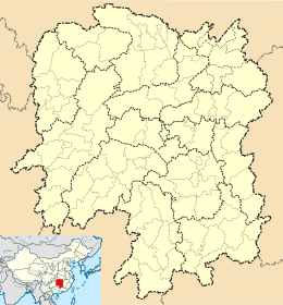 Zhentou Town Location in Hunan | |
| Coordinates: 28°00′34″N 113°19′26″E | |
| Country | People's Republic of China |
| Province | Hunan |
| Prefecture-level city | Changsha |
| County-level city | Liuyang |
| Area | |
| • Total | 158.8 km2 (61.3 sq mi) |
| Population (2015) | 5.71 |
| Time zone | UTC+8 (China Standard) |
| Postal code | 410319 |
| Area code(s) | 0731 |
Administrative division
The town is divided into eight villages and two communities, the following areas:
- Tianping Community (田坪社区)
- Beixing Community (北星社区)
- Gankou Village (干口村)
- Jinpai Village (金牌村)
- Yuelong Village (跃龙村)
- Jiangdong Village (江东村)
- Baishu Village (柏树村)
- Jintian Village (金田村)
- Gantang Village (甘棠村)
- Shuangqiao Village (双桥村)
Economy
The main industries in and around the town are food processing, vegetables, fruits and animal farming.
Geography
Liuyang River, more commonly known as the "mother river", flows through the town.
There are two reservoirs within the town: Xianrenzao Reservoir (仙人造水库) and Gantang Reservoir (甘棠水库).
Mountain located adjacent to and visible from the townsite are: Jiziling (鸡子岭).
Education
There is one middle school and one high school in the town: Zhentou Middle School and Liuyang No. 5 High School, both are public schools.
Transportation
Railway
The Shanghai–Kunming railway, from Shanghai to Kunming, through the town.[3]
The Hangzhou–Changsha high-speed railway, which connects Hangzhou and Changsha, runs through the town.[3]
Expressway
Two expressways run through the town: Liuyang–Liling Expressway and Shanghai–Kunming Expressway.[3]
Provincial Highway
The Provincial Highway S211 runs southwest to northeast through the town.[3]
Attractions
Three Tourism development zones located in the town: Zhongfo Temple (钟佛寺), Baibu Isle (百步洲) and Daji (大基).
References
- 浏阳镇头镇以奖代补推进水利冬修 (in Chinese). Liuyang News. Retrieved 2012-12-24.
- 浏阳市乡镇区划调整改革结果公示(附区划图). Sohu (in Chinese). 2016-04-15.
- Zhang Hong, ed. (2018). "Liuyang" 《浏阳市》. 《中国分省系列地图册:湖南》 [Maps of Provinces in China: Hunan] (in Chinese). Xicheng District, Beijing: SinoMaps Press. pp. 32–33. ISBN 978-7-5031-8949-4.