Zederik
Zederik (![]()
Zederik | |
|---|---|
Former municipality | |
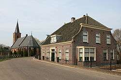 Skyline of Tienhoven aan de Lek | |
 Flag | |
.svg.png) Location in South Holland | |
| Coordinates: 51°55′N 5°0′E | |
| Country | Netherlands |
| Province | South Holland |
| Established | January 1, 1986 |
| Extinct | January 1, 2019 |
| Government | |
| • Body | Municipal council |
| • Mayor | André Bonthuis (acting) (PvdA) |
| Area | |
| • Total | 76.50 km2 (29.54 sq mi) |
| • Land | 73.73 km2 (28.47 sq mi) |
| • Water | 2.77 km2 (1.07 sq mi) |
| Elevation | 0 m (0 ft) |
| Time zone | UTC+1 (CET) |
| • Summer (DST) | UTC+2 (CEST) |
| Postcode | 4126–4128, 4230–4235, 4243, 4245 |
| Area code | 0183, 0345, 0347 |
| Website | www |
The municipality of Zederik was formed on January 1, 1986 through the merger of the former municipalities of Ameide, Hei- en Boeicop, Leerbroek, Lexmond, Meerkerk, Nieuwland, and Tienhoven aan de Lek. Zederik merged with Leerdam and Vianen into the municipality of Vijfheerenlanden in the province of Utrecht on January 1, 2019. The municipality was named after the Old Zederik, a small canal running through its area.
The population centres of Zederik consisted of Ameide, Hei- en Boeicop, Leerbroek, Lexmond, Meerkerk, Nieuwland, and Tienhoven aan de Lek.
Topography
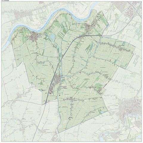
Dutch Topographic map of the municipality of Zederik, Sept. 2014.
Notable people
- Maarten Schakel Sr. (1917–1997) politician
- Teun Kloek (born 1934) economist and Emeritus Professor of Econometrics at the Erasmus Universiteit Rotterdam
- Govert Schilling (born 1956) popular-science writer and amateur astronomer
- Rita de Jong (born 1965) rower, she competed at the 1992 Summer Olympics
- Robin Chaigneau (born 1988) former cyclist
References
- "College" [Board] (in Dutch). Gemeente Zederik. Retrieved 30 August 2013.
- "Kerncijfers wijken en buurten" [Key figures for neighbourhoods]. CBS Statline (in Dutch). CBS. 2 July 2013. Retrieved 12 March 2014.
- "Postcodetool for 4231BP". Actueel Hoogtebestand Nederland (in Dutch). Het Waterschapshuis. Retrieved 30 August 2013.
External links
| Wikimedia Commons has media related to Zederik. |
Places adjacent to Zederik | ||||||||||
|---|---|---|---|---|---|---|---|---|---|---|
| ||||||||||