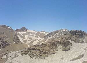
Zard-Kuh
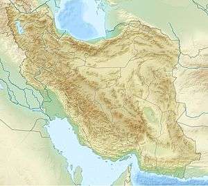
Zard-Kuh (meaning "Yellow Mountain", also spelled Zardkuh, Zarduh Kuh[2] or Zard Kuh-e Bakhtiari; Persian: زردكوه بختياري) is a sub-range in the central Zagros Range, Iran.
| Zard-Kuh زردكوه بختياري | |
|---|---|
| Kolunchin | |
 | |
| Highest point | |
| Elevation | 4,221 m (13,848 ft) [1] |
| Prominence | 2,095 m (6,873 ft) [1] |
| Listing | Ultra |
| Coordinates | 32°21′52″N 50°4′39″E |
| Naming | |
| English translation | Yellow Mountain |
| Language of name | Persian |
| Geography | |
 Zard-Kuh زردكوه بختياري | |
| Parent range | Zagros Mountains |

With an elevation of 4221 metres, the Zard-Kuh is located in the Zagros Mountains in the Chaharmahal and Bakhtiari Province of Iran.[3] The Karun and also Zayanderud rivers start in the Zagros mountains near the Zard-Kuh. There are small glaciers on the mountain owing to the relatively high precipitation, which are the only glaciers in the subtropics outside the Himalayas, Andes and Trans-Mexican Volcanic Belt.[4]
Geologically, the Zard-Kuh is situated in the Sanandaj-Sirjan geologic and structural zone of Iran and is mainly made of Cretaceous limestone.[5]
The famous early documentary Grass captures on film the Bakhtiari tribe's crossing of Zard-Kuh barefoot in the snow with 50,000 people and 500,000 animals.
See also
References
- "Iran: 54 Mountain Summits with Prominence of 1,500 meters or greater" Peaklist.org. Sources differ significantly on the elevation of this peak. Peakbagger for example gives an elevation of 4,548 m and a prominence of 2,443 m. Retrieved 2012-04-29.
- Rawlinson, George. 2002. The Seven Great Monarchies of the Ancient Eastern World (Vol. 2: Babylonia, Media and Persia)
- Microsoft Encarta World Atlas, 2001, Microsoft Corporation
- Glaciers of Iran
- Geological Map of Iran, National Geoscience Database of Iran, www.ngdir.ir