Zambales Mountains
The Zambales Mountains is a mountain range on western Luzon island in the Philippines. The mountains separate Luzon's central plain from the South China Sea. Its most prominent section is known as the Cabusilan Mountain Range composed of Mt. Pinatubo, Mount Negron and Mount Cuadrado, which are believed to be remnants of the ancestral Pinatubo peak. The highest elevation in the Zambales Mountains is Mount Tapulao, also known as High Peak, in Zambales province which rises to 2,037 metres (6,683 ft).
| Zambales Mountains | |
|---|---|
| Western Cordillera | |
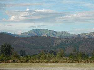 Zambales Mountain Range view from San Narciso, Zambales | |
| Highest point | |
| Peak | Mount Tapulao (aka High Peak), Zambales |
| Elevation | 2,037 m (6,683 ft) |
| Coordinates | 15°28′51″N 120°7′16″E |
| Dimensions | |
| Length | 180 km (110 mi) N-S |
| Area | 300 km2 (120 sq mi) |
| Geography | |
 Zambales Mountains topographic map
| |
| Country | Philippines |
| Provinces | List
|
| Region | III & I |
| Range coordinates | 15°41′N 120°05′E |
Extent
The Zambales Mountains has an area of 300 square kilometres (120 sq mi)[1] extending North to South from the mountains of western Pangasinan province, the whole length of Zambales, to tip of the Bataan Peninsula in the south enclosing Manila Bay.[2] The mountain range also encompasses the mountains in the municipalities of Bamban, Capas, San Jose, San Clemente, Mayantoc, Santa Ignacia, Camiling in the province of Tarlac. In Pampanga, it includes the mountains in Floridablanca, Porac, Angeles and Mabalacat.
Geology
The Zambales Mountains include Jurassic to Miocene ophiolite massifs, overlain by more recent sedimentary formation, including the Cagaluan Formation and the Santa Cruz Formation.[3]
Volcanoes
Although the mountains are volcanic in origin,[2] Mount Pinatubo is the only active volcano in the mountain range. Its eruption on June 15, 1991 was the second most powerful volcanic eruption of the 20th century after the 1912 eruption of Novarupta in Alaska. The volcanic eruption, which was complicated by the arrival of typhoon Yunya, covered the region with thick volcanic ash and lahar including the U.S. military base at Clark Field near Angeles, Pampanga.
Protected areas
See also
References
- "Zambales Mountains". NewCAPP. Retrieved on February 16, 2012.
- Smith, Warren D. (1913). "Journal of Geology, Vol. 21 – The Geology of Luzon, P.I.", pp. 39–40. University of Chicago, Department of Geology.
- Dimalanta, C. B.; Salapare, R. C.; Faustino-Eslava, D. V.; Ramos, N. T.; Queaño, K. L.; Yumul, G. P.; Yang, T. F. (2015). "Post-emplacement history of the Zambales Ophiolite Complex: Insights from petrography, geochronology and geochemistry of Neogene clastic rocks". Journal of Asian Earth Sciences. 104: 215–227. Bibcode:2015JAESc.104..215D. doi:10.1016/j.jseaes.2014.07.021.
| Wikimedia Commons has media related to Zambales Mountains. |